NOAA
Currents
Learn how ocean currents are vital to humans and marine life. The eighth installment of a 23-part NOAA Enrichment in Marine sciences and Oceanography (NEMO) program, focuses on ocean currents and how they affect global climate. The...
Miama-Dade County Public Schools
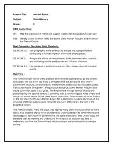
Ancient Rome
This resource outlines several general activities for a study of Ancient Rome, and includes guiding questions, a handout on the story of Romulus and Remus, and ideas for incorporating mapping and timeline activities into your review.
Curated OER
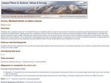
Wetland Safari!
Pupils identify how humans, fish, plants, birds, insects and other wildlife benefit from wetland environments. They observe a wetland and its inhabitants, draw a migration map that represents how birds use wetlands in traveling long...
Curated OER
The Origins of Man
Students learn about new technologies being used to update what is known about human evolution and migration. They then compare the new theories to the traditional knowledge.
Curated OER
Who Dropped What into the Melting Pot?
Students show the movement of people to the United States from other countries on maps. They study the geographic cultural roots of foods that contribute to the melting pot of food in America. They research where an ingredient comes from...
Curated OER
The Human Face of Flagstaff
Students make a brochure for Flagstaff, Arizona. In this geography lesson, students look at a map of Arizona and the Flagstaff Chamber of Commerce sheet to find natural and human features of the city. They create a brochure describing...
Curated OER
Maize to Maquiladoras: Movement from Mexico to Arizona
Fourth graders label maps of Arizona and Mexico to show the people, goods, and ideas that have moved between the two places. In this Arizona and Mexico lesson plan, 4th graders summarize the effects of the movement on Arizona life.
Curated OER
The Sexton and the Compass
Students evaluate how movement patterns create and affect interdependence. They analyze the interactions within and between regions and engage in artistic inquiry, exploration, and discovery in collaboration with others. They design...
Curated OER
Mapping Your Community
Students define the boundaries of their community by comparing the community's official boundaries with other historical, political, physical, and perceived boundaries of the area and create a community map.
Curated OER
Comparison of hometown life with that of life in a Canadian city
Learners research cultural characteristics of a Canadian city with that of their home town. They complete a map handout, providing the relative location on a large map and the absolute location on a provincial map. Students work together...
National Wildlife Federation
I Speak for the Polar Bears!
Climate change and weather extremes impact every species, but this lesson focuses on how these changes effect polar bears. After learning about the animal, scholars create maps of snow-ice coverage and examine the yearly variability and...
Curated OER
Understanding Growth of the Phoenix Area
Students study the growth of the Phoenix area using geographic images, maps, tables, and graphs. They study the idea of community.
Curated OER
Mountain Pine Beetles
Students research and develop power point presentations that answer the question, "What is changing our forests?" In this ecology lesson, students research the niche of Pine Beetles and their increased effect on the forests in...
Curated OER
Alberta And Saskatchwan: the View in 1905
Students analyze the differences between maps 1905 and current maps of Alberta and Saskatchewan. They use maps from the Canadian Council for Geographic Education to complete a guided inquiry. This lesson also has many extension activities.
Curated OER
Birds of the Northeast
Students identify several common birds through field observations, preserved specimens and personal experience. They classify the species and choose one to research. They draw a migration map and participate in a project that benefit...
Curated OER
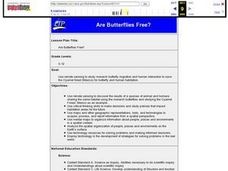
Are Butterflies Free?
Students use remote sensing to study monarch butterfly migration and human interaction to save the Oyamel forest (Mexico) for butterfly and human habitation.
Curated OER
What's In a Name?
Students explore the relationship between names and certain cultures and locations. For this identity lesson, students create family migration or immigration maps. Students read excerpts from When My Name was Keoko and Lost Names: Scenes...
Curated OER
Global Awareness
High schoolers read about how scientists are arriving at current theories of human origin and migration through mitochondrial DNA analysis. They then piece together a map showing the data from mitochondrial DNA analysis to plot the...
Curated OER
Taro
Young scholars locate taro growing areas on a map and how it got there, explain intercultural contact and how taro has been adapted in Hawaii and trace human/taro migration to Hawaii.
Curated OER
Our Way of Life
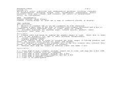
Students interview Native American Elders about animal migration, traditional food gathering, and subsistence. They research endangered animals, draw a game cycle, and create maps of local migration of animals.
Curated OER
City Bound
Fifth graders identify the reasons for people migrating to cities after the Civil War. Using population data, they discover why populations in cities rose while rural populations fell during 1860 to 1900. They discuss the impact a...
Curated OER
Sudan Surprise
Students consider animal migration patterns that have been recently documented in Sudan. They investigate the migratory patterns of animals and discuss how human conflicts and activities affect migratory wildlife populations.
Curated OER
Home on the Range
Young scholars use maps and mathematics to determine the appropriate panther population in a given area. In this Florida ecology lesson, students research the area requirements of male and female panther and use a map to help calculate...

