University of Wisconsin
Measuring Slope for Rain Gardens
The slope of the land is an important feature when considering the erosion that will occur. In this resource, which is part of a rain garden unit, learners calculate the slope of the proposed garden site. Even if you are not planning a...
Curated OER
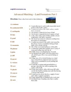
Advanced Matching--Land Formations Part 1
Using this activity, learners could review information they have covered about land forms, such as hills, mountains and plateaus. This 17 question activity could be used with upper elementary or ESL students to test or review information...
Curated OER
Understanding Topographic Maps
Underclassmen create a cone-shaped landform and then draw a contour map for it. Then they examine a quadrangle (which was easily located with an online search), and relate it to what they experienced. The accompanying worksheet is...
Montana State University
Meet Mount Everest
Learning about one landform might seem boring to some, but using the resource provided practically guarantees scholar interest. The second in a sequential series of eight covering the topic of Mount Everest includes activities such as a...
Curated OER
Kansas Land
Fourth graders discover the geographic regions of Kansas. In this geography lesson, 4th graders explore the different regions of Kansas and determine how the different geography affects daily life in Kansas.
Curated OER
Hurricane Impact: Storm Surges and Elevation Transitions
In this hurricane worksheet, student answer 6 multiple choice questions and 8 short answer questions about hurricanes. They color the map to show flooded areas.
Curated OER
Topographic Maps
Your choice of hands-on topographic mapping tasks is provided in this resource. From actual map-making to viewing and interpreting stereographic photos, the activities are sure to succeed. To make the most of this lesson, you will need...
Curated OER
Land and People: Cape Cod Activity 1
Students make a model aquifer to study the uniqueness of Cape Cod's ground-water system. Using the model., they determine how easily contamination spreads in the aquifer system by completing and recording three activities. Using the...
NOAA
Climate, Corals and Change
Global warming isn't just an issue on land; deep ocean waters are also showing troubling signs. Young scientists learn more about deep water corals and the many recent discoveries researchers have made. Then they examine data related to...
Curated OER
Working with Contour Maps
For this contour maps worksheet, students use contour maps to determine the slope and steepness of different land masses. This worksheet has 16 fill in the blank questions.
Curated OER
Historical Geography Scavenger Hunt
Students are told that Geography is the science that deals with the differentiation of the surface of the earth due to the influence of things like population, vegetation, geology, and land use. They explore the Geography Basics page. ...
Curated OER
Tracing Highs and Lows in San Francisco
On a topographic map, students identify the scale bar, north arrow, and contour interval. They then locate a hill on the map and make note of the contour lines. Students then locate other places with similar contour line patterns....
Curated OER
Jeopardy - Earth Sciences
Questions about water, weather, geology, astronomy, and the scientific process make up this Jeopardy game. It is a pretty well-rounded set of slides, although you may want to be aware that a few of the questions are specific to the state...
Curated OER
Forest Communities
Students identify tree specimens. In this tree specimens lesson plan, students collect different parts of a tree from the areas around the school or their home. They then work in groups to create booklet that identifies tree specimens.
Curated OER
Crash landing
Students invent a device to prevent a raw egg from breaking when dropped from a high elevation. In this crash landing lesson plan, students compete in a challenge to create the safest device to prevent an egg from crashing.
CK-12 Foundation
Topographic and Geologic Maps: Topographic Maps
Maps are great for helping you get where you're going, but what does that place actually look like? Geology scholars compare and contrast the features of topographical and geologic maps using an interactive lesson. The resource describes...
Curated OER
Common Themes
Tenth graders test usefulness of a model Earth by comparing its predictions to observations in the real world. In this landforms lesson students construct an island from a contour map using model clay then analyze the landscape features...
Serendip
Get the Lead Out!
Around 500,000 children under the age of six suffer from elevated levels of lead in their blood in the United States. Scholars apply their knowledge about lead to a fun game. As they correctly answer questions, they move their pieces...
Curated OER
Weather and Climate
It's hot today, but is that the weather or the climate? This colorful presentation isolates both concepts to allow for better understanding by covering the positioning of the planet, making comparisons of land versus water, and looking...
Curated OER
Exploring Wyoming Species Habitats
Students are introduced to the concept of species habitats and ranges. They introduced to ArcView GIS as a tool for mapping. Pupils use query data for species withina county, elevation, range, rivers and streams, land cover, and etc....
Curated OER
Relaxing with Impulse
Students discuss Newton's second law of motion in terms of momentum and impulse using examples of landing on concrete versus dirt if you were to jump off an elevated platform or football players wearing protective padding. Mathematical...
Curated OER
Volcano Contour Models Activity and Tracing the Highs and Lows in San Francisco
Students investigate how to draw topographic contours and read topographic maps.They examine the topography of San Francisco and contrast the elevation of different points within San Francisco.
Curated OER
Agriculture in Canada
Learners examine various elements in the physical environment and their relationship to agriculture in Canada. Using the ArcCanada CD-ROM, they analyze maps, and interpret relationships between the physical environment and land use.
Curated OER
Science: Draining the Land - the Mississippi River
Students use topographic maps to identify parts of rivers. In addition, they discover gradient and predict changes in the channels caused by variations in water flow. Other activities include sketching a river model with a new channel...


