Curated OER
Land Elevation
Students investigate land elevation. In this map skills lesson, students use a physical map to identify various elevations of the land. Students find landform features such hills and coastlines.
Curated OER
United States Map- Land Elevation
Young scholars explore a physical map. In this map skills lesson, students discuss examples of elevation and investigate the symbols used to identify elevation on a map. Young scholars use the map to identify various land elevations.
Richmond Community Schools
Map Skills
Young geographers will need to use a variety of map skills to complete the tasks required on this learning exercise. Examples of activities include using references to label a map of Mexico, identify Canadian territories and European...
Curated OER
Understanding Topographic Maps
Underclassmen create a cone-shaped landform and then draw a contour map for it. Then they examine a quadrangle (which was easily located with an online search), and relate it to what they experienced. The accompanying worksheet is...
Curated OER
Where Am I: How to Read a Map
Third graders develop an understanding of maps. They explore what a map is, who uses maps, and how to use maps. Students investigate the compas rose. They create a compose rose which illustrates the cardinal directions. Students practice...
Curated OER
Create a Country
Students work in small groups to list features and elements found on a variety of grade- appropriate maps. They develop a class list of map features and elements to draw from as they create a map of an imaginary country.
Curated OER
Mapping the Canyon
Students compare and contrast topographic maps and bathymetric maps. They investigate how bathymetric maps are made and how to interpret one.
Curated OER
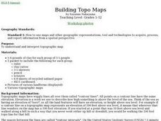
From Maps to Models
Students explore watersheds through the use of a topographic map. They observe topographical maps and discuss their characteristics. In groups, students create a model clay island and make a topographical map of it. Afterward, groups...
Curated OER
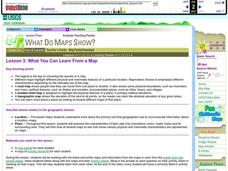
What You Can Learn From a Map
Students discover how to interpret maps. In this geography skills lesson, students explore geographic themes as they complete worksheet activities regarding road maps, shaded relief maps, and topographic maps.
Curated OER
Topographic Maps Worksheet
For this geography skills worksheet, students respond to 37 multi-part questions that require them to read and interpret topographic maps.
Curated OER
Tooling Around Arizona: Reading Arizona Maps
Students research Arizona maps. For this map lesson, students discuss map titles, scales, directions, elevation, and symbols. The class will examine topography, landforms, and rivers found on an Arizona map.
Curated OER
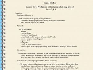
Production of the Lunar Relief Map Project
Middle schoolers replicate the lunar surface. In this mapping skills lesson, students study the topography of the moon. Middle schoolers then use craft materials to create topographic maps of the lunar surface where the Eagle landed.
Curated OER
Tracing Highs and Lows in San Francisco
On a topographic map, students identify the scale bar, north arrow, and contour interval. They then locate a hill on the map and make note of the contour lines. Students then locate other places with similar contour line patterns....
Curated OER
What You Can Learn From a Map
Students investigate the use of road maps, shadeded relief maps, and topographic maps.
Curated OER
Cookie Topography
Students construct a cross section diagram showing elevation changes on a "cookie island." Using a chocolate chip cookie for an island, they locate the highest point in centimeters on the cookie and create a scale in feet. After tracing...
Curated OER
3-D Topographic Maps
Students create a 3-D topographic map. In this map building lesson, students use cardboard to create a topographic map of the Catskills mountain region.
Curated OER
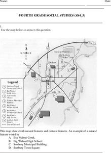
Fourth Grade Social Studies
In this social studies worksheet, 4th graders answer multiple choice questions on state maps, city maps, road maps, political maps, and more. Students complete 25 multiple choice questions.
Curated OER
Generate an Accurate Landscape Profile from a Topographic Map
Students enerate an accurate landscape profile from a topographic map. They determine the correct interval needed to accurately graph the change in elevation on a single piece of graph paper.
Montana State University
Meet Mount Everest
Learning about one landform might seem boring to some, but using the resource provided practically guarantees scholar interest. The second in a sequential series of eight covering the topic of Mount Everest includes activities such as a...
Curated OER
Kansas Land
Fourth graders discover the geographic regions of Kansas. In this geography lesson, 4th graders explore the different regions of Kansas and determine how the different geography affects daily life in Kansas.
Curated OER
Globe Skills Lesson 6 The Louisiana Purchase
Students explore the Louisiana Purchase territory. In this geography skills instructional activity, students use map skills in order to plot and note latitude and longitude, measure scale distance, and locate landforms that were part of...
Curated OER
Globe Skills Lesson 4 The Colonial Period
Students practice their map skills. In this Colonial geography lesson, students complete an activity that requires them to locate English colonial locations using latitude and longitude coordinates.
Curated OER
Globe Skills Lesson 5
In this map skills worksheet, students read a text selection about locations during the American Revolution and then respond to 8 fill in the blank questions.


