K-State Research and Extensions
Water
How are maps like fish? They both have scales. The chapter includes six different activities at three different levels. Scholars complete activities using natural resources, learn how to read a map, see how to make a compass rosette,...
Curated OER
Landforms - Landform Types (Matching)
In this landforms worksheet, students match land forms with their definitions. Students complete 11 matches total on this worksheet.
Curated OER
Maps and Models
Students study maps of New Mexico examining settlement patterns over time and the location of water sources. They research the history of their community and discover how cultural groups interacted, adapted to their physical...
Curated OER
Landforms - Landform Examples in the Philippines (Matching)
In this landforms worksheet, students match the landforms to their definitions. Students complete 10 matches on this worksheet and answer true and false and multiple choice questions about landforms in the Philippines.
Curated OER
Build a Model Watershed
Collaborative earth science groups create a working model of a watershed. Once it has been developed, you come along and introduce a change in land use, impacting the quality of water throughout their watershed. Model making is an...
Curated OER
Deep Blue: Exploring the Deep Ocean
Students examine landforms. In this social studies lesson, students bounce a beach ball around in order to discover that seventy percent of the Earth is covered in water. Students
Curated OER
Can You Catch the Water?
Students work together to construct a model of a water catchment basin. They survey water patterns and complete experiments to see where rain travels and collects. They discover how engineers design structures that help with drainage.
Curated OER
Coasts and Reefs: Shallow Marine Processes
A more thorough presentation on coastal systems would be difficult to find! Detailed diagrams illuminate the offshore, shoreface, foreshore, and backshore zones of beach. The sources and movement of sediments along the coastline...
Curated OER
I Love the Mountains
First graders discuss and define different landforms. They read the book "Our Land", sing a landform song and perform it with motions and then complete a worksheet.
Curated OER
The Great Water Hunt
Students create a model of the land to water ratio in a large group and search for all the places water is used at their school while on a Great Water Hunt. They identify where water can be found and compare how much of world is covered...
Curated OER
Landforms By Hand: Geography, Map Skills
Pupils experiment with landform vocabulary by using their own hands and a bar of soap as media.
NOAA
The Dead Zone
The fifth installment of a 23-part NOAA Enrichment in Marine sciences and Oceanography (NEMO) program defines dead zones and how they form. Pupils then examine data from the Gulf of Mexico to determine dead zone formation.
John F. Kennedy Library Foundation
JFK Challenge
And so, my fellow Americans: ask not what your country can do for you—ask what you can do for your country. And so begins your invigorating, innovative learning experience in the JFK Challenge app! Learners...
Curated OER
Tall as a Mountain, Flat as a Plain
Students examine pictures of various landforms before placing them on a chart under the appropriate label.They sing songs about landforms to the tune of "She'll Be Comin' 'Round the Mountain." Next, they use non-edible baker's dough to...
Curated OER
Clean Kansas Water
Students gain an understanding of ways we can be responsible custodians of our water supply. Students explore the governor's clean water initiative involving the Lower Kansas/Republican river basin and the pollutants present there.
Curated OER
War of 1812
Eighth graders locate the major land forms and bodies of water on a map of Louisiana. In groups, they discuss the role of the Mississippi River in the Battle of New Orleans and how land and water affect the outcome of battles. To end...
Curated OER
Sunken Millions
This PowerPoint provides a game show format with multiple choice questions about fresh and salt water. Topics include sources of water, water geography, uses of water, and the water cycle.
Curated OER
Tall as a Mountain, Flat as a Plain
Students examine a variety of landforms that are found on the Earth and compare and contrast the distinguishing qualities of these forms. A topographical model of the landforms is made.
Curated OER
Science: Draining the Land - the Mississippi River
Learners use topographic maps to identify parts of rivers. In addition, they discover gradient and predict changes in the channels caused by variations in water flow. Other activities include sketching a river model with a new channel...
Curated OER
Changing Planet: Rising Ocean Temperatures - Rising Sea Levels
As an anticipatory set, young environmental technicians watch a video about how ocean temperatures seem to be changing along with the global climate. They perform a laboratory demonstration with the purpose of observing what happens to...
Curated OER
Climate Patterns across the United States
Young scholars articulate differences between climate and weather using examples in a written statement. Using climate data from across the country, they describe climate patterns for various parts of the United States on a map. Students...
Curated OER
Identifying Pennsylvania Watersheds
Ninth graders study and identify the six major drainage systems in Pennsylvania. For this watershed lesson students read an article, complete an activity and take a quiz on what they learned.
Curated OER
To Protect Your Streams, Protect Your Mountains
Young scholars build and experiment with a watershed to understand the effects of pollution. In this movement of water lesson, students work in groups creating rock formations and change the viscosity of the liquids falling down the...
Curated OER
Groundwater Movement
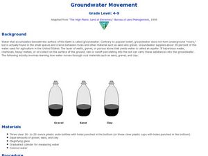
Students study groundwater movement beneath the surface of the Earth. In this agriculture lesson, students experiment with how water moves through rock materials such as sand, gravel, and clay.


