Curated OER
Using the Landscape Picture Map to Develop Social Studies Skills
Enhance your class' geography skills using this resource. Explore a variety of concepts including production and distribution, and people and the environment. Learners make predictions and identify locations on maps. This is a creative...
Curated OER
Landscape Picture Map- The Earth's Surface
Students discuss different landscapes. In this map lesson plan, students describe what they see when they travel between home and school. Students use a landscape picture map to locate the places or objects they see.
Curated OER
Landscape Picture Map
Students discuss differences between man made and natural features on the Earth's surface. In this natural and man made features lesson, learners brainstorm a list of features and categorize them on the board. Students study a landscape...
Curated OER
Landscape Picture Map - Lesson 8 (K-3)
Students explore the functions of landscape picture maps. In this geography skills lesson, students examine a landscape picture map and identify buildings on the map where people are employed. Students also participate in a discussion...
Curated OER
Landscape Picture Map - Lesson 7 (K-3)
Students consider the changing landscape. In this map lesson, students examine a large landscape picture map, discuss the building they find on it, and discuss how construction changes the landscape.
Curated OER
Simple Route Map
Students identify the best route between various locations on a map. In this map skills lesson, students use a landscape picture map to find routes to and from certain places. Students use map markers to highlight the routes.
Curated OER
Simple Route Map
Students demonstrate how to locate features on a Landscape Picture Map. In this map skills lesson, students locate and circle places where they would go to mail a letter, return a library book, or play a baseball game.
Curated OER
The Changing Landscape
Students explore how the landscape is constantly changing. In this landscape lesson, students identify a building under construction on the Landscape Picture Map. Students discuss the purpose of the construction and the effect on the...
Curated OER
Landscape Picture Map
Students design a landscape picture map. In this landscape picture mapping lesson, students understand when and why to use a landscape picture map. Students discuss landscape picture maps.
Curated OER
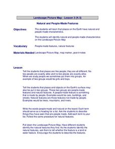
Landscape Picture Map: Natural and People Made Features
Young scholars explore the places and objects that make up the Earth's surface. In this natural and people made features lesson, students identify things they've seen that are people made and those that are natural to the environment. ...
Curated OER
Landscape Picture Map
Young scholars identify a neighborhood on a Landscape Picture Map. In this geography lesson, students discuss the characteristics of their neighborhood and identify their neighborhood on a Landscape Picture Map. Young scholars use...
Curated OER
Landscape Picture Map: Making a Map Grid
Students create a map grid system. In this map lesson plan, students discuss how mapmakers use a grid system to make giving directions easier. Students learn how the grid system works and create a grid system on their landscape pictures.
Howard Hughes Medical Institute
Lesson 6: Biomes and Landscapes
Aside from the amazing animals in Gorongosa National Park, what else is there to discover? The sixth installment in an eight-part themed series contains an interactive map where scholars can learn more about the geographic features of...
Curated OER
Natural Features
Students identify natural features on a map. In this map skill lesson, students use a landscape picture map to identify mountains, hills, islands, lakes, and rivers. Students use post-it notes to demonstrate their location.
Curated OER
Where People Live- Neighborhoods
Students use a map. In this neighborhood lesson, students describe a neighborhood, emphasizing the common characteristics between all neighborhoods. Students locate a neighborhood on a landscape picture map and discuss.
Curated OER
Natural Features as a Resource
Students investigate how land and water can meet basic needs. In this natural resources lesson, students locate water features on a Landscape Picture Map and describe how water is used to meet their needs.
Rainforest Alliance
Knowing the Essential Elements of a Habitat
To gain insight into the many different types of habitats, individuals must first get to know their own. Here, scholars explore their school environment, draw a map, compare and contrast their surroundings to larger ones. They then write...
Curated OER
Landscape Picture Map
Young scholars explore pollution of water sources. In this ecology instructional activity, students define and identify natural resources. Young scholars use map skills to locate local rivers and lakes used for recreation. Students...
Curated OER
Types of Transportation
Students identify and describe various modes of transportation. In this transportation lesson, students discuss the types of transportation shown in the Landscape Picture and discuss the purpose of that vehicle. Students locate examples...
Rainforest Alliance
Protecting the Critical Habitat of the Manatee and Loggerhead Turtle
Explore ocean habitats with a lesson that showcases the home of manatees and loggerhead turtles in Belize. Here, pupils compare and contrast the homes of ocean animals to those of humans, listen to an original short story about the...
Library of Congress
Investigating the Building Blocks of Our Community’s Past, Present, and Future
As Ken Jennings said, "There's just something hypnotic about maps." Certainly, the longer you look at them the more you can learn. In this project-based learning lesson, individuals study both historic and present-day maps of their area...
Curated OER
Natural Features
Learners identify natural features on a map. In this geography lesson, students identify six physical features and create pictorial definitions for each term. The terms which are listed in this lesson are mountain, hill, island, river,...
Curated OER
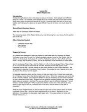
Lesson Six Where People Live
Students investigate where people live. In this early geography lesson, students read Make Way for Ducklings! by Robert McCloskey and then discuss what neighborhoods are as they identify them on landscape picture maps.
Curated OER
Landscape Picture Map: Natural Features
Students discover six landscapes. In this natural features lesson, students review the meaning and examples of natural features. Students use a landscape picture map to identify six natural features.


