CK-12 Foundation
Position and Displacement Simulation
How can we use vectors to determine a person's position when traveling? The simulation offers guided practice at determining the coordinates and the distance between coordinates on a map grid. It reinforces the importance of positive...
Curated OER
Why Is Climate Important to Growing Rice?
Third graders determine the location of major rice producing states in the United States. In this rice production lesson plan, 3rd graders locate the longitude and latitude of each rice producing state. They color the states and indicate...
Curated OER
Exploring Earth Through Maps and Technology
In this maps worksheet, students read 3 pages of detailed information about maps, latitude, longitude, topography, satellites and global positioning. Students then answer 10 questions. There is also a research project assignment available.
Curated OER
Walking that Line
Students attempt to describe and use longitude and latitude. They will identify different countries, their neighbors, and borders around the world. Included in the lesson the students identify natural features that control the borders of...
Curated OER
From Home to School, GPS Style
Students are introduced and increase proficiency in the use of the hand held GPS system. They explore the meaning of longitude and latitude lines, then identify the parts of the map.
Curated OER
Using My Nasa Data To Determine Volcanic Activity
Students use NASA satellite data of optical depth as a tool to determine volcanic activity on Reunion Island during 2000-2001. They access the data and utilize Excel to create a graph that has optical depth as a function of time for the...
Curated OER
Ozone Layer
Seventh graders develop an understanding of the ozone layer, it's affect on Earth, and the effect of human activity on the ozone layer. They then interpret data from satellite pictures and develop an understanding of longitude/latitude...
Curated OER
Destination Investigation!
Students interpret a map or Atlas. They determine latitude, longitude, and absolute location and create and evaluate a travel itinerary. They identify the benefits and drawbacks of an itinerary and conduct online research as a means to...
Curated OER
A Bird's Eye View of our 50 States
Third graders focus on state birds as they learned absolute location (latitude/longitude) of each state, as well as their relative location (bordering states).
Curated OER
Location of Cities 201
Students work in pairs to locate the ancient cities on a world atlas using the longitude and latitude measurements. They examine the physical and human futures that explain their locations.
Curated OER
Did You Feel That? Earthquake Data Chart
Students plot earthquakes on the world map using coordinates of longitude and latitude. They designate the earthquakes magnitude with a symbol which they include in the map key.
Curated OER
Five Themes of Geography
Students conduct research to determine why geography is important and how it provides information regarding many aspects of the world. They investigate the hemispheres, longitude, latitude and absolute location.
Curated OER
Geography Search: The New World
Students explore the "New World". They collect geographic information related to the ocean, latitude and stars, longitude and time, wind patterns, and the weather. They analyze the geographic data and make decisions to plot their...
Curated OER
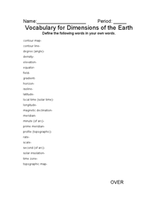
Vocabulary for Dimensions of the Earth
In this Earth dimensions activity, students define 24 terms associated with contour maps, latitude, longitude, and time zones.
Curated OER
Baseball Challenge - Basic Geography Skills
A fabulous presentation/activity based on geography. The author has designed a "baseball game" where batters advance to the next base if they correctly answer a multiple choice question about geography. Geographic terms are used, along...
Curated OER
Natural Disasters and the Five Themes of Geography
Have your class do research on natural disasters and create a presentation using this resource. In completing this activity, learners apply the five geography themes to their research. They write a paper describing their results. It's a...
Curated OER
Comparison of Snow Cover on Different Continents
Students use the Live Access Server (LAS) to form maps and a numerical text file of snow cover for each continent on a particular date and analyze the data for each map, corresponding text file to determine an estimate of snow cover for...
National Wildlife Federation
I’ve Got the POWER Wind Energy Potential at Your School
The 20th lesson in a 21-part series connects the wind data and expectations of a turbine to whether such devices should be built in your area. Scholars begin with estimating the wind potential at school by using long-term climate...
National Wildlife Federation
I Speak for the Polar Bears!
Climate change and weather extremes impact every species, but this lesson plan focuses on how these changes effect polar bears. After learning about the animal, scholars create maps of snow-ice coverage and examine the yearly variability...
Curated OER
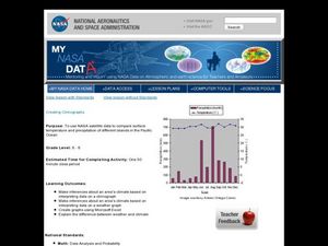
Creating Climographs
Students use satellite data to compare precipitation and surface temperatures on different islands. In this satellite lesson students create graphs and explain the differences between weather and climate.
Curated OER
Is Portland, Oregon Experiencing Global Warming?
Learners use data to determine if the climate in Portland has changed over the years. In this weather lesson students complete line graphs and study long wave radiation.
University of Colorado
Phases of Charon
Pluto, although no longer considered a planet, has five moons. Pluto's moon, Charon, is the focus of a resource that describes how the moon is viewed from the surface of Pluto. Photos help individuals see how Charon would look at...
Curated OER
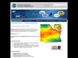
Comparing the Effects of El Nino and La Nina
Students examine the differences between an El Nino and La Nina year. In this investigative lesson students create maps and graphs of the data they obtained.
Curated OER
Solar Cell Energy Availability From Around the Country
Students determine areas that are the most likely to produce solar energy by using NASA data. In this solar energy lesson students analyze plots and determine solar panel use.
Other popular searches
- Longitude and Latitude
- Longitude Latitude
- Latitude and Longitude Games
- Latitude and Longitude Maps
- Longitude & Latitude
- Longitude and Latitude Game
- Longitude and Latitude Math
- Geography Latitude Longitude
- Whaling Latitude Longitude
- Longitude Latitude Minutes
- Longitude and Latitude Lines
- Volcano Latitude Longitude


