Curated OER
The 50 States
Fifth graders use maps and music to learn the 50 states. In this US Geography lesson, 5th graders map out a region of the United States and practice singing the song, The 50 States that Rhyme.
Curated OER
Puerto Rico: The 51st State?
Learners research the history of Puerto Rico, its culture, and geography. In this Puerto Rico instructional activity, students find Puerto Rico on a map and find specific regions or cities. Learners discuss Puerto Rico's statehood and...
Center for Civic Education
Matching Game with the US Constitution
In September we celebrate Constitution Day. Begin the celebration with a grand conversation about the US Constitution. Follow up the in-depth discussion with a learning game in which scholars match terms to images such as...
Curated OER
United States Map
Students access prior knowledge and locate the North and South Poles on the map. In this mapping lesson, students understand the position of the United States relative to the poles. Students answer questions about the globe.
Curated OER
Landforms and Resources of the United States and Canada
In this North American geography activity, students read about the physical features and resources of the United States and Canada. Students take notes and answer 3 short answer comprehension questions as they read the selection.
Heritage Foundation
Courts and Judges
If the Supreme Court is so supreme, why do all cases not just start there? High schoolers learn why every case does not start at the Supreme Court as well as the importance of hierarchy in the US judicial system in the 11th installment...
Facing History and Ourselves
The Importance of a Free Press
"Congress shall make no law . . . abridging the freedom of speech, or of the press;. . ." Why is this guarantee of free speech and a free press the First Amendment to the US Constitution? Why are these rights so essential to a...
Heritage Foundation
Lawmaking and the Rule of the Law
How many constitutional clauses does it take to create a bill? High schoolers find out with several activities and selected clauses about the rule of law and the US Constitution. Various coinciding activities help to strengthen...
Curated OER
U.S. States - The Midwest States
In this geography and math worksheet, students complete the simple addition equations and match the sums to the colors. Students then color the Midwest States by the color code.
Teach Engineering
Energy Forms and States Demonstrations
Does a tennis ball have energy? What about a bowling ball? Demonstrate concepts of different forms of energy forms and states with a variety of objects. Using the equations for potential and kinetic energy,...
Teach Engineering
Energy Forms, States and Conversions
Even magicians can't make energy disappear. In a discussion-based lesson, young scientists learn about energy forms and conversions. They see how energy is neither created nor destroyed; it just changes forms. This is the 11th...
Youth Leadership Initiative
Selecting a President: Primaries and Caucuses
What is a party caucus anyway? And what part do caucuses play in the primaries? Everything future voters need to know about the four stages in the presidential selection process is provided by this resource. The 2012 US...
Smithsonian Institution
A New America: The Hart-Celler Immigration Act of 1965
Many dream of coming to America, but few may enter. The instructional activity explores the Hart-Celler Immigration Act of 1965 and how it changed immigration policies in the United States. Academics learn how immigration quotas impacted...
Curated OER
Our Classroom Constitution
Develop a system of classroom rules created by the kids, for the kids with this three-part lesson series on the US Constitution. After learning about the structure of the Constitution and the government it established, young...
Curated OER
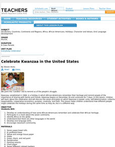
Celebrate Kwanzaa in the United States
Explore the components of the African American celebration of Kwanzaa in the United States. Complete with learning objectives, a materials and preparation list, and eight days of lesson plans, the resource incorporates the principles of...
Statistics Education Web
The United States of Obesity
Mississippi has both the highest obesity and poverty rate in the US. Does the rest of the data show a correlation between the poverty and obesity rate in a state? Learners tackle this question as they practice their skills of regression....
CK-12 Foundation
Regular and Irregular Polygons: Polygon States
Colorado would probably object if Wyoming enlarged its borders. Scholars use an interactive map to change the borders of U.S. states to see how angles change. They then answer questions about regular and irregular polygons.
DocsTeach
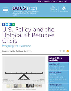
U.S. Policy and the Holocaust Refugee Crisis
How did the United States respond to the Holocaust refugee crisis during World War II? The activity focuses on the United States' foreign policies and the arguments for and against offering assistance. Scholars analyze historical...
Curated OER
The Debate in the United States over the League of Nations: Disagreement Over the League
Students examine the opposition of the US Senate to Woodrow Wilson's idea of a League of Nations. They discuss the central ideas involved in the debate over the League.
Curated OER
The Air We Have Around Us
Students listen to story, The Lorax, by Dr. Seuss, discuss air quality and how people affect the earth and its atmospheric cycles, and give oral reports on what they have learned.
Curated OER
Voting Simulation
Learners explore the process of voting. They study the lawmaking branch of the state government.
Curated OER
United States Pride
Third graders learn the responsibility of citizenship and learn facts about a state they choose to research.
Curated OER
all About the States
Students conduct Internet research about the states and use educational software to graphically organize the facts they have studied. As a class, students create posters and bulletin boards of the 50 states.
Curated OER
United States Map- State Capitals
Students explore map skills. In this state capital lesson, students view a United States Political Map and identify and use post-it notes to label the state capitals.


