Curated OER
Water Features - Lesson 2 - U.S. Political Map Grade 4-5
Students locate water features on maps. For this geography lesson, students complete worksheets that require them to identify water features on a U. S. political map.
Curated OER
Map Grids
Learners study map grids and explore how they can be used to locate positions of objects or features on a map. They read a story and then participate in a grid activity using a large map of the setting of the story.
Midnight Martian
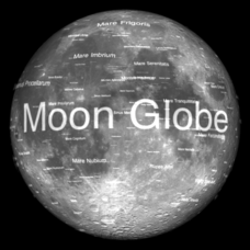
Moon Globe
Not just a simple globe of the moon, this interactive version allows you to choose lighting according to the location of the sun, views from different positions on Earth, and more! Satellite images and topographic data have been combined...
NOAA
A Moving Crust
Young scientists piece together the geological puzzle that is the earth in the third and final lesson of this earth science series. With the help of numerous multimedia resources and a series of engaging hands-on activities, students...
Curated OER
Simple Route Map
Students demonstrate how to locate features on a Landscape Picture Map. In this map skills lesson, students locate and circle places where they would go to mail a letter, return a library book, or play a baseball game.
Curated OER
Mapmaker, Make Me a Map!
Young scholars are introduced to the state quarter program and examine the Colorado state quarter. They locate Colorado on a map and create a map with a key. They discuss the state motto and examine pictures of the state's geographical...
Royal Geographical Society
An Introduction to Maps
First graders are introduced to a variety of maps such as globes, street maps, atlases, and different types of floor plans. The focus of the lesson requires individuals to create their own plan of the classroom using the PowerPoint...
Curated OER
Gingerbread Map
Second graders read the book Gingerbread Baby, identify local features and cardinal directions on a map, and then construct their own map. In this mapping lesson plan, 2nd graders construct their own map in groups based on where the baby...
Curated OER
Making a Travel Brochure of a Louisiana Parish
Although the attachments for this travel brochure project are no longer linked, you can still use the idea here and create your own assignment sheet and rubric. Learners choose a parish in Louisiana (or a city in your state) to research,...
Curated OER
Map Keys
Third graders examine maps and map keys. In this locating map features lesson, 3rd graders use crayons, markers and colored pencils to label maps. Students work in partners to read map keys and locate given places and things.
Compton Unified School District
How Can We Locate Places?
How can we locate places? Maps, of course! Expose second graders to the tools available in maps and discuss how these tools can help people find locations. Students also look at communities, including what makes a community and the...
Curated OER
What Do Maps Show?: Lesson 4 How to Read a Topographic Map
Students examine the use of topographic maps as two dimensional representations that show elevations and slopes with contour lines. They read maps of the Salt Lake City, Utah area and complete the associated worksheets that show map...
Owl Teacher
Introduction to World of Geography Test
Assess your learners on the five themes of geography and the most important key terms and concepts from an introductory geography unit. Here you'll find an assessment with 15 fill-in-the-blank and 14 multiple-choice questions, sections...
Curated OER
Things That Stick Out Or: How To Find Your Way Around on a Map
Students explain the meaning of and recognize the map outlines of a peninsula, an isthmus, and a cape.
Curated OER
Geography: Puerto Rico
Take a trip to Puerto Rico! Learners engage in a web quest, identify Puerto Rico on the map, and gather information related to physical features and cultural factors. Their efforts culminate when they design a brochure comparing the...
Curated OER
Geography of South America
Student's identify geographic features of a South American map. They use the scale of the map to calculate distances between points. They identify examples of the five geographic themes on the map of South America.
Curated OER
China Quest
Read and research information on China. Young researchers complete a knowledge hunt about China then locate and describe each location using directional words. They recognize the word meaning through context clues and application practice.
Curated OER
U.S. Political Map
Learners explore the symbols found in a map legend. In this map skills lesson, students locate the legend on a political map and explain what each of the symbols mean. Learners locate and identify several symbols on the map.
Curated OER
Simple Route Map
Students identify the best route between various locations on a map. In this map skills lesson plan, students use a landscape picture map to find routes to and from certain places. Students use map markers to highlight the routes.
Curated OER
Introduction to the United States Map
Students identify a map of the United States. For this United States map lesson, students study a map of the United States and find various locations on the map. Students then locate and list the state that touches their state.
Curated OER
Mapping Your Schoolyard Habitat
Students explore the terrain, structures, plants and signs of habitats around their schoolyard. They draw a sketch map showing the different areas around the schoolyard. Students identify the location of weeds and native plants on their...
Curated OER
United States Map
Students describe cities they are familiar with. In this United States Map lesson, students understand how cities are listed on a map. Students become aware of a map legend and the information in it.


