National Geographic
The Monsoon
Few things are as fascinating as the challenge of climbing Mount Everest. This lesson investigates how monsoon weather impacts climbers. To begin, you are instructed to show various video clips. The only one directly provided, however,...
Q Continuum
Planets
Have you ever looked up at the night sky and wondered what constellation you were seeing or whether that bright object was a star or a planet? Are you searching for the best tilt-to-view constellation and planet app that money can't buy?...
GLOBE Program
Making a Sundial
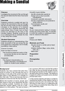
Sundials are more than just primitive clocks. Learners build their own sundials to study the location of the sun across the sky throughout the day. They use shadow evidence related to their sundials to make conclusions about solar movement.
Curated OER
Equator, North Pole, and South Pole
Students identify the Equator, North Pole, and South Pole on the globe. In this map skills lesson, students use a globe marker to locate specific locations on the globe. Students find where they live in relation to the Equator.
Curated OER
Using the Four Main Directions in the Classroom
Students use the four main directions to locate features in the classroom. In this direction lesson, students review the 4 main directions using a world map. Students use a magnetic compass to locate the north wall in their classroom and...
Curated OER
Our City
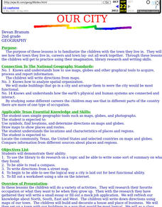
Second graders familiarize themselves with the town they live in by practicing their imagination, library research and writing skills.
Curated OER
2nd Grade - Act. 21: Me On the Map
Second graders read book, Me On the Map, and create map of their bedroom and of their house.
Curated OER
World Map and Globe - Four Main Directions
Students study the four main directions on a map. In this map lesson plan, students locate the North and South pole, and learn the four cardinal directions. They use the compass rose on a map to help with the directions. (Map is not...
Curated OER
World Map and Globe
Students locate and identify continents and countries. In this world map lesson, students locate and identify one country on each continent.
Curated OER
Globe Lesson 4 - The Compass
Young scholars study compass' and their use in navigation. In this compass lesson, students use a compass and a globe to answer the questions about navigation.
Curated OER
Modeling the Seasons
Junior geologists become the force that makes the world go around! With a lamp on the floor in the middle of the room to represent the sun, volunteers hold a globe, revolve, and rotate. Observers notice how the light hitting the globe...
Owl Teacher
Introduction to World Geography
Give your learners a thorough overview of what they will learn when studying geography, from the five themes of geography (location, place, environment, movement, and regions) to the tools of a geographer and parts of a map.
Royal Geographical Society
An Introduction to Maps
First graders are introduced to a variety of maps such as globes, street maps, atlases, and different types of floor plans. The focus of the lesson requires individuals to create their own plan of the classroom using the PowerPoint...
Geophysical Institute
Latitude and Longitude with Google Earth
Travel the world from the comfort of your classroom with a lesson that features Google Earth. High schoolers follow a series of steps to locate places all over the earth with sets of coordinates. Additionally, they measure the distance...
Curated OER
The Mekong River
Junior geographers explore the region through which the Mekong flows, its pathway, the landscape, how people depend on the Mekong, and future uncertainties. They apply the five themes of geography to examine the region. They create a...
Lake Afton Public Observatory
Shadows, Angles, and the Seasons
Shine some light on the topic of seasonal change with this collection of activities. Whether it's by measuring the change in the length of their shadows, or modeling the earth's orbit around the sun using a lamp and a globe, these simple...
Curated OER
Barrels and Buckets: Access to Water - What Would It Be Like to Live in Africa?
Learners compare water access in the United States with that of Africa. In this water access lesson, students located Ghana and Kenya on a globe before reading Peace Corps Volunteer accounts of the difficulty of accessing clean water....
Curated OER
NIGHT AND DAY: DAILY CYCLES IN SOLAR RADIATION
Students examine how Earth's rotation causes daily cycles in solar energy using a microset of satellite data to investigate the Earth's daily radiation budget and locating map locations using latitude and longitude coordinates.
It's About Time
Effects of Plate Tectonics
Explore our world from within as you lead young scientists on a thrilling adventure. Pupils examine the location of plate boundaries to determine earthquake and volcano distribution around the globe and explore the cause of hot spots in...
Teach Engineering
Earthquakes Living Lab: FAQs about P Waves, S Waves and More
Let's talk about earthquakes .... Using the Internet, pupils research what causes earthquakes, how scientists measure them, their locations, and their effects. The resource is not only informative, but it also builds crucial research...
Curated OER
Mapping Worksheet #1
Get out the compass and a pencil its time to use a coordinate grid to practice mapping skills. Young cartographers use the prompts and provided grid to plot locations, draw parallel lines, and determine distances between points.
Curated OER
Storm Clouds-- Fly over a Late Winter Storm onboard a NASA Earth Observing Satellite
Students study cloud data and weather maps to explore cloud activity. In this cloud data lesson students locate latitude and longitude coordinates and determine cloud cover percentages.
Curated OER
The Solstices
Compare surface temperatures when the solstice occurs in the different hemispheres. Young scientists draw conclusions from their investigation of data collected using spreadsheets and a globe.
Curated OER
Day to Day Life in a Small African Village
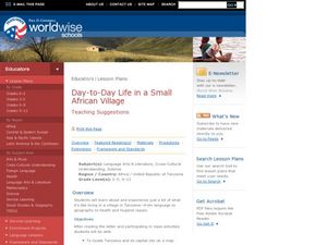
Students analyze what it is like to live in an African village. They locate Tanzania on a map and compare life there to life here in the United States. They write about the health issues in East Africa.


