Curated OER
The Pilgrims
Students use distance measuring tools to follow directions and chart the path the pilgrims made from Plymouth, England to Boston, Massachusetts. In this Pilgrim voyage lesson plan, students use a map to chart the distance traveled by the...
Curated OER
Mush! Tracking Travelers on the Trail
Students get to know Alaska and the Iditarod route that is run by dogs as they track the mushers' progress on a map that they create specifically for the race. They learn about latitude, longitude, plotting on a map, checkpoints, and...
NOAA
Tracking a Drifter
Be shore to use this drifter resource. The third installment of a five-part series has learners using the NOAA's Adopt-a-Drifter website to track to movement of a drifter (buoy) in the ocean. Graphing the collected data on a map allows...
Curated OER
Spherical Geometry: A Global Perspective
Students investigate spherical geometry using a globe and an apple. In this spherical geometry lesson plan, students translate Euclidean geometry terms to spherical geometry terms using a globe. They answer 3 questions about spherical...
Curated OER
Plot Your Course
Students determine distance and direction on a nautical chart. In this nautical lesson, students identify obstacles and characteristics of common aid to navigation on a nautical chart.
US Mint
Absolutely and Relatively: The Puerto Rico Quarter Reverse
How much does your class know about Puerto RIco? How much can they learn from the back of a 2009 quarter? Use the coin, part of a series of quarters that depict US territories, to teach learners about the geography, culture, and history...
Curated OER
Broken-Heart Matching Game
Students use this fun game to practice, reinforce, or apply a wide variety of skills around Valentine's Day. Each students receives half a heart with zig-zag cuts made of pink construction paper with a piece of information. Their job is...
Curated OER
Basic Mapping Skills
Establish and study the parts of a map with your class and, then they will work in small groups to create their own detailed map, including a legend. There are specific instructions to follow on what needs to be included.
Curated OER
Time Zones
Students solve time zone problems and chart travel around the world. In this time zone lesson, students learn about the history of time zones and view a time zone map. Students use the time zone map to solve time zone problems. ...
Curated OER
Where is Here?
Students are shown the very basics of navigation. The concepts of relative and absolute location, latitude, longitude and cardinal directions are discussed, as well as the use and principles of a map and compass.
Curated OER
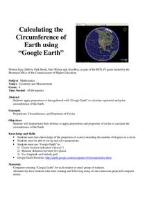
Calculation the Cricumference of Earth using "Google Earth"
Eighth graders investigate properties of circles. In this eight grade mathematics lesson, 8th graders apply proportional reasoning to data gathered with “Google Earth” to calculate equatorial and polar circumference of the Earth.
Curated OER
Analysis of Atmospheric Conditions for a High Mountain Retreat
Students examine the relationship between altitude, atmospheric pressure, temperature and humidity at a particular location. They practice science and math in real world applications. They write reports detailing their scientific...
Curated OER
GPS Treasure Hunt for Knowledge
Middle schoolers examine themselves as being part of a global community. For this global community lesson, students investigate GPS systems. Middle schoolers gain knowledge on how the device works. Students discover that satellites...
Curated OER
Osprey Journey
Learners investigate the migration route of one bird, Osprey B4, using information gathered from satellites to track birds over a two-year period. They coimpare their graphs with maps of B4's migrations that have been plotted by...
Curated OER
'Tis a Long, Long Way to Tipperary!
Learners practice finding the location of cities across the world by using an interactive Web site, and figure out the world's time and the value of time zones the world over.
Curated OER
Principles of Flight: Where are We?
Students explore the concept of topographical maps. For this topographical map lesson, students discuss how airplanes know where to fly. Students use topographical maps to simulate a field trip on the computer.
Curated OER
Anything I Can Do You Can Do Better
Students complete a two-week unit involving design and construction concepts. They watch a PowerPoint presentation about geometric shapes, draw the fourteen shapes incorporated in bridge construction, and in small groups design, build,...
Curated OER
Understanding Hurricanes and the ER-2
Students study hurricanes; in particular, what they look like, how they are formed, how they are categorized, how they are named, and how they are tracked. They examine the science of hurricanes as well as the mathematics of hurricanes.
Curated OER
High Mountain Retreat
Students explore and analyze atmospheric conditions for a high mountain retreat. They examine the relationship between altitude, atmospheric pressure, temperature and humidity at a particular location. In addition, they write reports...
Curated OER
How High Is That?
Students explore the National Spatial Reference System. For this vertical position lesson, students will discuss the use of vertical position data and solve practical problems involving geographic positioning.
Curated OER
Is Portland, Oregon Experiencing Global Warming?
Students use data to determine if the climate in Portland has changed over the years. In this weather lesson students complete line graphs and study long wave radiation.
Curated OER
Ocean Currents and Sea Surface Temperature
Students use satellite data to explore sea surface temperature. They explore the relationship between the rotation of the Earth, the path of ocean current and air pressure centers. After studying maps of sea surface temperature and ocean...
Curated OER
Radiation Comparison Before and After 9-11
Using the NASA website, class members try to determine if changes could be detected in cloud cover, temperature, and/or radiation measurements due to the lack of contrails that resulted from the halt in air traffic after the attacks of...
Curated OER
Fostering Geospatial Thinking: Space to Earth: Earth to Space (SEES)
Students locate and access data to help them with their science inquiry. In this geographical positioning lesson plan students evaluate and compare data sets.


