Curated OER
Broken-Heart Matching Game
Learners use this fun game to practice, reinforce, or apply a wide variety of skills around Valentine's Day. Each students receives half a heart with zig-zag cuts made of pink construction paper with a piece of information. Their job is...
Curated OER
Basic Mapping Skills
Establish and study the parts of a map with your class and, then they will work in small groups to create their own detailed map, including a legend. There are specific instructions to follow on what needs to be included.
Curated OER
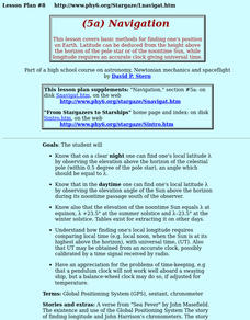
Navigation
Young scholars study the basic methods for finding one's position on Earth. Latitude can be deduced from the height above the horizon of the pole star or of the noontime Sun, while longitude requires an accurate clock giving universal time.
Curated OER
From Where to Where?
Learners find locations based upon their latitude and longitude coordinates. In this latitude and longitude lesson, students locate points on a grid and learn how to use an astrolabe.
Curated OER
GPS Scavenger Hunt
Middle schoolers go on a GPS scavenger hunt. They use GPS receivers to find designated waypoints and report back on what they found. They compute distances between waypoints based on the latitude and longitude, and compare with the...
Curated OER
Factors That Affect Climate
Fifth graders use captured portions of the Internet ("mininets") to perform research into climate. They create graphs of the data recorded using latitude as the independent variable and temperature as the dependent variable.
Curated OER
Time Zones
Young scholars solve time zone problems and chart travel around the world. In this time zone lesson, students learn about the history of time zones and view a time zone map. Young scholars use the time zone map to solve time zone...
Curated OER
Measure for Measure: Lengths and Heights
Students explore measuring tools by calculating heights and lengths of random objects. In this distance measurement lesson, students utilize the Internet service MapQuest to measure the distance between their current towns and many other...
Curated OER
How Does Temperature Change With Respect To Latitude and Longitude?
Students research the concept of predicting the weather. The research focuses on how some weather facts intuitively make sense. Students answer key questions based upon the mathematical concept of covariance.
Curated OER
What's Your Temperature?
Learners take a look at the local newspaper and focus on the weather section. They get into small groups, and each one looks at the same map, but of a different part of the country. They must prepare a presentation that shows how...
Curated OER
Westward Expansion
Students locate California and New York on a map and explore available means of travel in the 19th century. Students explore the role of trade in pioneer America and simulate various barter transactions.
Curated OER
"Where in the World is my School?"
Learners learn new vocabulary and discuss what GPS is and does. They locate their school using the equipment.
Curated OER
Making a Map of the Classroom
Young scholars create a map of the classroom using the computer programs AppleWorks and iChat in this math-based technology lesson plan. Lesson extension ideas include a scavenger hunt and maps of other school buildings.
Curated OER
Where is Here?
Students are shown the very basics of navigation. The concepts of relative and absolute location, latitude, longitude and cardinal directions are discussed, as well as the use and principles of a map and compass.
Curated OER
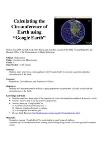
Calculation the Cricumference of Earth using "Google Earth"
Eighth graders investigate properties of circles. In this eight grade mathematics lesson, 8th graders apply proportional reasoning to data gathered with “Google Earth” to calculate equatorial and polar circumference of the Earth.
Curated OER
Analysis of Atmospheric Conditions for a High Mountain Retreat
Students examine the relationship between altitude, atmospheric pressure, temperature and humidity at a particular location. They practice science and math in real world applications. They write reports detailing their scientific...
Curated OER
GPS Treasure Hunt for Knowledge
Students examine themselves as being part of a global community. In this global community instructional activity, students investigate GPS systems. Students gain knowledge on how the device works. Students discover that satellites...
Curated OER
Graphing on a Coordinate Plane
Eighth graders explore the coordinate system. They identify the x and y-axis, parts of the coordinate plane, and discuss the process of plotting points. To emphasize the process of plotting points, 8th graders play an ordered pair...
Curated OER
Geometry: Mountain Rescue Mission
Fifth graders improve their skills using map coordinates by playing a mountain rescue game. In pairs, they roll dice to determine their moves up a mountain. The team that reaches the rescue site in the shortest distance on the grid...
Curated OER
Mapping Natural Disasters
High schoolers use Cartesian coordinates to plot current natural disasters. They relate location of natural disasters to their specific major project countries. Students tie in geometry within this lesson as connected to spatial...
Curated OER
Osprey Journey
Students investigate the migration route of one bird, Osprey B4, using information gathered from satellites to track birds over a two-year period. They coimpare their graphs with maps of B4's migrations that have been plotted by...
Curated OER
'Tis a Long, Long Way to Tipperary!
Middle schoolers practice finding the location of cities across the world by using an interactive Web site, and figure out the world's time and the value of time zones the world over.
Curated OER
Principles of Flight: Where are We?
Students explore the concept of topographical maps. In this topographical map lesson, students discuss how airplanes know where to fly. Students use topographical maps to simulate a field trip on the computer.


