Curated OER
5th grade social studies geography
In this geography instructional activity, 5th graders complete multiple choice questions about hemispheres, maps, cities, ecology, and more. Students complete 25 questions.
Curated OER
Sixth Grade Reading Quiz
In this reading worksheet, 6th graders answer multiple choice questions about passages they read, word parts, and more. Students complete 9 problems.
Curated OER
Application of Graph Theory
Students investigate different online tutorials as they study graphing. In this graphing lesson, students apply the concept of graphs cross curricular and use it to make predictions. They define the purpose and theories behind graphs.
Curated OER
Desert Cinquains
Students use the cinquain structure and correct parts of speech to write a poem with a desert theme.
Curated OER
Crossing Time Zones
Students explore the concept of differing time zones. Students refer to maps to identify the time zones in particular regions. They role play phone calls from different time zones. This lesson is intended for students acquiring English.
Curated OER
Is the Hudson River Too Salty to Drink?
Students explore reasons for varied salinity in bodies of water. In this geographical inquiry activity, students use a variety of visual and written information including maps, data tables, and graphs, to form a hypothesis as to why the...
Curated OER
Geography and Topography, History and Architecture
In this social studies lesson plan, students answer short answer questions about the geography, topography, history, and architecture of the east part of the United States. Students complete 24 questions.
Curated OER
Labeling a Map of the British Isles and Elapsed Time
In this map work and elapsed time worksheet, students label England, Scotland, Wales, and Ireland on a map. They calculate the elapsed time of a delivery that is described in a word problem that is broken down into four parts.
Compton Unified School District
How Can We Locate Places?
How can we locate places? Maps, of course! Expose second graders to the tools available in maps and discuss how these tools can help people find locations. Students also look at communities, including what makes a community and the...
Curated OER
Hurricanes As Heat Engines
Students examine sea surface temperatures to see how hurricanes get heat from the oceans surface. In this hurricanes lesson students use the Internet to find data and make line plots.
Concord Consortium
The Six Faces of Amzora
Here's a task that is out of this world! Given a description of a fictional cube-shaped planet, scholars answer a set of questions about the planet. They create a two-dimensional map and consider the distances between locations on the map.
Curated OER
Star Maps and iPads: Explore The World Above
Use these helpful stargazing tips and tools to enjoy the night sky this summer.
NOAA
Into the Deep
Take young scientists into the depths of the world's ocean with the second instructional activity of this three-part earth science series. After first drawing pictures representing how they imagine the bottom of the ocean to appear,...
Space Awareness
Valleys Deep and Mountains High
Sometimes the best view is from the farthest distance. Satellite imaging makes it possible to create altitude maps from far above the earth. A three-part activity has your young scientists play the role of the satellite and then use...
Curated OER
"The Drum"
Second graders read and discuss the folktale "The Drum" from India. They also answer story comprehension questions, complete an adjectives and verb worksheet, and label a map of India. Students sequence events from the story and make...
Curated OER
Regents High School Examination: Physical Setting Earth Science 2009
In this earth science worksheet students complete a series multiple choice questions. There are 85 questions that include diagrams.
University of Southern California
What Is The Ocean?
Go on a tour of the ocean through the lens of a scientist. Learners read maps of the ocean floor, study tide behavior, examine wave motion, and analyze components of soil. Each lesson incorporates a hands-on component.
Seussville
Oh! the Places You'll Go!
Honor Dr. Seuss on his birthday with a read aloud of the story Oh! the Places You'll Go! and a variety of activities that inspire scholars to dream of their future endeavors. Readers take part in conversations, research the life of...
Curriculum Corner
Book Study: The Mitten
Looking for a set of resources to compliment a reading of The Mitten by Jan Brett? A fun winter resource has everything from story sequencing and writing prompts to a parts of speech sort and a mitten flap book. The activities are great...
Mathematics Assessment Project
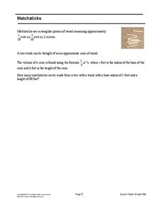
Matchsticks
How many matchsticks can be made from a single tree? That is the problem facing middle schoolers. Scholars first determine the volume of a matchstick given its dimensions, and then use this information to estimate the number of...
Curated OER
What a Relief Map
Students create a map using cookie dough. In this geography instructional activity, students research the physical features of a country, draw a diagram and design and create a map out of cookie dough.
Curated OER
Mapping Plate Boundaries
Students discover plate boundaries based on the uneven geographic occurrence of geologic hazards. After discussing geologic hazards, students plot different sets of earthquakes and volcanic eruptions on maps.
Curated OER
Idea Mapping
Students generate, share and display ideas as a group. They break into small groups to work on hand-drawn maps made up of concentric circles. they come before the group and make a similar diagram by charting each other's characteristics.
Curated OER
Lesson 2: Mapping Our Home
Young scholars recognize the importance of community participation in the census. In this U. S. Census lesson plan, students use map-reading skills to find answers and learn the difference between senators and members of Congress.


