Curated OER
2: Isle of Shapes - Based on the Puerto Rico Quarter Reverse
Learners identify both two and three-dimensional shapes. In this geometric shapes instructional activity, students listen to a teacher led instructional activity about the island of Puerto Rico. They look at the symbols and shapes on...
Curated OER
Papier-Mâché Globe
Paper mache projects are great for using up paper from the recycle bin. Give your class the chance to create a three-dimensional globe out of paper mache. They'll work to make their globes as accurate as possible, adding proper colors...
Curated OER
Ukrainian Style Scratchboard Eggs
The class explores Ukrainian motifs, the scratchboard technique, and two-dimensional art. They design and produce a Ukrainian style egg with tagboard, crayon, tempera paint, and a stylus. Ukrainian egg designs are similar to those used...
Curated OER
Create A Map!
Students examine two- and three-dimensional shapes, and discuss map skills and attributes. They plan and create their own school campus maps using pre-cut building site shapes.
Curated OER
Fold a Paper House
Students make a folded paper model of a Korean thatched roof house, label its parts and color it appropriately.
Curated OER
Salad Tray 3D Topographic Model
High schoolers explore the characteristics of topographical maps. They examine the relationship of contour lines and vertical elevation. Students create a three-dimensional model of a landscape represented by a topographic contour map.
J. Paul Getty Trust
O Greek Shape! O Fair Pose!
Everything old is new again. The Los Angeles J. Paul Getty Museum presents a lesson on how Greek black-figure painting influenced eighteenth century Neoclassical artists. After looking at a series of examples, class members create their...
Curated OER
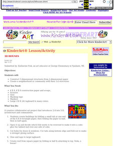
3D Houses
Students construct 3-dimensional structures from 2-dimensional paper. They design and compile their structures to resemble a neighborhood community.
Perkins School for the Blind
Beginning Map Skills
Maps can be so much fun, they help you understand spatial relationships, distance between objects, and can foster direction skills. Budding cartographers with visual impairments use the Wheatley Tactile Diagramming Kit to create their...
Curated OER
SAMMY DISCOVERS SHAPES AT SCHOOL
Students study maps and use them for real world experiences.
Curated OER
Inuit Sculpture
Kids in grade four through eight research Inuit artists and art styles. After a critical look at Inuit sculpture, they use those forms for inspiration as they create one of their own. They practice using the subtractive method of...
Curated OER
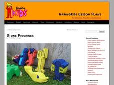
Stone Figurines
Students analyze visual arts by examining images on the Internet. In this figurine lesson, students research Keith Haring's artwork on the web and identify his body movement artistic style. Students utilize soft stones, carving...
Partnership for Educating Colorado Students
Mayan Mathematics and Architecture
Take young scholars on a trip through history with this unit on the mathematics and architecture of the Mayan civilization. Starting with a introduction to their base twenty number system and the symbols they used, this eight-lesson unit...
Curated OER
Creating Hope: Making Butterfly Stamps
Students create foam ink stamps. In this Holocaust lesson, students discover the history of the Holocaust and why butterflies represented a symbol of hope during those times. Students use BalsaFoam to carve out a butterfly...
Curated OER
Down on the Farm
Learners are introduced to a map of an Illinois farm. They determine whether the map is of the past, present, or future by looking at features on the map. They also use the map to make a three-dimensional model.
Curated OER
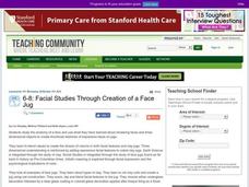
Facial Studies Through Creation of a Face Jug
Middle schoolers study facial expressions and create a face jug. In this facial study instructional activity, students look at images of face jugs through history before drawing thumbnails of facial images. They use the coil method to...
Curated OER
Building a Topographic Model
Students explore Mount Shasta and various locations on Mars to examine ways geographical data can be represented. They study topographic maps and translating data from 2-Dimensions to 3-Dimensions.
Curated OER
Kites of Japan
Young scholars perform research into the designs of Japanese kites in order to appreciate them for their aerodynamic designs. The appreciation builds student interest in order to produce their own similar designs.
J. Paul Getty Trust
Expressing Emotions through Art Lesson 4—Everybody Celebrates
Students create a celebratory hat after viewing images of artwork depicting people celebrating an event. In this artistic perception lesson plan, students discover why people celebrate their accomplishments and how to express feelings...
Curated OER
Faux Cloisonne Enameling
Middle and high school students engage in enameling and apply design elements. They study the history and tradition of Cloisonne. The history of traditional Chinese Cloisonne dates back over 700 years, with the most beautiful, artistic...
Curated OER
World Projections
Students identify map projections and examine polar maps. For this map skills lesson, students use a flat world map to identify various projections and calculate the distances between locations by using a map scale.
Curated OER
Gargoyles
Students design gargoyles modeled after the ones seen on Gothic cathedrals. They research the function and significance of gargoyles.
Curated OER
Personal Mummy Case
Students create a papier mâché mummy case covered with personal symbols from students' lives.


