K20 LEARN
Show and Tell Museum - Investigating Primary Sources: Read and Interpret Primary Sources
Scholars become detectives in a lesson plan that focuses on primary sources. Learners practice their observational skills by examining the teacher's artifact and visiting the Show and Tell Museum that highlihgts items from...
Curated OER
Mapping Our Home
Students explore how communities participate in census counting. In this census lesson, students recognize the absolute and relative location of a state and understand ideas about civic life and government.
Curated OER
United States Map- Rivers
Students learn about rivers. In this maps lesson, students describe rivers and what human activities take place in a river. Students use a map to locate the rivers in the United States.
Education Outside
Nature's Treasure Map
Youngsters construct a map of treasures that they find along a nature trail as they hike. They also make sketches and create place names of some of the spots along the trail. Once back in class, pupils use their treasure maps to help...
Curated OER
Exploring Maps: Lesson 2 Guide: Navigation
Students explore and examine how maps have been used in navigation. They research how travelers collected observations to keep track of their positions and plotted information on maps. Each student then makes a Mercator projection...
Curated OER
From Restriction Maps to Cladograms
Biology aces analyze restriction maps to determine the relationships among different primate species and then complete a cladogram. Preface this instructional activity with an explanation of how restriction enzymes are used to create the...
Curated OER
Cartographer on Assignment: Creating a Physical Map of Africa
Students use geographic information to make an outline map of Africa, then demonstrate their understanding of the physical landscape of Africa by using a variety of materials to create a physical map of Africa
Curated OER
Introduction to Maps
Students investigate a variety of maps to explain what each one is used for.
Curated OER
Things That Stick Out Or: How To Find Your Way Around on a Map
Students explain the meaning of and recognize the map outlines of a peninsula, an isthmus, and a cape.
Curated OER
The Mind Map
Learners form a mental map of their residence in relation to school and recreate it on paper showing distance, direction, location and symbols. This lesson is designed to introduce young scholars to geographic thinking.
Curated OER
Mapping the Prairie
Fifth graders study maps of the Chicago area looking at defining characteristics and place names. They investigate settlement patterns by looking at the maps.
Curated OER
Isoseismal Maps
Young scholars examine the difference between magnitude and intensity in earthquakes. They complete map work and write a first hand account of a person living in each level of intensity on the Modified Mercalli Scale.
Curated OER
World War II New Guinea Campaign
Although the big picture for this lesson on the New Guidea Campaign of WWII is taking a field trip to the Douglas MacArthur Memorial, you can easily use it as a guide to an independent or group research project as well. However, if you...
Curated OER
Compass Rose
Keep it simple and visual when practicing directions using this compass rose labeling worksheet. Learners fill in the compass themselves, using cardinal and intermediate direction abbreviations. Consider using their compass on a map to...
Curated OER
Making Gateway Middle School Handicapped Accessible
Learners discuss the situation at their middle school about being handicapped accessible. In groups, they identify the various types of handicaps and their accommodations. They create a blueprint of the building and make suggestions in...
Radford University
Getting Around Millbrook
When is the distance formula not accurate? Referencing a map of the school, pairs determine the walking distance between two locations. Creating coordinates for each location, pupils determine the distance between the two points and...
EngageNY
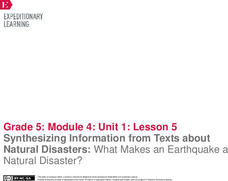
Synthesizing Information from Texts about Natural Disasters: What Makes an Earthquake a Natural Disaster?
Are all disasters natural? Scholars reread Earthquakes! to determine what classifies these events as a natural disaster. They label earthquake facts as N for natural or D disaster to support their ideas. They then discuss academic...
Notion
Popplet
Add color to the mind-mapping process! Users double tap to create a bubble and everything flows quickly from there as they drag, draw, type, and more.
New York State Education Department
Global History and Geography Examination: June 2012
Want to find out how much class members really know about history? A copy of a New York state test assesses scholars' knowledge of world geography and history in a multi-format test that includes multiple choice and essay items. The...
New York State Education Department
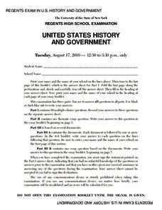
US History and Government Examination: August 2010
Geography has played a complex role in America history. The Atlantic Ocean has served as a buffer to protect the United States from European Wars, but its proximity to Cuba, however, left it vulnerable to nuclear war during the Cuban...
New York State Education Department
Global History and Geography Examination: August 2012
Let's test global history knowledge. The standardized test, designed for high schooler scholars, assesses world history and geography. The assessment is divided into five different sections, including essay items and multiple choice. It...
Curated OER
School Neighborhood Walking Tour
Students list specific boundaries in their school neighborhood and explain their possible purpose. They examine a neighborhood and see what connects us and what divides us. They, in groups, make maps of various neighborhoods and present...
Mary Pope Osborne, Classroom Adventures Program
The Backpack Travel Journals
Strap on those backpacks, it's time to travel through history with this literature unit based on the first four books of The Magic Tree House series. While reading through these fun stories, children create story maps, record...
Curated OER
Making Grading Manageable, Efficient, and Purposeful
Maintain your workload through focused assignments, expressed objectives, and clear rubrics
Other popular searches
- Making Maps Geography
- Making Maps and Research
- Making Maps Using Technology
- Making Maps of History
- China, Making Maps
- Making Maps of Community
- Reading Making Maps
- Neigborhoods and Making Maps
- Making Maps Lesson Plans
- Making Maps Usign Technology
- China Making Maps
- Neighborhoods and Making Maps
