Curated OER
African-American Communities in the North Before the Civil War
Middle schoolers examine what life was like in free African-American communities before the Civil War. They analyze maps, identify elements of everyday life in these communities, explore various websites, and complete a chart.
Curated OER
What They Left Behind: Early Multi-National Influences in the United States
Students research the impact of European voyages of discovery and colonial influence on different aspects of American culture. They access a number of online sources and reference maps to trace the influences of England, France, Holland,...
Curated OER
Energy, Matter, and Organization
Tenth graders review the Energy, Matter, and Organization unit. They have one week to complete an essay. Students must submit a concept map or drawing. The activity is introduces by reading a short story line which presents a simple...
Curated OER
Weather instruments
Students explore weather instruments. In this weather lesson, students make rain gauges, anemometers, and barometers following the instructions given in the lesson. Students set up a weather station using their instruments and record and...
Orange County Water Atlas
Location, Location, Location…
Young geographers discover not only how to read and recognize coordinates on a map, but also gain a deeper understanding of latitude and longitude and how climate changes can vary significantly across latitudes.
National Wildlife Federation
It's All in the Name: Weather Versus Climate
What goes up when rain comes down? An umbrella! Activity eight in the series of 12 explores weather and climate. In pairs, participants analyze maps, watch a short video, create a weather forecast, and complete a reading to determine the...
Curated OER
Fish and Zooplankton Through Remote Sensing
Ecology aces examine sea surface temperature maps and relate temperatures to concentration in fish and zooplankton populations. Take your class to a computer lab and provide experience with actual remote sensing data. Some of the links...
Curated OER
Overland Trails To The West
After observing a map of trails that settlers took in the 1800s, your class will write a journal with the perspective of a settler. In their journals, they must describe the trail they traveled, geographical features they saw, states and...
National Research Center for Career and Technical Education
Hospitality and Tourism 1: Safety and Sanitation
Math and science come alive in this career-related lesson plan on sanitation. Along the way, learners explore bacterial growth rates using exponential notation and graphs. A link to a very brief, but vivid video shows just how quickly...
Curated OER
Nellie Bly's Newspaper Club: Introducing the Science of Writing
Students evaluate a video about Nellie Bly, a famous reporter from the 19th century. They consider what makes a high-interest news article, write an essay in pairs and present it a literary tea.
Curated OER
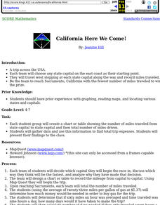
California Here We Come!
A highly relevant and great cross-curricular project! In teams, your class will plot a course from the East Coast to Sacramento, California passing through all of the state capital cities along the way. As part of the journey, teams...
Curated OER
The Mekong River
Junior geographers explore the region through which the Mekong flows, its pathway, the landscape, how people depend on the Mekong, and future uncertainties. They apply the five themes of geography to examine the region. They create a...
National Endowment for the Humanities
The War in the North, 1775–1778
Using primary source documents, including maps, learners examine Revolutionary War events from 1775 to 1778. The focus here is on the challenges George Washington and the Continental army faced and how they persevered in spite of those...
Curated OER
Geography/Current Events Project
Using the Balkan region as an example, fourth graders review the five themes of geography as a class. They identify the physical and human characteristics of a region before labeling the countries and landforms on a map. They then...
Curated OER
Conejito
Third graders read the story "Conejito" and write a descriptive story about the rainforest in Panama. They answer story comprehension questions, complete worksheet questions about a map of Panama, and rewrite a paragraph changing the...
Curated OER
Soils
Young scholars apply knowledge of soil, environmental impacts, economics, multiple human demands, and use given data for a proposed scenario in making land use decisions. They debate land use issues and/or scenarios and discuss a case...
Curated OER
Tropical Rainforests
Students create their own rainforest environment. This tropical rainforest lesson, introduces where rainforests are located, their real world connections, and their structural make up. It includes further resources online.
Curated OER
African Ecology and Art
Explore Samburu culture as students examine art work by many artists and compare and contrast their styles. They view Kenyan images and find Kenya on the map. Students identify conflict in the animal world and draw animals and record in...
Curated OER
Scale/Ratio
Investigate the use of ratios in scale drawings. Learners scale objects up or down using ratios then find the actual size of something using ratios. They apply their knowledge of ratios as they make their own telescopes in science...
Curated OER
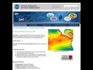
Comparing the Effects of El Nino and La Nina
Students examine the differences between an El Nino and La Nina year. In this investigative lesson plan students create maps and graphs of the data they obtained.
Curated OER
Build a Model Watershed
Collaborative earth science groups create a working model of a watershed. Once it has been developed, you come along and introduce a change in land use, impacting the quality of water throughout their watershed. Model making is an...
Curated OER
Tracking the Salt Front
Using the Hudson River as the focus, learners discuss the difference between salt water and fresh water environments, analyze maps and graphs, and complete addition and subtraction problems. This lesson comes with a wealth of...
Geophysical Institute
Latitude and Longitude with Google Earth
Travel the world from the comfort of your classroom with a lesson that features Google Earth. High schoolers follow a series of steps to locate places all over the earth with sets of coordinates. Additionally, they measure the distance...
Polar Trec
Swan Savvy
Just like so many other birds, swans migrate during the cold winter months. Your class can gain a better understanding of migration and bird life as they act out some of the activities common to the tundra swan. They make a nest, sit on...
Other popular searches
- Making Maps Geography
- Making Maps and Research
- Making Maps Using Technology
- Making Maps of History
- China, Making Maps
- Making Maps of Community
- Reading Making Maps
- Neigborhoods and Making Maps
- Making Maps Lesson Plans
- Making Maps Usign Technology
- China Making Maps
- Neighborhoods and Making Maps
