Curated OER
My Summer Vacation: Traveling
A classic instructional activity idea, kindergarteners share stories about their summer vacations on their first day of school! First, your young learners will listen to you talk about your summer vacation, making sure to use plenty of...
Curated OER
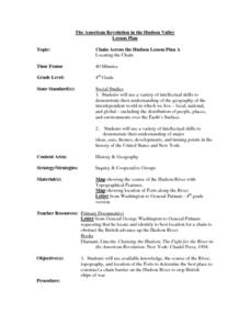
Chain Across the Hudson Lesson Plan A - Locating the Chain
Young scholars read a letter from George Washington requesting them to identify on a map a location that would stop the advance of British warships. They choose a location and justify their choice.
Curated OER
What's For Dinner?
Eighth graders discover how the location of restaurants affects the future location of different restaurants. Using a fictionous town, they map the locations of all current restaurants and analyze the data to determine what type of...
Curated OER
"We Didn't Start the Fire"
Students extract geographical and historical information from the lyrics of a popular song, make associations between people, places, and events, and plot their information on a map.
Curated OER
Pets Around the World
Students communicate via e-mail with other students to learn about pets, animals of interest , and geography from different parts of the world. Vocabulary focuses on rural, urban, and suburban areas.
Curated OER
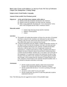
Immigration: Creating Change
Students explore how immigration has changed the culture of America. After identifying the foods and diets of Europeans and Native cultures, students create a map indicating where foods came from. Students design a restaurant menu,...
Curated OER
Grocery Store Field Study
Students visit a local grocery store (not a community market) to gather information about where some commonly eaten produce items come from. Once they have collected this information, locate the countries of origin on a map and research...
Curated OER
Where is Everybody?
Students collect data from different grade levels at their school and develop thematic maps which show population density, and determine how this might affect the school and themselves in the future.
Curated OER
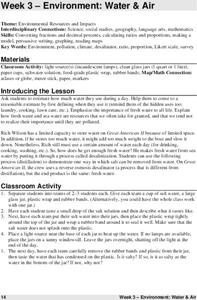
Environment: Water & Air
The introduction to the instructional activity mentions a sailor's limited capacity to store drinking water on his ship. Pupils then set up an overnight experiment to remove freshwater from salt water by distillation. There is a math and...
Curated OER
"Planet" Vacation
Students research a location of their choice using the internet. They list the characteristics of the location and why they chose it as their ideal vacation spot. Using maps, they pinpoint their destination and trace their route. They...
Curated OER
The Sweet Connection
Students use maps to find what crops are dominant in areas where honey bees are raised and discuss possible correlations. They mark the top ten honey- producing states on a US map.
Curated OER
Various Industries to Help Hawaii's Economy
Students identify various industries in Hawaii and where those products/services are exported to. They create a timeline which highlights important dates and events of those different industries. Finally, they identify on a map places...
Curated OER
How Mountains Shape Climate
Students use raw data to make a climatograph; they explain the process of orographic precipitation and the concept of a rain shadow.
Curated OER
Baseball in Korea
Seventh graders explore the origins of baseball. In this Geography lesson, 7th graders compare Korean baseball teams with other countries. Students create a map of all the baseball teams around the world.
Curated OER
From There To Here...
Learners find out where some of the products in hour homes come from, then become aware of our local trash, landfills and incinerators. They chart and graph data and use maps for different purposes.
Curated OER
Where Does Our Food Come From?
Fourth graders identify the state or country that a food product came from and locate it on a map. They identify products that are grown in Hawaii and the factors important in the location of economic activities.
Curated OER
What's Russia To Do?
Students watch a PowerPoint presentation on the Gulag system in Russia. In groups, they use the internet to create maps on climate and population pyramids for the country of Russia. They must use this information and develop a plan to...
Curated OER
My Home of North Dakota
Discuss the people, history and geography of North Dakota using this resource. Learners use a variety of sources to do research on North Dakota and present their findings in a PowerPoint presentation. They answer questions involving...
Curated OER
War Consumes Europe
How did the world react to Austria's declaration of war? This activity, guided by the McDougall Littell text, World History, has historians examining the beginnings of WWI through cause and effect analysis. Groups reference the text as...
Curated OER
Whoever You Are
Students examine cultures, traditions, and feeling throughout cultures. In this cultural lesson, students use literature, maps, and cultural information to examine how people have universal feelings despite their different cultures and...
Curated OER
Town Along the Chesapeake Bay
Fourth graders make a drawing of a town along a river off of the Chesapeake Bay in Maryland. Upon completion, they give an oral description of their town, including its houses, stores, businesses, farm area, government, etc., and will...
Curated OER
African Country Report
Sixth graders describe the relationship between the people of Africa and their environment. They examine the climate, economy and inhabitants of this land. Using maps graphic organizers and writing a report, 6th graders demonstrate how...
Curated OER
The Rivers and Lakes of Alberta
Learners are introduced to the online Atlas of Canada and they identify the lakes and major rivers of Alberta.
Curated OER
Historical Indian Treaties and Aboriginal Population
Sixth graders navigate an online atlas of Canada and compare the land area of of historical Aboriginal peoples in Manitoba to present-day figures.

