Curated OER
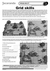
Grid Skills
In this geography worksheet, students use grid references on a map to locate places in the pictures given. They also identify another advantage of using a grid map, which they have an overhead view of the content to prevent any features...
Curated OER
Global Intelligence
Students discuss the war in Afghanistan and the conditions surrounding the hunt for Osama bin Laden after reading the article "Bin Laden and Omar: Far Harder to Find" from The New York Times. After the class discussion, students...
Curated OER
Early Explorers
Fifth graders investigate the routes taken by the early explorers. In this explorers instructional activity, 5th graders use interactive notebooks, discussion and maps to discover the routes taken. Students get into pairs and label maps,...
Curated OER
Fractile vs. Equal
Students compare and contrast methods of categorizing data. In this data collection lesson plan, students complete worksheet activities that require them to note the differences between equal and fractile intervals. Students also discuss...
Curated OER
Donde en el mundo estas?
Learners give & follow directions given in Spanish, using oral, written and graphics. They use maps, globes, atlases, and remote sensing, GIS, and GPS to acquire and process information about places.
Curated OER
Great Cities of the Middle East
Students explore the cities of Cairo, Istanbul, Jerusalem, Mecca and Tehran. In this Middle East lesson plan, students complete a map, research one of the five the cities and prepare a presentation that includes details about the...
Curated OER
Ireland: the Emerald Isle
Third graders complete a unit of study that examines several perspectives of Ireland. They explore how climate shapes Irish culture, reference historical and political maps, compute exchange values for Irish money, complete worksheets,...
Curated OER
Multinational Corporation Relocation
Students examine and analyze the concept of why multinational corporations relocate production facilities from developed nations to less developed nations. They explore the patterns and networks of economic interdependence incorporating...
Curated OER
Cultures and Cuisines WebQuest
High schoolers create and present a powerpoint presentation. In this cultures and cuisines research lesson, students select a country, interview someone from that country and visit a restaurant from that country. High...
Curated OER
Yodeling in the Swiss Alps
Students become familiar with the country of Switzerland, its geography and yodeling music. In this Switzerland instructional activity, students recognize that Swiss cheese is a producct of Switzerland and write about the process...
Curated OER
WHERE DOES OUR FOOD COME FROM?
Students examine the sources, location and availability of local food, develop mapping skills, interact with Elders to gain pertinent information, and examine subsistence issues of the past and present.
Curated OER
Find Yourself with Global Positioning
Students examine different types of new mapping technologies. They use the internet to gather information about mapping and navigation. They create their own global positioning tool and defend it to the class.
Curated OER
The Dip Felt Around the World
Young scholars share their opinions about a story about a sudden decline in China's stock markets. After reading an article, they identify the global impact of China's falling stock markets. They create a cause and effect map about the...
Curated OER
What Lives in the Open Ocean and Where Do They Live?
Young scholars explore oceanography by participating in a flash card activity. In this ocean inhabitant lesson, students define a list of ocean related vocabulary terms and answer ocean geography study questions. Young scholars utilize...
Curated OER
Our Watershed
Students work with the Tribal Council and Elders to explain the historical importance of the area's watershed. They develop a model of the watershed and map the route of water flow from the watershed to the ocean.
Curated OER
How To Find a Site
Fourth graders identify the three basic needs of humans. They identify on a map the best places to live and make a list of items that they can find on a map - streams, river, hills, plains, forests, etc.
Curated OER
Social Studies:
Learners identify various types of breads fromother countries and locate them on maps. In small groups, they make story maps of books that mention bread and make books resembling sandwiches. Students have a bread tasting party and...
Curated OER
Mending the Rift
Students determine what factors identify a country's political borders. After reading an article, they investigate questions surrounding the Great Rift Valley. On a map, they trace the valley from Asia through Africa and research the...
Curated OER
Westward Ho!
Second graders use a minimum of three maps of Kansas developed during the 1800's. They plot five major settlements that developed near water sources. Students brainstorm reason settlements may have developed near water sources.
Curated OER
Dante's Inferno
Students examine Dante's trip through Hell. In this literature lesson plan, students read The Inferno and then collaborate to discuss moral redemption and create their own maps of Hell based on the poem. Written descriptions are required...
Curated OER
Travel Plan Project
You can use a travel plan project in the classroom to learn about budgets, maps, time management, and more.
Curated OER
The Mother Culture of Mexico: The Olmecs
Sixth graders study the Olmec civilization. They develop a map of Mexico and a map of the area of the Olmec civilization. They research Olmec art, religion, and architecture. They construct Olmec symbols including giant heads, altars,...
Curated OER
Discovering Your Heritage
Learners interview a family member about their heritage. They listen to and record part of their family's oral history. Students also create and label a family tree going back a minimum of two generations and compare and contrast...
Curated OER
Hyperlink Habitats
Students explore an online Hyperlink Habitat to illustrate the interconnectedness of a tropical rainforest ecosystem. They create a map of the Hyperlink Habitat and research a local ecosystem and create their own print or Web version of...


