Curated OER
When You're Hot, You're Not!!
Students investigate volcanoes. In this landforms lesson, students locate two volcanoes on a world map. Students compare and contrast the types of volcanoes by using various Internet sites.
Curated OER
Discover Your World
Fifth graders, in groups, locate a place on a map where the group would like to visit, research the place then write a complete report on the outcome of the findings. They groups must make a cooperative oral presentation to the class.
Curated OER
Country Mouse, City Mouse?
Students recognize the characteristics of a rural area. They analyze land use to determine whether the map is of a rural (country) area or an urban (city) area.
Curated OER
Charles Lindberghs's Flight to Paris
Young scholars practice map skills. In this map skills instructional activity, students locate the cities of New York and Paris on a map. Young scholars read about the flight made by Charles Lindbergh in May 1927 from New York to Paris....
Curated OER
Louisiana Purchase
Students use maps, lecture and discussion to explore the unique contributions to the U.S. resulting from the purchase of the Louisiana Territory. They complete worksheets, label maps and participate in discussion groups.
Curated OER
Christmas in the Philippines, Pasko Sa Aming Bayang Pilipinas
Students examine the way in which Christmas traditions are celebrated in the Philippines. They investigate why Christmas is the most important festival while looking at the geography and history of the region.
Curated OER
Discovering Your Community
Students focus on the origins of the families that make up their community by exploring their family's origins through themselves, parents, and grandparents. Students create a map marked with family origins for the class.
Curated OER
This Is Tanzania
Young scholars begin the lesson by locating Tanzania on a world map. While reading an article, they note what the author's opinion is of the people who live there and discover the connection the people have with the land. They examine...
Curated OER
Terrorism and General Information about September 11, 2001
Students view a variety of pictures from September 11, 2001 either online or a slideshow. They discuss how the pictures make them feel and then complete a KWL chart highlighting what they already know about 9/11, and what they would like...
Curated OER
World War II Review
Ninth graders review previously presented material on World War II and discover how the world was at that time. They, in groups, participate in map work designed to explain Axis and Allied countries using toy army men.
Curated OER
Max Knows Mexicao, United States and Canada
Students utilize their map skills to explore the regions of North America. They explore the physical characteristics and climates of the regions. Students label their map and prepare a presentation of their findings.
Curated OER
Opening Doors to Social Studies with Children's Literature: The Desert Alphabet Book
Students explore the geography of the United States. In this social studies instructional activity, students identify the major deserts on a map of the United States.
Curated OER
Weather, Migrations, and Plants
Students research the effects of day-to-day weather on animal migrations, plant growth and other seasonal events. They consult maps, observe and record local conditions, keep journals and use their collected data check hypotheses.
Curated OER
5 Themes Awareness of Current Event Issues
Students analyze newspaper articles for the 5 themes of geography. They create a colorful portfolio explaining how each theme: location, place, etc. is relevant in a chosen current event.
Curated OER
America the Beautiful
Students analyze the physical geography of the United States and how we have adapted to or altered the land to create the country we know today. Students complete maps with physical features, states and cities of interest.
Curated OER
Prehistory Web Quest
Sixth graders identify how geography and climate determine the lives of early hominids, the characteristics of hunter-gatherer societies, how animals affected the lives of early hominids, and how hominids overcame their physical...
Curated OER
Learning About the Basin
Learners use watershed maps to explore the Lake Pontchartrain Basin in Louisiana. In this geography lesson, students identify important features such as elevation, vegetation, cultural, historical and land use on a map of Lake...
Curated OER
Collage/Assemblage
Students identify different shapes and patterns. They locate France on a world map and examine the works of artist, Henri Matisse. They discover shapes that are related to Math.
Curated OER
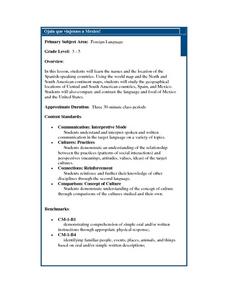
Ojala que viajemos a Mexico!
Learners research the names and locations of Spanish speaking countries throughout the world. They use a world map to become familiar with the locations of these countries and use the Internet to conduct further research. They sing...
Curated OER
Fruits and Vegetables
Students make a variety of recipes that include fruits and vegetables. For this fruit and vegetables lesson plan, students make recipes, learn about the proper amounts of fruits and vegetables needed per day, describe how to sanitize...
Curated OER
Countries of Africa
Learners study the coutries of Africa. In this African American history, small groups of students research a different country, color the country on the map of Africa, write a paragraph about the country, and draw pictures of its flag.
Curated OER
Early Explorers Web Quest
Students use the Canadian atlas online to research early explorers and settlers in Canada. They also complete a Web Quest to gather information from maps. They make generalizations about the early settlement patterns as well.
Curated OER
Land Use Over Time
Students view aerial photos and topographic maps of their local area. They compare and contrast major land use patterns over time by comparing these images to maps that are at least 50 years old. They analyze them using the four land use...
Curated OER
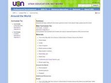
New: Around the World
First graders identify and demonstrate how symbols and models are used to represent features of the environment. They use a map and a globe to label where the students in the book came from, point out the continent, and show which ocean...


