Curated OER
Sam Houston for President...Again
Fourth graders discover the political career of Sam Houston. In this Texas history lesson, 4th graders research primary resources and create a modern-day version of Sam Houston's political campaign of the 1840s.
Curated OER
Countries of Africa
Learners study the coutries of Africa. In this African American history, small groups of students research a different country, color the country on the map of Africa, write a paragraph about the country, and draw pictures of its flag.
Smithsonian Institution
Lexington and Concord: Historical Interpretation
Learners view and analyze three different images related to the Battle of Lexington and Concord. They also answer a variety of questions in a graphic organizer to help keep the information straight.
Curated OER
Underground Rails: The New York City Subway System
Students explore the New York Subway system. They investigate its usefulness as mode of transportation for the people in the city and study its history compared to other city subway systems. They examine how the subway connects the...
Curated OER
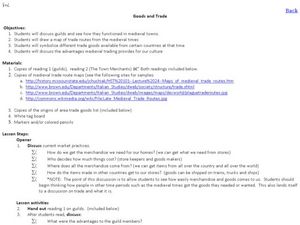
Goods and Trade
Students examine the trade that took place in Medieval Times. In this Middle Ages lesson, students read and discuss the roles of the guild members, the town merchants, and the individuals in trading goods. Students make maps of Medieval...
Curated OER
VA Statute for Religious Freedom, I. Semantic Map
Students analyze the Virginia Statute for Religious Freedoms and consider its implications. In this document analysis lesson, students explore primary and secondary sources regarding the document and create a semantic map that...
Scholastic
Biographical History
Elementary learners study and research an important historical figure. They research a historical figure and use a four square organizer to take notes. They develop a timeline and poem that reflects the life of the historical figure....
Curated OER
Asian-American History for Grades 6-8
Students use web technology to access American history and the Asian-American experience. They evaluate journals as historical artifacts, especially the concept of firsthand account vs. history text. Students discuss Asian American...
Curated OER
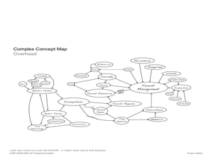
Project Jukebox
Students analyze an interview with the Climate Change Project Jukebox in order to help them undertand how to use a concept map. In this writing and climate change lesson, pairs of students log onto the Internet site for Climate...
Curated OER
Planning A Railroad Online Lesson
Students plan a route across Donner Summit using topographical maps in order to understand the challenges involved in constructing the railroad in the Sierra Nevada Mountains. In this history lesson plan, students first discover how to...
Curated OER
Establishment of Plainfield
Eighth graders analyze documents and maps of Plainfield, CT from different time periods, then, working in a small group, create a map for a giventime. In this Plainfield lesson, 8th graders read primary and secondary sources...
Curated OER
Trailblazers - Now and Then
Students, working in pairs, use maps to determine the most efficient routes between two cities. They research which route would have been used by early trailblazers. They present a first person account of one of the trailblazers place in...
Curated OER
This Land is Your Land
Young scholars consider the concept of borders and their development by looking at maps and documents. They create a presentation highlighting a current border dispute and propose solutions.
Curated OER
Map Making
First graders explore maps to realize the concept that maps are simply small representations of a much bigger picture. They discuss the importance of maps in everyday life, examine a map of the school, and then make a map of their...
Curated OER
Map Making with Lewis and Clark
Students develop maps based on a virtual internet expedition of The Louisiana Purchase land area. They create the maps based on an actual outdoor expedition of their communities. Student create two maps, one based on the Louisiana...
Curated OER
Between the Rivers
Second graders compare and contrast historical American cultures. In this American history lesson, 2nd graders participate in reading, writing, oral, and hands on activities. Students discuss the similarities and differences...
Curated OER
Discovering Your Community
Students focus on the origins of the families that make up their community by exploring their family's origins through themselves, parents, and grandparents. Students create a map marked with family origins for the class.
Curated OER
Colonial Vacation Planner
Students plan a family vacation to states that were among the original 13 colonies. The groups determine which state they visit, map their route, calculate the mileage, and determine how much money they spend on gasoline.
Curated OER
The Hopi Indians
Fourth graders read and look at maps of the Hopi Indians and compare and contrast their lives with the Hopi Indians. In this Hopi Indians lesson plan, 4th graders learn about different cultures and answer short answer questions.
Curated OER
The Anasazi
Students investigate and determine the origins of the ancient Anasazi who inhabited present-day Utah and the Four-Corners-Region.
Curated OER
The Anasazi
Sixth graders investigate and determine the origins of the ancient Anasazi who inhabited present-day Utah and the Four-Corners-Region, after receiving direct instruction and carrying out activities in cooperative group settings. They...
Curated OER
Mineral Exploration Using Remote Sensing
Students use quantitative data that they gather to figure out where there is an ore body in their model. They describe how geologists could use similar information in order to figure geologic patterns and geologic history for a specific...
Curated OER
Traveling to the Gold Rush
Fourth graders research the experiences the people who traveled to California during the Gold Rush by land and sea. They create a map showing the various routes that individuals took to get to California. Students explain the...
Curated OER
Is Urban Sprawl Causing Us To Lose More Than Ground?
Students map the changes that occur in the land as a result of urban sprawl. They explore the problems that paving and building have on the watershed and the habitats on the Northshore.


