Kate Stickley
Reading the World: Latitude and Longitude Lesson latitude and longitude, maps, coordinates on a map, prime meridian, reading maps, equator, globes
Find five activities all about longitude and latitude! Use oranges to show the equator and prime meridian, plot birthdays on a map using coordinates, and plan a dream vacation.
Annenberg Foundation
Reading Maps
Can you read a map? Scholars use an interactive technology tool to analyze maps of various kinds to gather evidence and data to better understand their meanings and usefulness. Using newly obtained knowledge, they form an interpretation...
Annenberg Foundation
America's History in the Making: Using Digital Technologies
How can digital technology of today link us to the events of the past? Scholars use technology to uncover the vast number of historical resources available in lesson 12 of a 22-part America's History in the Making series. Using databases...
Museum of Science
Make a Map
It's important to know the final destination. Scholars first measure distances in a region of interest using a standard measuring device or by counting steps. They then use an appropriate scale and graph paper to create a map of the...
Curated OER
Learning About Maps
Learners take a "field trip" with the teacher through the school then draw a diagram of what they saw. They bring the maps to the computer lab where they create electronic maps using the software program Neighborhood Map Machine.
TED-Ed
A Digital Reimagining of Gettysburg
Why would Robert E. Lee order Pickett's Charge, an action that changed the course of the Civil War? Geographer and historian Anne Knowles uses digital technology to explain what she thinks is the missing piece in trying to understand...
Curated OER
Mapping the Past
Young scholars study historical maps to view how the world evolved from medieval times through the Renaissance. They work in groups to examine the maps and present a report on one of the listed maps.
Annenberg Foundation
Mapping Initial Encounters
Picture someone's excitement of seeing a horse for the first time. How about a cow? The Columbian Exchange changed life for not only Native Americans, but also for Europeans and the entire world. The second lesson of a 22-part series...
Curated OER
Pirate Map
Students write directions explaining how to get from one location to another by using a map of their town and use simple maps to identify and locate places.
Civil War Trust
Map the Civil War
Mapmaking was a very important element in successfully planning attacks on enemies during the Civil War. Guide pupils through the process of pacing to find the average length of their steps, measure the distance between one object to the...
Curated OER
Lewis and Clark
Students investigate Lewis and Clark. In this Lewis and Clark lesson, students search the Internet for information about Lewis and Clark and the Corps of Discovery. Students use maps to understand the explorations and decide which...
Curated OER
Way to Go! Create a Road Map Game
Students create a travel game of one of the United States. They research a state of their choice and create a travel game using a common road map. They interpret map symbols as they calculate map mileage for their games. They create...
Curated OER
But Where Is It On This Modern Map? A problem-solving, mind-boggling experience!
Trace Columbus' voyages by locating them on 21st Century maps. Using a navigators lesson, 4th graders will examine the Age of Exploration and trace Columbus's routes accurately on laminated world maps using different maps. Note: You...
Curated OER
Map It!
Fourth graders demonstrate map making skills by using the computer to create maps of the geographic features, regions, and economy for their state.
Curated OER
Create A Park Map
Students design ultimate park experience for Florida families as they demonstrate their knowledge of map legend skills.
Curated OER
A Map Mystery
Second graders solve a map mystery. In this technology lesson plan, 2nd graders develop an awareness of maps and the symbols associated with maps as they the "Neighborhood Map Machine."
Curated OER
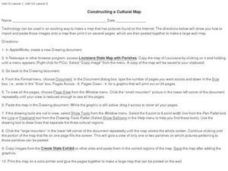
Constructing a Cultural Map
In this constructing a cultural map worksheet, students use cut and paste technology to make a map of Louisiana that has pictures from the Internet.
New York State Education Department
Global History and Geography Examination: June 2011
People in Ukraine, Rwanda, and Cambodia have all faced challenges to their human rights and even genocide. Using primary and secondary sources, scholars evaluate these challenges and the international community's role in them. The...
Curated OER
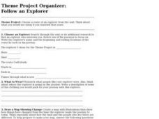
Project Organizer: Follow an Explorer
This is both a great idea and a great way to help your class organize a themed project. They use these worksheets to assist them in writing a creative historical narrative about the life and travels of an explorer. They'll compare and...
Curated OER
Finding Your Way Around the World
Students plan a trip around the world and create a PowerPoint presentation of the journey. In this map, atlas, and technology instructional activity, students plan a trip around the world in which they avoid using an airplane. Students...
Curated OER
Map the Civil War
Students explore the Civil War through original maps. In this mapping lesson, students calculate distance and show it on an original map. Students examine the type of landscape and its landmarks and draw symbols on the map.
Global Oneness Project
The Value of Ancient Traditions
Imagine having to give up cell phones, computers, and TV? What would be lost? What gained? An examination of the Drokpa, a nomadic people who live in the grasslands of Tibet, provides class members an opportunity to consider how access...
Curated OER
Second Graders on the Map
Second graders explore the various types of maps. They examine the differences between street maps and aerial photographs. Students identify various features on each map. They use cardinal directions and the compass rose. They write...
Curated OER
Making a Report to President Washington
Learners gain an understanding of some of the challenges the U.S. faced at its birth. They are asked to compose a report on the state of the nation in 1790 (addressed to President George Washington), which includes a narrative, maps and...


