Curated OER
Me on the Map Lesson 1
Students use maps, globes, geographic information systems and other
sources of information to analyze the nature of places at a variety of scales. They identify on a map and determine the population
of the city, county, state, country...
Curated OER
Draw To Scale The E-Z Way
Fourth graders draw a rough floor plan of a house to scale without using a ruler to determine measurements. They see how architects use scale to draw blueprints, and solve math problems using scale.
Curated OER
Worksheet for Analysis of a Map
For this primary source analysis worksheet, students respond to 6 short answer questions that require them to analyze the maps of their choice.
Curated OER
Drawing A Map
Students discuss any information they already know about maps. As a class, they draw a map of a park following written directions making sure to include a compass rose and key. They are graded based on a rubric and discuss the need for...
Curated OER
Tracing Highs and Lows in San Francisco
On a topographic map, students identify the scale bar, north arrow, and contour interval. They then locate a hill on the map and make note of the contour lines. Students then locate other places with similar contour line patterns....
Curated OER
Geography of South America
Student's identify geographic features of a South American map. They use the scale of the map to calculate distances between points. They identify examples of the five geographic themes on the map of South America.
Curated OER
Orienteering - Lesson 4 - Distance and Height
Pretend that you've been dropped onto a mountain, in the middle of nowhere, and all you have to find your way is a topographical map and a compass. Could you find your way to the nearest town? Orienteering teaches the skills of map...
Curated OER
Exploring Hawaiian Mountain Zones
Fourth graders watch a video that describes the climate and vegetation zones of Hawaii. They describe the different physical conditions that create vegetation zones from the sea to the mountains. In groups, they create an illustrated...
Curated OER
Rivers Run Through It
Using a relief map of New York State, learners answer questions about the distance between different cities, identify bodies of water, and more. First, they discuss vocabulary related to the Hudson River area. Then, they complete a...
Curated OER
River Run Through It
With vocabulary lists, worksheets, and more, this lesson sets learners on an exploration of the Hudson River area. They read an essay about the area, analyze a relief map of New York State, and complete a worksheet.
Curated OER
Exploring the Hudson in 1609
While this lesson focuses on a study of the Hudson River, it could be used as a template for a discussion of map skills, converting measurements, and plotting a route. The lesson includes vocabulary and other resources to make it a...
Curated OER
Science Jeopardy - The Earth Sciences
The earth sciences are the focus for this Jeopardy-style review game. Categories include geology, space, scientific investigation, meteorology, and oceanography. Diagrams and pictures are involved with most of the questions, making this...
Curated OER
The Crash Scene
Fifth graders explore geography by participating in a mapping activity. In this engineering instructional activity, 5th graders identify the differences between latitude and longitude and practice locating precise points on a globe or...
Curated OER
You Are Here
Students map local places and learn to use scale and distance. In this mapping lesson plan, students map their school and a favorite place. Students recreate their maps showing distance and scale sizes. Students locate their...
101 Questions
Neptune
Examine an innovative approach to a large-scale model. Pupils across the state of Maine teamed up to create a model of the solar system that spans 40 miles. Put thinking skills to work within your classes as they make the calculations to...
Curated OER
Formulas Multiple Choice
In this formulas learning exercise, students determine the distance between two points. They read story problems, identify needed information, write equations and solve them. Students find the midpoint of a line. This...
Curated OER
Isoseismal Maps
Young scholars examine the difference between magnitude and intensity in earthquakes. They complete map work and write a first hand account of a person living in each level of intensity on the Modified Mercalli Scale.
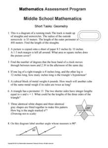
Mathematics Assessment Project
Geometry
Help learners find joy in facing mathematical challenges. The questions posed on this instructional activity encourage young mathematicians to utilize skills learned throughout a geometry unit, and to apply themselves and persevere...
Curated OER
Making Personal Maps
Students study maps and become familiar with how to use one. In this investigative lesson students create a map of an area and provide a legend.
Curated OER
Design an Island
Students make a map of an imaginary island using the topographic symbols provided from a worksheet. Students place lakes, dwellins, reefs, etc. in areas where they would logically be located from understanding how the topography of an...
Curated OER
Map Maker Map Maker
Students create their own maps. In this map making lesson, students go to Microsoft Word and create a chart. They label directions, buildings, streets, and distance.
Curated OER
Understanding Topographic Maps
Underclassmen create a cone-shaped landform and then draw a contour map for it. Then they examine a quadrangle (which was easily located with an online search), and relate it to what they experienced. The accompanying worksheet is...
Curated OER
Making a Map of the Classroom
Students create a map of the classroom using the computer programs AppleWorks and iChat in this math-based technology lesson. Lesson extension ideas include a scavenger hunt and maps of other school buildings.
Curated OER
Understanding Geography
Students create a map of their own neighborhood to show the relationships between the geography of the neighborhood and its economy and culture. They view and discuss an introductory video on how geographers study an area then go out...


