Science 4 Inquiry
Edible Plate Tectonics
Many people think they can't observe plate tectonics, but thanks to GPS, we know that Australia moves at a rate of 2.7 inches per year, North America at 1 inches per year, and the Pacific plate at more than 3 inches per year! Scholars...
Curated OER
Sonar Mapping
Students use a shoe box to create a seafloor model and use cardboard for layering inside of the shoe box to simulate the ocean floor. They probe the ocean floor to simulate sonar echoes. Finally, students graph their data to get a...
Curated OER
Data Processing
Young scholars explore the application of Geographic Information Systems (GIS) in a variety of businesses and organizations. They present proposals, representing different businesses and organizations, that support how GIS technology...
Teach Engineering
What's Wrong with the Coordinates at the North Pole?
Here is an activity that merges technology with life skills as individuals use Google Earth to explore the differences between coordinate systems and map projections. The self-guided worksheet is the fourth segment in a nine-part unit....
Curated OER
Volcanoes: Sixth Grade Lesson Plans and Activities
Bring a set of pre-lab, lab, and post-lab lesson plans on volcanoes to your earth science unit. Sixth graders explore the three types of volcanoes found on Earth, plot the specific locations of these volcanoes on a map, and investigate...
Curated OER
GIS Mapping: Special Instructions for Using Digital Orthophotos
Learners practice cartography using GIS technology. They create a map of Austin using GIS and aerial photos.
Curated OER
Trouble in the Troposphere
Learners Use data sets from MY NASA DATA to produce graphs comparing monthly and yearly ozone averages of several U.S. cities. They analyze and evaluate the data and predict trends based on the data. In addition, they discuss and...
Curated OER
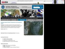
Linkages Between Surface Temperature And Tropospheric Ozone
Students collect and interpret data to make predictions about the levels of ozone in the atmosphere. Using the internet to collect data students use their collected data to create a line graph for analysis. Students make mathematical...
NOAA
A Moving Crust
Young scientists piece together the geological puzzle that is the earth in the third and final lesson of this earth science series. With the help of numerous multimedia resources and a series of engaging hands-on activities, students...
Curated OER
GIS: Mapping Watersheds of the Edwards Aquifer in Travis County
Learners manipulate existing GIS data to create and map a new layer of information that shows that watersheds in Travis County that are on top of Edwards Aquifer. They create and map that shows the watersheds in Travis County that are on...
Curated OER
Fostering Geospatial Thinking: Space to Earth: Earth to Space (SEES)
Students locate and access data to help them with their science inquiry. In this geographical positioning lesson plan students evaluate and compare data sets.
Curated OER
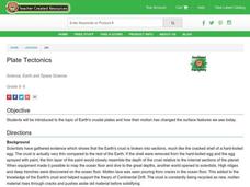
Plate Tectonics
Students complete a data sheet. In this Earth composition lesson, students learn what happens when the Earth's plates push against each other. They watch a teacher demonstration and complete a data sheet.
Science Matters
Finding the Epicenter
The epicenter is the point on the ground above the initial point of rupture. The 10th lesson in a series of 20 encourages scholars to learn to triangulate the epicenter of an earthquake based on the arrival times of p waves and s waves....
Curated OER
Mapping and Excavating a Jello Mold
Fifth graders, in groups, map the three layers of different colored jello layers in molds and note the placement of fruit in them. On the grid paper they draw each grape, raisin, or other object and carefully remove each layer. After...
Curated OER
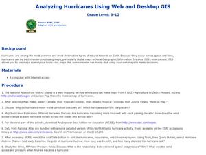
Analyzing Hurricanes Using Web and Desktop GIS
Young scholars analyze hurricanes. In hurricanes lesson, students use the Internet and GIS to analyze hurricanes. Young scholars view the National Atlas of Maps to discuss the direction hurricanes move. Students study the wind and...
Curated OER
Roman Archy
Third graders use Google Earth to examine Roman architecture. For this ancient Rome lesson, 3rd graders visit the noted URLs to look at examples of Roman architecture. Students work in teams to examine data about the structures.
Curated OER
Stratigraphy -- Layers of Time in the Earth
Students are introduced to the process of stratification. Using the internet, they read about the Richard Beene archeological site near San Antonio. Using a map, they color code the different layers present at this site and answer...
Curated OER
Fossil Fuels (III), The Geology of Coal: Interpreting Geologic History
Students hypothesize about why various samples of coal have different characteristics. Pupils use information that they found during Internet searches to ascertain the validity of their hypotheses and verify the "story" of coal. ...
Curated OER
Analogies
Analogies demonstrate how words relate to each other and crafting analogies is a good way to encourage learners to develop their understanding of the layers of meanings in words. This worksheet provides pupils practice completing and...
Columbus City Schools
Diversity of Living Things
Here's a topic classes can really dig—the fossil record. Use the well-organized and thoughtful road map to take eighth graders back in time to unearth the answer. Learn how our climate has changed, and how organisms have changed along...
Curated OER
The Breathtaking Nature of the Urban Explosion, Part 2
Young scholars explore ozone levels. They measure the concentrations of ground-level ozone in the atmosphere. Students observe changes in the concentrations of ozone over time. Young scholars complete a data sheet to record ozone...
Curated OER
Linkages Between Surface Temperature And Tropospheric Ozone
Students organize and analyze data regarding changes in tropospheric ozone and then hypothesize about the consequences of these changes.
Curated OER
Liquid Layers
In this density worksheet, students investigate what will happen when various liquids with different densities are put into the same container. They hypothesis and make observations. Students answer 4 questions about their investigation...
Curated OER
Rocks in our Backyard
Learners examine igneous and sedimentary rocks. They observe and identify geological formations in their community, analyze igneous and sedimentary geological layers using a geological map, and use GPS to locate geological formations.


