Curated OER
Learn the States and Postal Abbreviations
If you are preparing to cover the 50 states with your class, you don't want to miss this resource. It includes an excellent set of worksheets through which learners practice identifying states from their abbreviations and placing those...
Curated OER
Choropleth Mapping Skills
In this geography activity, students identify and describe how to apply choropleth mapping skills. They examine the map given and convert it into a choropleth map through coloring. Then students use those colors to shade in their key and...
Curated OER
Map Activities
In this geography instructional activity, learners follow the directions and shade 3 different regions of a UK political map, shade European Union countries on a political map of Europe, match 4 physical feature of Africa to their...
Curated OER
United States: Physical Features Fun
In this map worksheet, students color and trace eleven listed features on a map of the United States. Students answer six additional questions about the map. A United States map is not provided. However, websites are provided to find...
Curated OER
Logical Relationship of Postulates & Theorems
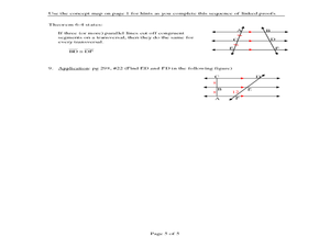
In this postulates and theorems learning exercise, students explore a concept map containing information about angles and sides, alternate interior angles, and diagonals of a parallelogram. They use the concept map to prove theorems...
Curated OER
Reading a Map 1
In this map reading worksheet, students examine the map of Melton Park and determine if the sentences are true or false. Students answer 20 questions.
Curated OER
History Mapping
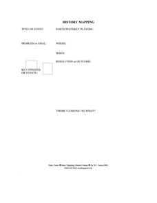
In this history mapping graphic organizer, students list an event, key players, problem, setting, key episodes, resolution, and lessons in order to better understand the event's impact on history.
Curated OER
A Map of Ghana
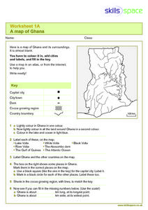
In this Map of Ghana worksheet, students are given a blank map and key. They are told to label major features and color according to directions.
Curated OER
Map Coloring
In this math worksheet, students create a map using different colors. They use a specific pattern and can use only four colors. This worksheet is a proof of the making of a map using no more than 4 colors. There is an answer key.
Curated OER
Do You Know Your 50 States?
Learners use the names and abbreviations of the 50 states to label a blank map of the United States.
K12 Reader
Tap on the Map
Work on -ap words with a straightforward exercise. Class members read a short poem that includes plenty of -ap words and respond to three included reading comprehension questions.
Baylor College
Pre-Assessment Activity: What Do You Know About Microbes?
In an introductory lesson, youngsters take a pre-assessment quiz, get a grasp of a gram of mass, and then estimate the mass of microorganisms that live within a human body. Using Glo Germ™, a material that allows you to simulate the...
Curated OER
Story Mapping: Guide for Cross-Disciplinary Application
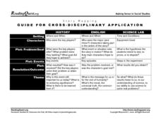
In this story mapping worksheet, students read how story mapping can apply to 3 different areas of study: history, English and science lab. The components of story mapping that are included here are setting, characters, problem/goal,...
Curated OER
Map Activity: Place Name
In this map worksheet, students locate given words on a map of the United States, then answer a set of 4 related short answer questions.
Curated OER
Ecosystem Concept Map
How do ecosystems change? How do organisms keep their ecosystem going? Learners use a word bank to fill in 12 blanks that describe the functionality of ecosystems.
Geography 360°
Introducing Europe
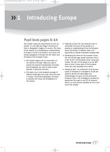
Provide your learners with a comprehensive introduction to Europe with this great set of worksheets. Map activities include matching European countries to their capitals and places on a political map, as well as exploring different...
National Research Center for Career and Technical Education
Transportation, Distribution, and Logistics: Tire and Wheel Assemblies
Is bigger really better? By the end of this activity, learners will be able to apply formulas for computing the diameter of tires and wheel assemblies. Begin by showing a slide presentation that will review definitions for radius and...
Oregon State
World Map of Plate Boundaries
Young geologists piece together the puzzle of plate tectonics in an earth science lesson. Given a physical map of the world, they search for land formations that indicate the location of different types of plate boundaries.
American Chemical Society
Development of Baking Powder
Did you know baking powder can be used to treat acne, whiten teeth, and make sugar cookies? The lesson on the development of baking powder is ready-to-go with no preparation required. Through readings, pupils answer questions, complete...
Illustrative Mathematics
The Longest Walk
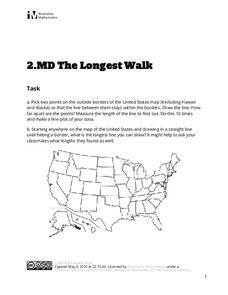
How long of a line can you draw within this activity? Learners pick two points outside and within the map to create the longest line they can. After drawing 10 lines, learners plot the length of each line on a line plot. Then they...
United Learning
The Great Age of Exploration (1400-1550)
Delve into the Age of Exploration with this activity-packed resource! Complete with a pre-test, discussion questions and quiz for a 30-minute video on the period, map activities, timeline of discoveries, vocabulary, etc. this is a...
Lrymple Secondary College
Plate Boundary
Scholars examine diagrams and complete a concept map to discover key details about convergent, divergent, and transform plate boundaries.
Geophysical Institute
Latitude and Longitude with Google Earth
Travel the world from the comfort of your classroom with a lesson that features Google Earth. High schoolers follow a series of steps to locate places all over the earth with sets of coordinates. Additionally, they measure the distance...
British Council
Weather 1
Match weather words with pictures in a weather vocabulary worksheet. Beginning readers look at pictures of various weather patterns and choose/write the word that describes the weather. They create a map and write about the weather...
Other popular searches
- Map Key and Legend
- Using a Map Key
- Create Map Key
- Map Key and Symbols
- Project Map Key
- Map Key Topography
- Map Key Legend
- Reading a Map Key
- Map Keys and Legends
- Map Key Worksheets
- Read a Map Legend
- Reading Map Keys


