Curated OER
Using Maps to Make Public Health Descisions Case Study: Harmful Algal Blooms in the Gulf of Mexico
Students are introduced to GIS and its uses. Students participate as public health scientists to deliberate a course of action to explore possible research questions. Pupils interpret spatial data, and make predictions based on GIS data,...
Florida Center for Reading Research
Comprehension: Expository Text Structure, Text Feature Find
Scholars explore an expository text to answer questions about its structure.
K12 Reader
Conflict Over North American Lands
Readers are introduced to some of the conflicts that arose over land and resources in the Americas in a two-part cross-curricular comprehension worksheet that asks kids to study the article and then to use information provided to...
Orlando Shakes
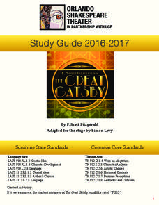
The Great Gatsby: Study Guide
Uncover the exciting world of the Roaring Twenties with The Great Gatsby study guide. Individuals become critics as they write a review of the production. Scholars also read historical information and analyze the differences between the...
Curated OER
Where, Oh Where
Young scholars use maps to explore several traditional regions of Native Americans. They research information on the regions' climate, resources, landforms, flora and fauna.
Curated OER
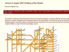
Interstate Highway Trip
In this algebra worksheet, 11th graders calculate a path taken without repeating and crossing the same path more than once. They are given clues to help-them find the right answer. There is a solution key with his word problem.
Curated OER
Civil War
Students explore the Civil War. In this U.S. Civil War U.S. history activity, students participate in a cubing activity in which a variety of Civil War projects are described on a paper cube. Students roll the cube to...
Curated OER
Whale Migrations
Learners use whale migration patterns to determine sex and age of whales and determine where these whales can be located during different seasons. They use mapping skills to plot the migration patterns of four unknown whales.
Curated OER
Our State Road Trip
Students take a virtual tour of the country of China instead of a state. Using the Internet, they examine the differences between a political and physical map and use latitude and longitude to locate specific places. They also research...
Curated OER
Fort Pickens and Fort Barrancas Historic District
Students use maps, readings, photos and diagrams to identify and describe events in Pensacola, Florida that preceded the Civil War. They examine the role of Fort Pickens during the Civil War and consider the community impact of military...
Curated OER
Naming Roads
Students investigate the aspects of a historic map of roads and trails in the Southeastern United States. They explore reasons for giving roads certain names and decide on names for other roads themselves.
Curated OER
Climate and Topography, What Is the Connection?
Fourth graders study Neumann's world continent map and explore topography and climate.
Curated OER
Religions of the World
Second graders explore the part that religion plays in a culture. They explore how many different religions there are in the world and where they're located.
Curated OER
Oh Where, Oh Where, Can My Industry Be?
High schoolers conduct observational studies of three ecosystems by visiting the Web World Wonders website. They gather data, compare/contrast the information, and decide on the establishment of a nuclear power plant at one site over the...
Curated OER
Exploring the Objectives of the European Union
Students identify the members of the EU and brainstorm on how these countries would benefit by having an alliance. In groups, they examine the main objectives of the EU and present to the class.
Curated OER
Biomes: Islands and Evolution
Students discover how islands form, how plant and animal species get there and what the term means. For this biomes lesson students prepare a presentation that describes the life forms and geography of an island.
Curated OER
A-maizing Facts
Students research the lives of Native Americans living in the Northeast Woodlands region, focusing on how the climate, location, and physical surroundings affected their way of life.
Curated OER
LAB: Temperature Inversion - Pollution Simulation
Students, after identifying and examining the relationship of temperature and air masses in association with smog and pollution, create a temperature inversion in a long aquarium jar. They experience what happens when smog builds up and...
Curated OER
Effects Of Natural Disasters On Environment
Students investigate the concept of how natural disasters effect the environment. They conduct research using a variety of resources. They are given a scenario that needs a defensive speech. Students take a position and defend it by...
Maps of Mexico
Virtual Picture Travel Map of Florida
Click on Florida and take a virtual tour of Daytona, Orlando, Cocoa Beach, West Palm Beach, Ft. Lauderdale, Miami, Key West, Naples, Fort Myers Beach, Fort Myers, St. Petersburg, Clearwater and Tampa. Visit places of interest such as the...
Maps of Mexico
Virtual Picture Travel Map of Florida
Click on Florida and take a virtual tour of Daytona, Orlando, Cocoa Beach, West Palm Beach, Ft. Lauderdale, Miami, Key West, Naples, Fort Myers Beach, Fort Myers, St. Petersburg, Clearwater and Tampa. Visit places of interest such as the...
Other
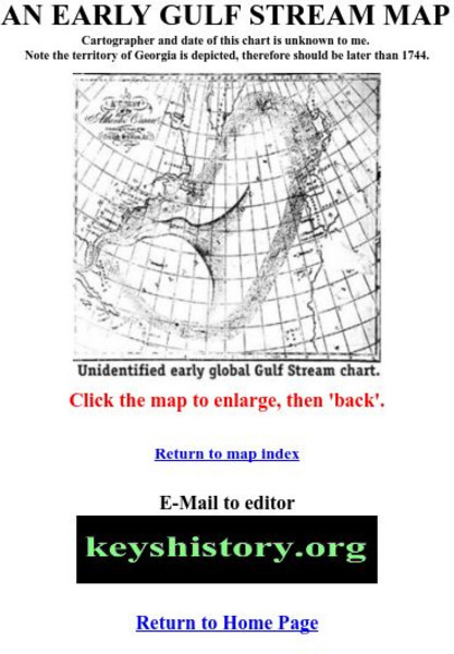
Florida Keys History Museum: An Early Gulf Stream Map
This is one of the earliest maps of the Gulf Stream, probably after 1744.
Curated OER
Educational Technology Clearinghouse: Maps Etc: The West, 1783 1789
A map of the early United States between 1783 and 1789 showing the territorial State claims west to the Mississippi River, and is keyed to show undefined or disputed boundaries, boundaries of States and territories, and boundaries not...
Curated OER
Educational Technology Clearinghouse: Maps Etc: The United States, 1790
A map of the early United States in 1790 showing the boundary established west to the Mississippi River, and is keyed to show undefined or disputed boundaries, boundaries of States and territories, and boundaries not settled. The map...


