Curated OER
Investigating Earthquakes: GIS Mapping and Analysis
Students describes the technique of preparing "GIS-ready" data and shows how to map that data and conduct basic analyses using a geographic information system (GIS).They use latitude and longitude fields to plot the data in a GIS and...
Curated OER
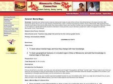
Minnesota-China Connections: Mental Maps
Students examine the concept of mental mapping. They draw a map of their school, before and after touring the space they draw. Then they draw mental maps of China and Minnesota, before and after seeing actual maps of the areas.
Curated OER
Media Center Map Skills
Student demonstrates the ability to locate, retrieve, and handle media and equipment by utilizing the library media center floor plan, symbols, and guides. They then use systems of classification to identify, locate, and retrieve materials.
Curated OER
THE GULF STREAM
Students explore how to describe the Gulf Stream, how Benjamin Franklin charted it, and correctly plot it on a map.
Curated OER
Ecozones Project
Students examine, detail and produce a display about a particular ecozone in Canada. They produce a detailed wall map, written report and a summary sheet.
Curated OER
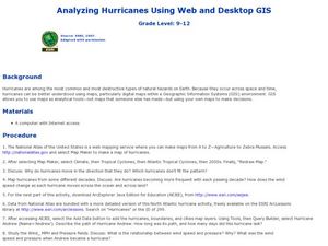
Analyzing Hurricanes Using Web and Desktop GIS
Learners analyze hurricanes. In hurricanes lesson, students use the Internet and GIS to analyze hurricanes. Learners view the National Atlas of Maps to discuss the direction hurricanes move. Students study the wind and pressure fields to...
Curated OER
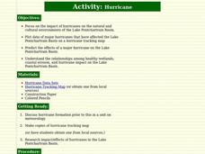
Hurricane
Students learn about and track hurricanes. In this natural disasters lesson, students discuss hurricane formation and research the impact/effects of hurricanes in the Lake Pontchartrain Basin. Students use a hurricane tracking map to...
Curated OER
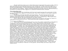
Arkansas History Lesson Plant One: Play-Do Soto
Fifth graders complete a variety of projects to learn about Arkansas history. In this Arkansas lesson plan, 5th graders go on a field trip to a state park, explore an Arkansas map, put play-dough on the trail of De Soto, color regions of...
Curated OER
Planning a Railroad Online Lesson
Students design a train route using a topographical map. In this historical and spatial thinking lesson plan, students must plan a route through the Sierra Nevada mountains that a train could physically travel. Links to printable student...
Curated OER
Making a Travel Brochure of a Louisiana Parish
Although the attachments for this travel brochure project are no longer linked, you can still use the idea here and create your own assignment sheet and rubric. Learners choose a parish in Louisiana (or a city in your state) to research,...
Curated OER
Finding Longitude and Latitude on Pennsylvania Maps
Students draw the lines of longitude and latitude on a map. Students look at a topographical maps to see how topography relates to land use.
Illustrative Mathematics
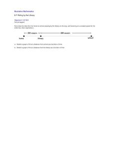
Riding by the Library
Draw a graph that shows the qualitative features of a function that has been described verbally. Make sure learners understand where time is zero and the distance is zero. It may take them some time to understand this concept, so working...
Curated OER
Arkansas is Our State: Differentiating Between a State and a Country
An ambitious geography lesson is geared toward kindergartners. They discover what the differences are between states and countries. They look at maps of Arkansas, and learn what the shapes and lines mean. Additionally, they create a...
Curated OER
Where Has It Been? Tracking the Ivory-Billed Woodpecker
By studying the assumed extinction, and subsequent rediscovery of the Ivory-billed Woodpecker, learners use maps and come up with a scenario for the rediscovery of the bird. This incredibly thorough lesson plan is chock-full of...
Curated OER
The Coldest Place at the Bottom of the World
Students examine Ernest Shackleton's journey through the Antarctic and trace Shackleton's Actual Route on a map using longitude and latitude coordinates. Students compare his intended route with his actual and determine how far off...
Curated OER
Red Dirt Groundbreakers
Discover Oklahoma's first farmers. Read about 14 different agriculture workers and their contribution to Oklahoma's farming. After reading, have your class complete several activities such as researching an agriculturist, writing a...
2012 Teaching Resources
Analyzing Character Traits
Character analysis becomes easy with a 24-page packet packed with mini-lessons, graphic organizers, and activities. A must-have for your curriculum library.
University of Wisconsin
BEAM: Background, Exhibit, Argument, Method
Thinking of assigning a research paper? Get writers off on the right foot with a lesson that introduces the BEAM research model. Writers brainstorm the background of their topic, explicate the aspects of their topic, consider the...
Curated OER
McLean Train Yard
Students conduct online research and incorporate graphics and maps into a Powerpoint presentation that details life at the McLean train yard in its heyday.
Curated OER
Chart Making for Navigators
Students discuss the importance and function of nautical maps for sailors. They, in groups, take soundings of a simulated bay in a shoebox and develop a nautical chart that enable them to navigate the shoebox safely.
Curated OER
Where We Live
Students forecast future population growth of the U.S. Virgin Islands. In this U.S. Census lesson plan, students explain the factors that influence population density on the U.S. Virgin Islands, including geography and economic activity.
Curated OER
The Outside Dog
Students observe the book, "The Outside Dog," and predict the events of the story. At the conclusion of the story, students act out various paragraphs from the book and write about specified characters. Additional cross-curriculum...
Curated OER
Children's Literature Across the Curriculum Ideas-The Christmas Miracle of Jonathan Toomey
Students read The Christmas Miracle of Jonathan Toomey by Susan Wojacieckowski. They complete a variety of cross-curricular activities surrounding the Christmas holiday. Included are reading, art, math, science, writing, social studies,...
Curated OER
Children's Literature Across the Curriculum Ideas-OGBO : Sharing Life in an African Village
Students read OGBO: Sharing Life in an African Village by Ifcoma Onyefulu. They complete a variety of cross-curricular activities surrounding the study of Nigerian culture. Included are reading, art, math, science, writing, social...

