PBS
Pbs: The u.s. Mexico Border a History
This site has complete information about the U.S.-Mexico border. It has an interactive timeline of important border events and a morphing map that shows changes in the border.
US Energy Information Administration
Energy Information Administration: Mexico
A report on Mexico's Oil Industry. Oil is the "cash cow" of Mexico and has been run by the state owned company Pemex. Includes many pictures, maps, and graphs to enhance the material.
Other
Map Town: Maps for Central America
Here are all seven Central American countries plus Mexico at a glance. Study a map or just general information about one of the countries.
Mex Connect
Mex connect.com: Map of Michoacan
MexConnect offers a map of Michoacan that shows the locations of the major cities located within.
NOAA
Noaa: Cpc: Regional Climate Maps
Provides large colorful maps of climate data about each continent for the current week, month, or previous quarter.
The Newberry Library
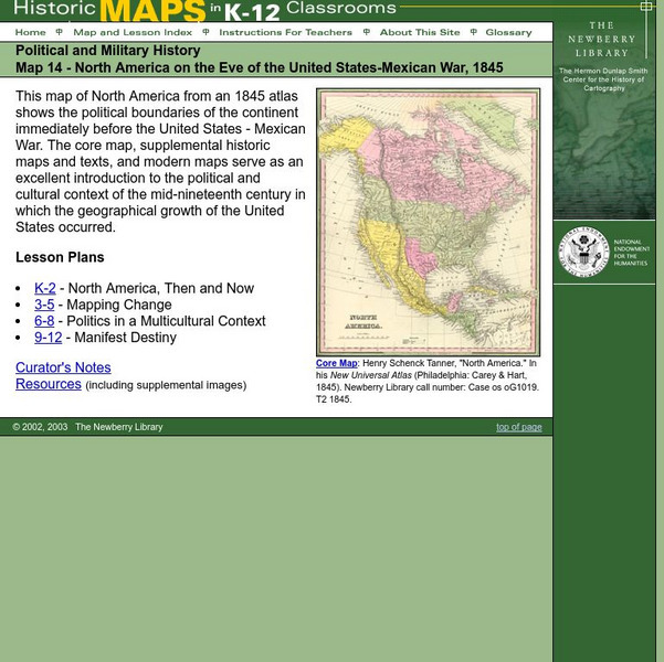
Newberry: Political and Military History: Map 14: u.s. Mexican War, 1845
Lessons for learners in K-12 depicting North America prior to the United States and Mexico War, 1845. Students explore the mid-century political and cultural context in which the U.S. experienced growth and expansion.
Curated OER
Map of Mexico
This is an online resource for information on Mexico. The site includes map and flag, government, languages, natural resources, industries, economic summary, and a history of the country.
Geographic
Mexico (Maps)
Maps of Mexico, including one with major cities, and another with the Mexican states.
Other
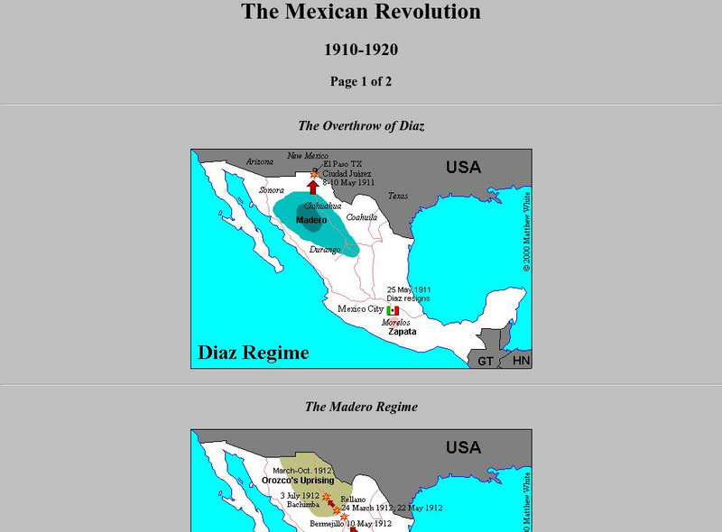
Maps: The Mexican Revolution: 1910 1920
Five maps of the Mexican Revolution, with battle sites and areas of power.
E-learning for Kids
E Learning for Kids: Science: Pacific Ocean: Mexico: Why Must We Care for the Environment?
Join Mateo on his trip to Mexico. During his trip, he will teach all about conservation, and contributing to a healthy environment.
E-learning for Kids
E Learning for Kids: Science: Mexico: What Is a Skeleton?
Isabel celebrates the Day of the Dead in Mexico, for which many people dress up like skeletons. She wants to teach her brother Carlos about the skeleton and some different bones. This interactive module helps young learners understand...
Curated OER
Etc: Maps Etc: Mexico, Central America, and the West Indies, 1898
A map from 1898 of Mexico, Central America and the West Indies. The map includes an inset map of Cuba and the Isthmus of Nicaragua. "The surface of the Rocky Mountain highland in Mexico is quite similar to that of the great plateau...
Curated OER
Etc: Maps Etc: Mexico, Central America and the West Indies, 1852
A map from 1852 of Mexico, Central America, and the West Indies. The map shows territorial boundaries at the time, including the Mexican States, capitals and major cities and ports, railroads, rivers, lakes, mountain systems, and terrain...
Curated OER
Educational Technology Clearinghouse: Maps Etc: Mexico City and Vicinity, 1580
A facsimile of a map by Saverio Clavigero (1780) of Tenochtitlan (Mexico City) and vicinity around the time of the Spanish conquest in 1519. This map, according to William H. Prescott (History of the Conquest of Mexico, 1876), defies...
Curated OER
Educational Technology Clearinghouse: Maps Etc: Mexico, 1872
A map from 1872 of Mexico, showing states and state capitals, major cities, towns, and ports, railroads, lakes and rivers, mountain systems, terrain, and coastal features. Steamship routes to major ports are shown, with distances marked...
Curated OER
Educational Technology Clearinghouse: Maps Etc: Mexico, 1904
A map from 1904 of Mexico showing the states, major cities and towns, railroads, mountains, and coastal features. An inset map shows the island of Cuba. "Mexico is divided into twenty-seven States with two Territories and the federal...
Curated OER
Educational Technology Clearinghouse: Maps Etc: Mexico, 1902
A map from 1902 of Mexico showing the states and state capitals, major cities and towns, trunk and secondary railroad lines, mountains, and coastal features. This map shows isotherms of mean annual temperature in degrees Fahrenheit, and...
Curated OER
Educational Technology Clearinghouse: Maps Etc: Mexico, 1906
A map from 1906 of Mexico showing the states, major cities and towns, railroads, mountains, and coastal features. An inset map shows the City of Mexico and vicinity, including the lakes, railroads, mountains, and neighboring cities.
Curated OER
Educational Technology Clearinghouse: Maps Etc: Mexico and Central America, 1910
A map from 1910 of Mexico and Central America showing political boundaries at the time, capitals and major cities, rivers, terrain and coastal features, reefs, and neighboring islands (Cuba and Jamaica). A map note shows the Panama Canal...
Curated OER
Etc: Maps Etc: Mexico, Central America, West Indies, 1882
A map from 1882 of Mexico, Central America, and the West Indies showing the political boundaries at the time, capitals and major cities, mountain systems, coastal features, and islands of the region. The map is color-coded to show the...
Curated OER
Etc: Maps Etc: Mexico, Central America, and the West Indies, 1901
A map from 1901 of Mexico, Central America, and the West Indies showing the political boundaries and Mexican States at the time, capitals and major cities, railways, mountain systems, coastal features, and islands of the region. Inset...
Curated OER
Etc: Maps Etc: Mexico, Central America, and the West Indies, 1906
A map from 1906 of Mexico, Central America, and the West Indies showing the political boundaries at the time, capitals and major cities, mountain systems, coastal features, and islands of the region. An inset map shows the entire North...
Curated OER
Educational Technology Clearinghouse: Maps Etc: Mexico, 1914
A map from 1914 of Mexico showing the states and state capitals, major cities and towns, railroads, mountains, rivers, lakes, and coastal features of the country. A grid-key in the margin references the locations of states and...
Other popular searches
- Mexico Outline Map
- Mexico Geography Map
- New Mexico Map
- Mexico Political Map
- Mexico City Map
- Topographical Map of Mexico
- Blank Map of Mexico
- Bm Map of Mexico
- Map of Mexico Activity
- Outline Map of Mexico
- Blanca Map of Mexico
- Mexico Map


