National Wildlife Federation
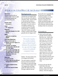
Where In the World Is the Arctic?
Exactly how far away is the Arctic? Learners use maps to orient themselves to their locations on the globe. They then make calculations to describe how their location relates to the location of the Arctic regions.
Curated OER
Where Did Foods Originate? (Foods of the New World and Old World)
What do papayas, peanuts, pineapples, and potatoes have in common? Why, they are foods explorers brought back to the Old World. Young researchers use the Internet to investigate how New World explorers helped change the Old World's diet....
Curated OER
The Brief American Pageant: American in World War II
From the home front to the middle of Europe, America's presence in World War II was forever transitioning with the strain of war. The variety of maps and charts offered in this presentation helps to contextualize the 1940's. The amount...
Curated OER
Mapping the News
Students explore cartography. In this map skills and map making lesson, Students work in groups to create wall size world maps including legends, compass roses, latitude and longitude, and physical features. Students collect current...
Big History Project
Human Migration Patterns II
While humans have always been on the move, the period between 1400 and 1800 saw vast migrations of people between the East and the West. These migrations—whether through slavery or a desire to colonize new lands—shaped the modern world....
Curated OER
Christopher Columbus: The Man, the Myth, the Legend
Learn more about maps by examining Christopher Columbus's voyage to the New World. Kindergartners will learn about basic map skills and how to identify the compass rose, oceans, and land masses. They will also discover the purpose of...
Population Education
Population Map
Here is a very interesting graphic of a world map where each country's size is adjusted accordingly to its population. The bottom row of the document also includes several maps depicting the major shifts and growth of the world...
PBS
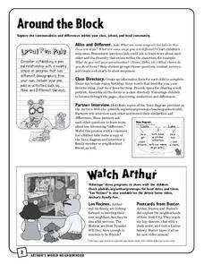
Around the Block
Arthur and his friends help children explore the concepts of family, community, and diversity in a fun series of activities. From performing peer interviews to mapping out the different places students have lived or visited, this...
PBS
Make a Balloon Globe
"We've got the whole world in our hands," is what your students will be singing after completing this fun geography activity. Using the included templates for the seven continents and a balloon, they create their very own globes.
Curated OER
Finding Your Spot in The World; Geography, Maps, Multi-Culturalism
Young scholars use a variety of maps to locate their home, their school and the origin of their ancestors.
Curated OER
Countries of the World
Young scholars define the meaning of the word country. For this countries of the world map lesson, students identify boundaries, countries, and symbols within countries on the map. Young scholars distinguish the words country and continent.
Curated OER
Mapping Perceptions of China
Students discuss what types of things are included on a map. They compare and contrast maps of China with a map they create and practice using different types of maps. They write analysis of their classmates maps.
Curated OER
Where in the World is Hawaii?
Students compare a globe and a two-dimensional world map and explore how they both represent the planet Earth. They locate the Hawaiian Islands on the globe or the world map and describe how the geographical position is unique.
Curated OER
Magical Maps
Second graders discuss the importance of using maps and how they are used. After they listen to a folktale, they develop their own story line maps and write their own folktale to accompany a map. They also identify and locate the seven...
Curated OER
Maps
If your students are just starting a unit on Geography this could be the introduction you're looking for. This PowerPoint presents a clear and organized overview of the different types of maps people use and why each is important. Tip:...
Curated OER
A Month of Mapping Literature
Explore the world through literature! With push pins to mark where each story came from, learners examine cultural differences, geographical location, and how those elements affect story content. This lesson could use deeper development,...
Curated OER
What in Our World Affects the Way People Live
Sixth graders study various maps that show geographical features and population. They compare the maps and make inferences about how various geographical features influence the population and human activities of an area.
Curated OER
Maps and the Pictures in Our Heads
Geographers of all ages examine different types of maps. They draw maps of their environment, utilizing both three-dimensional and picture maps. They interpret map information, noting how it can sometimes be misleading. Some good...
Curated OER
Map Skills
Do you need to practice map skills? Children with a range of abilities will complete a KWL chart about maps, practice important map vocabulary and then read a few pages from their textbook. They will use their vocabulary words and...
Curated OER
Investigating the Countries of the World
Explore world geography by creating presentations for different countries around the world. Researchers identify many different countries on a globe and select one for which they will create a presentation. They share their research and...
Curated OER
State Map of Utah
In this social studies worksheet, students examine a state map of Utah and answer 7 questions, using the map as a reference. The map includes freeways and bodies of water. There is no compass rose.
Curated OER
Where in the World Is Mexico?
Students practice map-reading skills as they locate Mexico and its cities on a world map. By creating a puzzle out of a map of Mexico, students engage in a meaningful hands-on activity to help them explore that country's geography.
Curated OER
Mapping the New World Lesson Plan
Students compare two maps of the same area from different time periods. For this American History lesson, students look at two maps of the English colonies from 1636 and 1651. They discuss why the maps changed and predict maps from the...
Curated OER
Geography and Culture of China
Take out a map, a paper, a ruler, and those coveted colored pencils for a instructional activity on Chinese culture and geography. This is a multifaceted approach to basic geography skills that incorporate story telling, class...
Other popular searches
- World War Ii Map
- World War I Map
- World War 2 Map
- World War I Outline Map
- World Climate Map
- World Biomes Map
- World Outline Map
- Blank Map of the World
- World Political Map
- Ancient World Greece Map
- World Time Zone Map
- Deciduous Forests Map World


