Curated OER
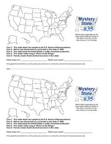
Mystery State # 41
Kids use their deductive reasoning skills, state knowledge, and five clues to determine mystery state #41. They'll follow the clues to locate the mystery state on a US map. Note: This is a warm-up activity, so it includes two short...
Curated OER
Midwestern States
In this United States geography worksheet, students study the image of the Midwestern states. Student then label the states with the following choices: Missouri, Iowa, South Dakota, Minnesota, Nebraska, Illinois, North Dakota, Kansas,...
Scholastic
Volleyball Road Trip
Review coordinate mapping with your young geographers by matching cities on a volleyball team's road trip itinerary to their appropriate coordinate locations.
Curated OER
States/Capitals L-N: Matching
In this geography practice worksheet, students match the 17 listed states to the appropriate 17 listed capital cities located in the United States.
Curated OER
USA: Physical Map
In this United States physical map worksheet, learners investigate the major landforms and bodies of water located throughout the country.
Curated OER
Unit V: Worksheet 2 - Constant Force
Physics learners studying force and acceleration practice solving eight problems with this assignment. They calculate acceleration and deceleration, net force, and distances required for stopping a moving object. Kinematics equations and...
Curated OER
Mystery State #31
In this United States mystery worksheet, students determine which state is described by the 5 clues listed on the sheet and then mark it on the outline map of the United States.
Curated OER
Mystery State #23
In this United States mystery worksheet, students determine which state is described by the 5 clues listed on the sheet and then mark it on the outline map of the United States.
Curated OER
Mystery State #35
In this United States mystery worksheet, learners determine which state is described by the 5 clues listed on the sheet and then mark it on the outline map of the United States.
Curated OER
Mystery State #36
In this United States mystery worksheet, students determine which state is described by the 5 clues listed on the sheet and then mark it on the outline map of the United States.
Curated OER
Mystery State #38
For this United States mystery worksheet, learners determine which state is described by the 5 clues listed on the sheet and then mark it on the outline map of the United States.
Chicago Botanic Garden
Unit 2 Pre-test, Grades 7– 9
This pre-assessment launches a unit on climate change and weather. 15 questions, both short answer and multiple choice, asses the classes' knowledge about these concepts.
San Antonio Independent School District
The Not So Big Book of Westward Expansion
From the thirteen colonies to the Mexican cession, your learners will track the territorial acquisitions made by the United States during eighteenth and nineteenth centuries with this printable booklet.
Curated OER
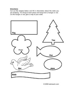
State Information
In these research worksheets, students will discover facts about one of the fifty United States. They are asked to research seven facts about their state including the state bird, state motto, and state flower. Students then create a...
Curated OER
United States Capitals Map Quiz
In this online interactive states and captials quiz worksheet, students examine the 50 pictured states and try to name all of the state capitals.
Curated OER
Blank US Map
In this blank outline map worksheet, students study the physical boundaries of the 50 states that make the United States. This outline map may be used for a variety of geographic activities.
Curated OER
Washington, D.C. Map
Here is an outline map of Washington, DC. Some of the points of interest in the city are labeled, as are Maryland, Virginia and Arlington. There are plenty of important monuments and locations not identified, making for a good project.
Curated OER
The Louisiana Purchase: Worksheet
Celebrate the anniversary of one of the United States' most important land acquisitions with a fun worksheet. The class answers five matching questions related to those involved with the Louisiana Purchase and then think about what life...
Ms. Catsos
Ancient Rome Map Worksheet
It wasn't just the great leaders of ancient Rome that shaped their civilization—the geography of the region played a major role as well. After first identifying major land masses, bodies of water, and city states on a map of Europe,...
Curated OER
U.S. Geography for Children: State Capitals
In this United States map skills instructional activity, students locate and label specified states and their capitals, and create icons and a map key to show something for each state that is famous. Students answer 5 questions.
Student Handouts
Geography of Dr. Martin Luther King, Jr.
Young geographers follow Dr. Martin Luther King's journey during the civil rights movement by identifying major events on a map of the eastern United States, such as his birth in Atlanta, Georgia and his famous "I Have a Dream" speech in...
University of Florida
Sailing to St. Augustine
Using a Florida map from 1597, young explorers consider the physical characteristics they would need in a site for a new colony and the resources they would need to survive. After selecting a site, class members research to discover the...
Curated OER
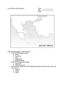
Ancient Greece Map Worksheet
Since the beginning of time, geography has shaped the development of human civilization, and ancient Greece is no exception. This activity supports young historians with exploring this relationship as they first identify key land masses,...
Carolina K-12
Colonialism and American Foundations Sample Test Questions
What was the main cause of European colonization in America? How did Thomas Paine's Common Sense play a role in the establishment of the United States? What was the trans-Atlantic slave trade? These are just a few of the many questions...
Other popular searches
- United States Map Skills
- United States Map
- Blank United States Map
- United States Map Activities
- United States Map Questions
- Northeast United States Map
- United States Map Games
- United States Political Map
- United States Rivers Map
- Blank Map of the United States
- United States Regions Map
- United States Map Worksheet


