Curated OER
Where We Live
Students forecast future population growth of the U.S. Virgin Islands. In this U.S. Census lesson plan, students explain the factors that influence population density on the U.S. Virgin Islands, including geography and economic activity.
Curated OER
History In Pictures
Sixth graders explore Lewis and Clark's expeditions. For this Lewis and Clark lesson, 6th graders view the routes they took and discuss how the territory has changed. Students make a timeline of their journey. Students research online...
Curated OER
The Impact of Disease on Our Lives
Students write a report about infectious diseases where they demonstrate their understanding of new terminology. In this writing lesson, students analyze the effect of disease in their lives and and make scientific inquiry about the...
Curated OER
Immigration and Ellis Island
Fourth graders explore family histories. In this social studies lesson, 4th graders identify the countries from which their ancestors came and locate them on a map. Students discuss the role that Ellis Island played in immigration in the...
Curated OER
Winter Holidays Around the World
How much do you know about the holidays around the world? Second graders put their knowledge to the test with a 14-day lesson about global celebrations. They read informational text, employ KWL charts, and compare and contrast the many...
Curated OER
Topography: Know the topography of your neighborhood
Middle schoolers read and identify features on a topography map. In this topography lesson plan, students learn how to read a topography map, and then go out and take pictures of their own and discuss the topography pictures they took.
Curated OER
SpellO': An Orienteering Lesson
Students participate in hands-on activities to practice orienting maps. Given activity cards, students accurately read maps and locate specific stations. Students collect information from the maps to spell a message when the activity...
Curated OER
Continents and Oceans on the Move
Young scholars create an awareness of the vast percentage of water covering the earth. They relate similarities/differences between topographical maps and other maps of various time periods. Students examine how to use a topographical map.
Curated OER
Natural Resources and Transportation in the United States
Students study thematic maps (included with the lesson) to determine possible relationships. They develop three hypotheses about the relationship. Students choose one of their hypotheses to explain. The explanation is to include reasons...
Curated OER
Women's Rights Historic Sites
Students use maps, readings, floor plans, photos and cartoons to research the conditions of upstate New York in the first half of the 19th century, examine the issues that led to Women's Rights Convention of 1848 and consider current...
Curated OER
Ohio and Erie Canal
Students use maps, readings and photos to research the construction and effects of the Ohio and Erie Canals. They compare the region's economy before and after the canal's construction and analyze transportation routes in their own...
Curated OER
Bimaadagaako Adventure
Students use an interactive website to complete a wilderness trail adventure where they learn about Native cultures, voyagers, and the Canadian fur trade. In this interactive history lesson, students visit the wilderness classroom...
Curated OER
Fort Morgan
Students investigate how Mobile, Alabama was significant to the Confederacy during the Civil War. They analyze maps, read primary source documents, write a research paper on Civil War military technology, and explore the Fort Morgan...
Curated OER
Building A Model of the East Pacific Rise
Students describe the physical attributes of the East Pacific Rise. After locating the region on a map, students work in groups do define each layer of the structure in order to begin their build. Students build their model according to...
Curated OER
Mapping My Community
Ninth graders are introduced to GPS technology. They complete fieldwork as they visit a specific area of their community to identify and map types of land use in the surveyed area. They use the collected data to create a digital map.
Curated OER
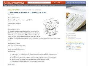
The Power of Words in Charlotte's Web
"How can a few good words save a pig's life?" Posed with this question, your ELD students explore E.B. White's Charlotte's Web in a meaningful, valuable way. By analyzing specific word choice from the book, especially the excerpts...
Curated OER
Borrowing Narrative Skills from Mr. Fletcher: Using a "Prompts in Reverse" Technique to Inspire Your Writers
Help your class find their writing voices with this lesson which uses the work of Ralph Fletcher to guide a "Prompt in Reverse" activity. Using the chapter "First Pen" from Fletcher's Marshfield Dreams, learners decipher what they...
The New York Times
Stress Less: Understanding How Your Mind and Body Respond to Anxiety
What could be more relevant to teens and preteens than experiencing stress? Use an article from the New York Times website to practice valuable Common Core skills for informational text reading, and also get a discussion going in your...
Curated OER
Hit The Trail
Young historians research one of the most colorful periods in US History: the cattle drives of the 1800's. They research the three most popular trails, and complete mapping and writing assignments about each one. The lesson has many...
Miami-Dade County Public Schools
Five Themes of Geography Packet
The five themes of geography are perfect for introducing learners to some of the ways that people interact with the world around them. This packet contains 20 full lessons, each focused on topics relating to the five themes of geography,...
Curated OER
"The Drum"
Second graders read and discuss the folktale "The Drum" from India. They also answer story comprehension questions, complete an adjectives and verb worksheet, and label a map of India. Students sequence events from the story and make...
Curated OER
How Does Your Garden Grow? Discovering How Weather Patterns Affect Natural Cycles
For the warm-up in this cool climate lesson, you will need to click on "Mapping" and then "US Mapping" once you arrive at NOAA's "US Climate at a Glance" page. Earth science explorers realize that 2012 was a warm winter for us. They read...
Curated OER
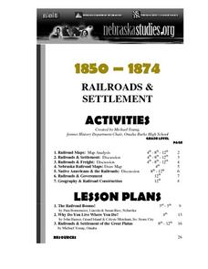
The Railroads and Settlement of the Great Plains
Enhance your American literature unit with this resource, in which readers access the Nebraska Studies website and read about "Railroads and Settlement." They search for a photograph of some aspect of the railroad from the Prairie...
Curated OER
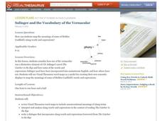
Salinger and the Vocabulary of the Vernacular
Writers explore vocabulary and expressions used in the English language. They use visual word maps to become aware of the different uses of words which will allow them to more readily interpret texts. Then they listen to/read excerpts...
Other popular searches
- Map Reading Skills
- Earth Science Map Reading
- Esl Map Reading
- Map Reading Activities
- Reading a Map
- Basic Map Reading
- Map Reading Powerpoint
- Topographic Map Reading
- Map Reading Grade 6
- Lessons on Map Reading
- Elements of Map Reading
- Geography Map Reading Skills

