Curated OER
Map Scale and Ratios
Introduce you map scale and ratios lesson with this informative video. A student demonstrates how to properly use a scale on a map, as well as read a topographic map. This is a fantastic video to show during your map unit!
Corbett Maths
Maps Scales
For I have miles to go before I truly understand map scales. By watching a video, scholars learn about map scales. They see how to determine actual distances on a map using the scale and how to calculate the map scale.
Curated OER
Maps- Looking at Map Scales
In this map scale worksheet, learners examine how to convert measurements on a map. They read 5 examples before completing 8 multi-step conversion problems. They insert the answers in an online version of the worksheet to determine if...
Richmond Community Schools
Map Skills
Young geographers will need to use a variety of map skills to complete the tasks required on this worksheet. Examples of activities include using references to label a map of Mexico, identify Canadian territories and European countries,...
abcteach
Street Mapping
What's around the block? Or down the street? Ask your pupils to tap into their map skills by drafting the area around their home and school.
Curated OER
How Do You Solve a Scale Model Problem Using a Scale Factor?
Scale drawings are used to represent many things. Scales are used all the time on maps, and in architectural drawings. Watch this video as the instructor illustrates a simple drawing of a blueprint to represent the footage of an actual...
Curated OER
What is a Scale Drawing?
Scale drawings are an easy and plausible way to represent large things, such as roads and buildings, on paper. This tutorial explains what a scale drawing is and uses the example of a house to demonstrate how a scale drawing works. It...
Curated OER
What is a Scale Drawing?
Scale drawings are an easy and plausible way to represent large things, such as roads and buildings, on paper. This tutorial explains what a scale drawing is and uses the example of a house to demonstrate how a scale drawing works. It...
Corbett Maths
Enlargements with Fractional Scale Factors
Enlargements make it bigger, right? A video shows viewers how to perform a basic dilation with a fractional scale factor. They learn how to use the scale factor to find the location of the transformed vertex by multiplying the horizontal...
Curated OER
Maps Reinforcement
For this map worksheet, middle schoolers complete 6 multiple choice questions and 5 short answer questions about 3 different map figures.
Curated OER
Geographical Skills-- Map Scale
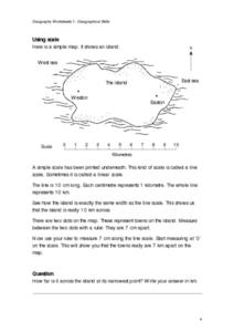
In this maps worksheet, students study a simple map and the scale in kilometres. Students read the directions and answer one question. Students then look at a sketch map of a town and answer 2 questions. Students also read how to show...
Journey Through the Universe
A Scale Model Solar System
Between the time scientists discovered Pluto and reclassified it as a dwarf planet, it did not even make one full revolution around the sun. In two activities, scholars investigate scale models and their properties. Pupils find that it...
Curated OER
Map Work: How Far?
In this map scale worksheet, students analyze a map of an area with several towns marked. Students use the scale (1 cm = 1 km) to answer 6 questions about the distances between towns.
Curated OER
Scaling in Maps
For this recognizing map scale ratios worksheet, students use ratios and centimeter measurements to calculate the distances in reality. Students solve 8 problems.
Curated OER
Scale Skills
In this mapping skills activity, students read an excerpt that describes three different types of scales and how to calculate distance on a map. They respond to two short answer questions using the map provided on the sheet and to...
University of Nottingham
Drawing to Scale: A Garden
See how design and geometry go hand in hand. The activity asks learners to use geometry to design a backyard garden given dimensions of each feature. Scholars work with ratios and scale to develop an accurate scale drawing that includes...
Curated OER
Project Map: Scale Worksheet
In this map reading instructional activity, students determine the distance from a plotted treasure on a topographic map. They must adjust for magnetic declination.
Owl Teacher
Introduction to World of Geography Test
Assess your learners on the five themes of geography and the most important key terms and concepts from an introductory geography unit. Here you'll find an assessment with 15 fill-in-the-blank and 14 multiple-choice questions, sections...
Curated OER
Science Concept Maps
A collection of concept maps has some terms filled in and others left blank for young scientists to fill in. This library can provide you with many pop quizzes for all of your middle to high school science curriculum.
Curated OER
Exploring Earth Through Maps and Technology
In this maps worksheet, students read 3 pages of detailed information about maps, latitude, longitude, topography, satellites and global positioning. Students then answer 10 questions. There is also a research project assignment available.
Domain of Science
The Map of Biology
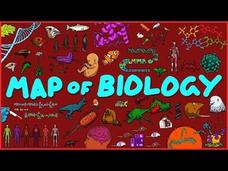
Many define biology as the study of life but can't agree on a definition of life. Trying to explain all of the domains and subdomains of biology seems a bit easier than defining life. See a full map of the topics covered by the general...
Curated OER
Scale Problem
In this scale problem worksheet, 6th graders solve 9 different problems that include reading a map scale of a neighborhood. First, they determine the distance between each person's home as illustrated. Then, students determine the...
Curated OER
Three Scale Drawing Activities
For this scale drawing worksheet, learners complete three different scale drawing activities. One activity is making a scale drawing, one involves answering questions from a given scale drawing, and one is a cross-number puzzle. The...
Curated OER
How To Read A Map
In this map skills worksheet, students view a map and answer five short answer questions by using the map key as a guide.
Other popular searches
- Using a Map Scale
- Map Scale Worksheets
- Map Scale Activities
- Geography Map Scale
- Map Scale Math Lessons
- Map Scale Math
- Geography Map Skills Scale
- Math Map Scales
- Map Scale Lesson Plans
- Using Map Scales
- Reading a Map Scale
- Using Map Scale Distance


