NASA
Outline Maps
Don't miss this gold mine of blank maps for your next geography lesson! Regions include traditional continents such as Asia, Europe, and Africa, as well as other major world areas such as the Pacific Rim and the Middle East.
Curated OER
Mapping Perceptions of China
Students discuss what types of things are included on a map. They compare and contrast maps of China with a map they create and practice using different types of maps. They write analysis of their classmates maps.
Rocklin Unified School District
Spanish Speaking Countries Project
Ask your class members to provide a tour of a Spanish speaking country with a brochure and flag project. Learners research their assigned country, making sure to check off each of the required pieces of information listed on the first...
Curated OER
Geography: Puerto Rico
Take a trip to Puerto Rico! Learners engage in a web quest, identify Puerto Rico on the map, and gather information related to physical features and cultural factors. Their efforts culminate when they design a brochure comparing the...
Curated OER
Mapping Our Home
Students explore how communities participate in census counting. In this census lesson, students recognize the absolute and relative location of a state and understand ideas about civic life and government.
Curated OER
East Asia Country Project
Get your young historians thinking about East Asian culture and history during this partner research project, in which they analyze a variety of East Asian aspects to prepare for a presentation. After an initial "what do we already know"...
Curated OER
Introduction to the United States Map
Students identify a map of the United States. In this United States map lesson plan, students study a map of the United States and find various locations on the map. Students then locate and list the state that touches their state.
Curated OER
U.S. Political Map
Students explore the symbols found in a map legend. In this map skills lesson, students locate the legend on a political map and explain what each of the symbols mean. Students locate and identify several symbols on the map.
Curated OER
Do the Tallywalker
Students study the basics of mapmaking, then make a tally walker, (geographic location device used in secret).
Curated OER
Tooling Around Arizona: Reading Arizona Maps
Students research Arizona maps. In this map lesson, students discuss map titles, scales, directions, elevation, and symbols. The class will examine topography, landforms, and rivers found on an Arizona map.
Curated OER
Create Your Own Country Project
Young scholars demonstrate their knowledge of geography with this fun, collaborative social studies project. Working in small groups, students develop their very own countries, writing descriptions of their physical location, social...
Beyond Benign
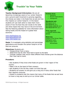
Truckin’ to Your Table
Food takes a trip to the table. Class members choose a meal from a menu and calculate the total cost of the meal including tax and tip. Using a food origin card, pupils determine how far each of the ingredients of a meal traveled to end...
Constitutional Rights Foundation
Refugees from the Caribbean: Cuban and Haitian “Boat People”
Should refugees fleeing poverty be allowed the same entrance into the United States as those fleeing persecution? High schoolers read about US foreign policy in the late 20th century regarding refugees from Cuba and Haiti, and engage in...
Curated OER
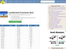
Landlocked Countries Quiz
In this online interactive geography quiz worksheet, students examine the chart that includes details about the population in 44 landlocked countries. Students identify the names of the countries in 5 minutes.
Curated OER
United States Map- Continent, Country, State
Students identify their continent, country, and state on a globe. In this geography lesson, students use a globe to identify the seven continents, the United States, and the state which they live in. Students define key terms.
Curated OER
Geography Puzzles
Students study the continents of the world. In this Internet geography lesson, students connect to online mapping games. Students collaborate in order to develop their understanding of world geography, including countries and capital...
Channel Islands Film
Once Upon A Time (Saxipak’a): Lesson Plan 1
As part of a study of the history of the Chumash on California's Channel Island chain, class members view the documentary Once Upon a Time, respond to discussion questions, and create a timeline for the different waves of migration.
Curated OER
Tears of Joy Theatre Presents Anansi the Spider
Accompany the African folktale, Anansi the Spider, with a collection of five lessons, each equipped with supplemental activities. Lessons offer multidisciplinary reinforcement in English language arts, social studies, science, and arts...
Curriculum Project
Comprehension and Discussion Activities for the Movie Rabbit-Proof Fence
Lead discussion and thoughtful analysis as pupils view Rabbit Proof Fence, a drama based on true story about three aboriginal girls who ran away from Western Australia to return to their Aboriginal families in 1931. Here you'll find...
CK-12 Foundation
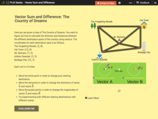
Vector Sum and Difference: The Country of Dreams
Find your way around using vectors. Scholars use an interactive to learn about vector addition. They answer a set of questions about modeling a route on a map using vectors.
Curated OER
Charts, Maps, and Graphs Lesson on the Holocaust
High schoolers practice interpreting data. In this Holocaust lesson, students research selected Internet sources and examine charts, maps, and graphs regarding the Jewish populations in and out of Europe. High schoolers respond to...
Curated OER
Computer Activities: Countries of the World
Students research a country. In this research and computers lesson, students select a country and research various aspects about it including the capital city, the flag and fun facts. Students create slides about their country and then...
Curated OER
Lesson 1: Map Data and the Census
Learners learn about the history of the census. For this U. S. Census lesson plan, students develop an understanding about how the United States Constitution grants and distributes power and discover how the spatial organization of...
Curated OER
Cacao Tree Geography
Students use a map to learn about where chocolate comes from. For this lesson on the cacao tree, students locate various regions where the cacao tree grows. They will discuss why the cacao tree grows more favorably in particular climates...


