Curated OER
Texas Cities Map Quiz
In this online interactive geography worksheet, students examine a map of Texas and identify the 15 noted cities on the map using a pull down menu within 3 minutes.
Curated OER
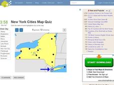
New York Cities Map Quiz
In this online interactive geography activity, students examine a map of New York and identify the 11 noted cities on the map using a pull down menu within 3 minutes.
Curated OER
South America Map Quiz
In this online interactive geography quiz worksheet, students examine the map that includes all of South America's countries. Students identify the 13 countries in 2 minutes.
Curated OER
Middle East Map Quiz
For this online interactive geography quiz worksheet, students examine the map that includes 26 Middle Eastern countries. Students identify the names of the countries in 4 minutes.
Curated OER
Central America Map Quiz
In this online interactive geography quiz learning exercise, learners examine the map that includes 22 Central American countries. Students identify the names of the countries in 3 minutes.
Curated OER
California Cities Map Quiz
In this online interactive geography quiz worksheet, students examine the map that includes 12 California cities. Students identify the names of the cities in 3 minutes.
Curated OER
Michigan Cities Map Quiz
In this online interactive geography worksheet, students examine a map of Michigan and identify the 14 noted cities on the map using a pull down menu within 3 minutes.
Curated OER
Canada Map Quiz
For this online interactive geography quiz worksheet, students examine the map that includes 13 Canadian provinces and territories. Students identify the names of the provinces and territories in 2...
Curated OER
Map Your Community
Students study their community's assets and needs to create a service project that would meet the needs. In this community project instructional activity, students research their community and look for the strengths and weaknesses of the...
Curated OER
The Country of Venezuela
In this map skills of Venezuela worksheet, students use an outline map to find an label important cities landforms, and bodies of water. Students label and color code 10 answers.
National History Day
“Saving the Bear”: The Russian Expeditionary Force of World War One
How have Russian politics affected countries on a global stage? The discussion of the Russian Revolution and World War I begins with an analysis of primary resource letters. Learners finish with a project where they create a timeline of...
TED-Ed
A Digital Reimagining of Gettysburg
Why would Robert E. Lee order Pickett's Charge, an action that changed the course of the Civil War? Geographer and historian Anne Knowles uses digital technology to explain what she thinks is the missing piece in trying to understand...
Echoes & Reflections
The Children and Legacies Beyond the Holocaust
Using video testimony, primary source documents that detail international agreements, and structured discussions, learners consider the precarious position of children during the Holocaust and other international conflicts, and how to...
Curated OER
Vocabulary Review and Map Skills
Students, when given the name of a community, identify a food, a craft, a custom, language and music, unique to that community 100% of the time. They find similarities and differences between this community and their own in four...
Curated OER
Map your Schoolyard
Young scholars practice their mapping skills by creating an accurate map of their schoolyard using an aerial photo from the National Map web site. Students include legends, a scale, and a north arrow on their maps.
Curated OER
Mathematics of Cartography
Students practice their math skills as they explore maps. In this cartography lesson, students calculate distance, scale, coordinate systems, and projection as they work independently reading online maps.
Curated OER
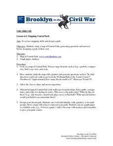
Mapping Central Park
Students use the mapping skills to explore New York's Central Park. They examine a map of Central Park to discover its features. After discussing the characteristics of the park, students design their own dream park and draw it to scale.
Curated OER
Introducing Topographic Maps: Guiding Students from Concrete Models to Graphic Representations
Students interpret topographic maps and infer human activity as it is influenced by the landscape.
EngageNY
How Do Dilations Map Segments?
Do you view proofs as an essential geometric skill? The resource builds on an understanding of dilations by proving the Dilation Theorem of Segments. Pupils learn to question and verify rather than make assumptions.
Curated OER
Storm Clouds-- Fly over a Late Winter Storm onboard a NASA Earth Observing Satellite
Students study cloud data and weather maps to explore cloud activity. In this cloud data lesson plan students locate latitude and longitude coordinates and determine cloud cover percentages.
PHET
Mapping the Ambient Magnetic Field
No GPS allowed! High school scientists continue to explore magnetic fields with a hands-on activity. After mapping the ambient magnetic field in the classroom and completing data analysis, they write about the similarities and...
Curated OER
Survivor Stories
Trace a survivor's story using a timeline, map skills, poetry and/or prose and photography, and make a visual representation of a survivor's journey through his or her life as a culminating activity for the class and the survivor....
Curated OER
Using Word Maps to Expand Vocabulary
Looking for a good lesson on dictionary and word definition skills? The lesson presented here is for you! In it, learners utilize a worksheet, embedded in the plan, to record a word's definition(s), etymology, multiple meanings,...
Museum of Tolerance
Where Do Our Families Come From?
After a grand conversation about immigration to the United States, scholars interview a family member to learn about their journey to America. They then take their new-found knowledge and apply their findings to tracking their family...


