Curated OER
Boundaries
Learners are introduced to the term of mental mapping. Individually, they develop their own mental map of Washington state and discuss as a class what makes a boundary. They draw their mental map on paper and compare it with their...
Curated OER
Ghost Canoe
Fourth graders are read the book "Ghost Canoe" by their teacher. Using a map, they locate the physical characteristics of Washington State and describe how people adapted to their environment before statehood. They discover how people...
Curated OER
The Colony of Virginia as Far as the Mississippi
Students study George Washington's map and journal of his 1754 expedition to the French. They draw conclusions about the importance of western lands and the problems involved in tapping the resources of the West during that era.
Curated OER
An Encounter of Former Foes
Students examine a timeline on the internet showing the relationship between the American Government and the Nez Perce in the 19th Century. After looking at the timeline and included map, students answer questions.
Curated OER
Big Apple, Here We Come
Students role play the role of immigrants coming to America for the first time. They complete an imaginary trip with their family and must rent a car and make seven stops along the way. They calculate distances and use maps to...
Curated OER
Planning a Railroad
Students use a topographical map to plan a route from Doknner Summit to Truckee, then compare it to the route selected by Theodore Judah.
Curated OER
A Place Called Fairfax
Middle schoolers use maps to locate Virginia, its surrounding states and Fairfax County. Individually, they describe the absolute and relative location of the county and why it is important to know both. As a class, they brainstorm the...
Curated OER
Visual Arts: Portraits
Second graders examine a portrait of George Washington, and analyze the historical record and likeness in portraits of the period. They create their own portraits from snapshots brought to school.
Curated OER
Arthur Meets the President
Pupils discuss the role of the President. In this government lesson, students read Arthur Meets the President and complete a story map. Pupils develop new vocabulary related to the story.
Curated OER
Treaty Trail: Crossing the Bitterroot Mountains
Students examine art and primary documents that depicts the Native Americans' crossing of Washington's Bitterroot Mountains to arrive at the Spokane Council. Students investigate and compare maps and other historical materials determine...
Curated OER
Lesson #3: Internet Map Activity
Students label assembly centers and relocation camps on a given map of the United States in order to create a better understanding of the relocation experience of Japanese-American citizens and the distance that families had to move and...
Curated OER
States of Fitness
Learners participate in physical activities coordinating to divisions on a map.
Curated OER
Scaling the Map
Middle schoolers practice determining map distances using the map scales. They discover how much an area represents on the map in relation to the actual area. They decide on the best place to build their cavern.
Curated OER
Her Day in Court Women Judges and Justice in Washington State
High schoolers study the history of women in the legal profession in Washington. They define the vocabulary of sex discrimination and identify barriers women faced in becoming lawyers and judges.
Curated OER
Exploring United States V. Hirabayashi
Students review the case of the United States V. Gordon Hirabayashi. Students order the events leading up to the Hirabayashi case on a timeline and analyze the final decision, including identifying any alternative outcomes.
Curated OER
Past and Present
Students identify George Washington on the obverse of the quarter and read about George Washingington. They compare Washington to the current president and practice distinguishing between events in the past and the present.
Curated OER
Congressional Travel
Students determine the distances traveled by the members of the legislative branch of the US Government. In this travel distance lesson plan, students locate Washington, DC on a globe using the longitude and latitude of the city. They...
Curated OER
Early Presidents and Politics
Students investigate early presidents of the United States. Students complete a series of lessons in which they research the contributions and political climate during the terms of U.S. presidents from George Washington to Andrew Jackson.
Curated OER
Roles of the President
Students read a document which explains the roles and responsibilities of the President of the United States. In groups, they tour the George Bush Presidential Museum and participate in a Presidential scavenger hunt. Once back in the...
Curated OER
U.S. Mint Releases New Jefferson Nickel
Students share their knowledge of Lewis and Clark, then read a news article about the redesign on the U.S. nickel to commemorate Lewis and Clark's expedition. Introduce the article with a discussion and vocabulary activity, then students...
Curated OER
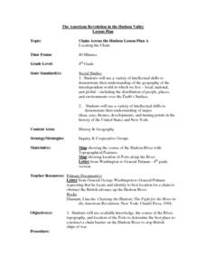
Chain Across the Hudson Lesson Plan A - Locating the Chain
Learners read a letter from George Washington requesting them to identify on a map a location that would stop the advance of British warships. They choose a location and justify their choice.
Curated OER
The Treaty Trail: Examining an Artist's Perspective
Elementary school leanrners examine artwork from the time period of the United States and Native American treaties. They discuss the causes and effects of the treaties being signed. They also examine how cultural perspective influences art.
Curated OER
Why Kosovo? Why Now?
Middle schoolers explain the establishment of the modern state of Yugoslavia and the breakup of the country. They examine the human characteristics of the region - ethnic groups, languages, and religions.
Alabama Department of Archives and History
La Mobile: A Case Study of Exploration and Settlement
The Le Moyne brothers, Jean-Baptiste and Pierre, were among the first explorers of the Gulf Coast. Class members read biographical information and journal entries about these men, study maps showing where the settlements they established...
Other popular searches
- Washington State Map
- U.s. States Map Washington
- Us States Map Washington
- Washington State Map Skills
