Curated OER
Label the Southern States
During your study of the United States, challenge your class to label the seventeen Southern states. Can they do it without the key? The answer sheet is included.
Curated OER
Washington State Map
For this Washington map worksheet, students color and label the major cities and important physical features on the map. Students also study a second map that shows the location of Washington in the United States.
Curated OER
George Washington's Revolutionary Journeys
Students take a closer look at historical maps. In this American Revolution activity, students examine the provided historical maps and documents to determine the assignments that George Washington assigned to subordinates during the...
Curated OER
Do You Know Your 50 States?
Learners use the names and abbreviations of the 50 states to label a blank map of the United States.
Curated OER
Map Memory
Fifth graders, working in a whole class setting, label a United States map with the names of all the states that they know. They transfer the names of the states to an individual map and color it. Next, they receive directions on how to...
National Museum of the American Indian
The A:Shiwi (Zuni) People: A Study in Environment, Adaptation, and Agricultural Practices
Discover the connection of native peoples to their natural world, including cultural and agricultural practices, by studying the Zuni people of the American Southwest. This lesson includes examining a poster's photographs, reading...
Curated OER
Geography: Puerto Rico
Take a trip to Puerto Rico! Learners engage in a web quest, identify Puerto Rico on the map, and gather information related to physical features and cultural factors. Their efforts culminate when they design a brochure comparing the...
Curated OER
Comparison of Juan Bautista de Anza and George Washington
Fifth graders discover that Anza and Washington lived at the same time but on opposite sides of the American Continent. They identify differences and similarities in their lives. They present the data in an illustrated time line
Curated OER
Volcanoes in Washington State and Tanzania
Students research volcanoes in Washington State and in Tanzania and create a poster on one specific volcano in each area. Once research is complete on each area, students compare and contrast volcanoes in Washington State and Tanzania.
Curated OER
Mr. Powell Leaves Washington
Students examine the life and achievements of Colin Powell. After reading an article, they discuss the role of the Secretary of State. In groups, they evaluate his successes in different regions throughout the world. They reflect on the...
Curated OER
Capitals, Oceans, And Border States
Students investigate geography by completing games with classmates. For this United States of America lesson, students examine a map of North America and identify the borders of Mexico and Canada as well as the Pacific and Atlantic....
Curated OER
Country Capitals
Learners locate country capitals on a world map. In this map skills lesson, students review the definition of the word country and discuss what a capital is. Learners locate and label capital cities on a world map using a map marker.
Carolina K-12
Who the People? Representative Democracy in North Carolina and Congress
Our elected officials are supposed to represent us, but what does it mean when they aren't like us? Budding citizens explore the demographic makeup of the US Congress, the role of money in political elections, and the Citizens United...
National First Ladies' Library
Capital Monuments: Exploring Washington, DC Frances Cleveland: Law, Politics and Government
Students, working in small groups, research seven of the most famous monuments found in Washington, DC. They design brochures based on the information they gather from Internet and print resources. Upon completion, they share the...
Curated OER
Salmon Stories
Work on author's purpose with this instructional activity, which focuses on sequence of events and audience as well. Middle and high schoolers describe the 50 State Quarters Program for background information. After discussing the...
Curated OER
The American War for Independence
Students complete a unit of lessons that examine the goals of the Americans during the Revolutionary War. They explore an online interactive map of major campaigns, read and analyze primary source documents, and analyze diplomatic and...
Curated OER
Looking at Landforms-Based on the Washington Quarter Reverse
Students use a Washington State Quarter to examine different landforms and discuss natural resources. After a class discussion on the items found on a Washington State quarter, students brainstorm a list of natural resources found in...
Curated OER
The Geography of Europe
Learners examine maps of Europe. In this geography skills instructional activity, students interpret several maps to determine the boundaries of the European Union and respond to assessment questions about the maps.
Curated OER
Washington, Jefferson, Roosevelt, Lincoln
Students study four of the most influential and important presidents in United States history. In this United States presidents lesson, students learn the facts and histories to four of the most influential presidents in history - George...
Curated OER
Discovering the Physical Geography of Washington
Students develop a mental map of the state of Washington and draw it on paper. Using the Virtual Atlas, they identify the physical features of the state and draw them on their map. They also examine the populations and diversity of the...
American Battlefield Trust
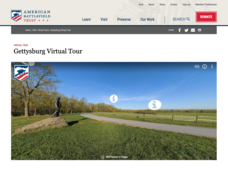
Gettysburg Virtual Tour
Step into one of the most iconic battlefields of the American Civil War with an educational interactive resource. Young historians learn about key moments, locations, soldiers, and turning points in the battle with a clickable map and...
Curated OER
George Washington Carver
Second graders participate in an investigation of George Washington Carver and his life. They conduct research using the provided text. Specifically, 2nd graders use the large print and pictures to strengthen reading comprehension. They...
Curated OER
Bridge to the Future: Enlarging the European Union
The political, social, and economic challenges the European Union faces as it enlarges is the focus of a six-lesson unit. Class members investigate and craft a presentation about a member country, the treaties member states must...
Curated OER
Capitalization and Washington, D.C.
Second graders learn and practice capitalizing names of cities, states, countries, streets, buildings, bridges, and geographical places around the theme of Washington, D.C. through activities at learning centers in the classroom.


