Curated OER
Mapping the Census
Students learn why the census makes a difference. In this U.S. Census lesson plan, students learn the key elements of cartography, examine the difference between data and their representation, and create a map using census data.
Curated OER
Introduction to Field Mapping with a Compass and Pace
Students practice using compass and calibrate their own pace, take field measurements of pre-set course with compass and pace, convert measurements into map, using angles and vectors, and make composite class map by adjusting different...
Curated OER
Customized Topographic Maps and Models
Students explore the information depicted on topographic maps. They construct a 3-D topographic map of a local area. They go on a field trip to the depicted area and compare the 'real world' with their models.
Curated OER
Fantasy / Art Maps
Ninth graders analyze a fantasy art map by Jeremy Anderson, paying careful attention to the way the topographic features of the land are represented. They create a similar map of Sacramento that includes topographical features as well as...
Curated OER
Maps and Modes, Finding a Mean Home on the Range
Fifth graders investigate data from maps to solve problems. In this data lesson, 5th graders study maps and collect data from each map. Students present their data in a variety of ways and calculate the mode, mean, median, and range.
Curated OER
Story Mapping
Help your learners map a story with a graphic organizer provided. Four squares for setting, problem, characters, and solution surround the circle for theme. Use this with any story you may be reading to go over important elements of story.
TED-Ed
A Digital Reimagining of Gettysburg
Why would Robert E. Lee order Pickett's Charge, an action that changed the course of the Civil War? Geographer and historian Anne Knowles uses digital technology to explain what she thinks is the missing piece in trying to understand...
Curated OER
Mapping the Past
Young scholars study historical maps to view how the world evolved from medieval times through the Renaissance. They work in groups to examine the maps and present a report on one of the listed maps.
Curated OER
How Big is the Playground: Creating a Map
Young scholars create a topographical map of an area outside of the school. In this mapping lesson, students compile data on angles, distances, and key landmarks for a predetermined area on the school grounds to create a map using...
National Geographic
Mapping the Shape of Everest
With Mount Everest as the motivator, your earth science class learns about topographic maps. Begin by showing a film clip from The Wildest Dream: Conquest of Everest, featuring fearsome virtual imagery of a path up world's tallest peak....
Teach Engineering
Where Are the Plastics Near Me? (Mapping the Data)
The last activity in a nine-part series has teams create a Google Earth map using the data they collected during a field trip. Using the map, groups analyze the results and make adjustments to the map to reflect their analysis. A short...
Curated OER
Geo-Class Mapping My Neighborhood
Students create a map of the school and surrounding neighborhood. In this mapping lesson, students discover their school's location and learn about its past. Students use math skills and the steps in the design process to complete the...
NASA
Cloudy vs. Clear - Maps
Find out the science of how clouds keep Earth cooler on hot days. Using guided discussions, investigators analyze and interpret maps of how much solar energy Earth receives at different times of the year. Participants draw conclusions...
CK-12 Foundation
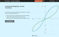
Inverses by Mapping: Inverse Functions
Map your way to successfully understanding inverse functions. Pupils use an interactive map to investigate how changes in the graph of a function affect the graph of its inverse. The results of the activity lead to the conclusion that...
Curated OER
Play Doh Map of Your State
Students create a state map using Playdoh. In this hands-on state geography lesson, students work in groups to form a three-dimensional map of their state using Playdoh made at home following a (given) recipe. Students use four colors...
Curated OER
Maps
Students investigate three types of maps. In this history lesson, students idenitfy different maps and explore how they relate to the area, while keeping climate and topography in mind. They discuss maps used to navigate land. air and sea.
World Globes & Maps
United States Map- Intermediate Directions
Students identify the four intermediate directions. For this map skills lesson, students use post-it notes to label the four intermediate directions on a map. Students locate various states using intermediate directions.
Do2Learn
Brainstorming Map Array
Getting ideas down on paper is often the first step when starting a project or new unit of study. Try out this straightforward brainstorming map with your class. Learners write in a topic and use the six bubbles that branch out of the...
DiscoverE
LIDAR: Mapping with Lasers
We would be lost without maps! How are they made? Introduce junior topographers to LIDAR technology with a fascinating activity. Set up a mock city, then have learners operate a laser measure to determine the shape of the landscape using...
National Wildlife Federation
Quantifying Land Changes Over Time Using Landsat
"Humans have become a geologic agent comparable to erosion and [volcanic] eruptions ..." Paul J. Crutzen, a Nobel Prize-winning atmospheric chemist. Using Landsat imagery, scholars create a grid showing land use type, such as urban,...
Curated OER
Basic Mapping Skills
Establish and study the parts of a map with your class and, then they will work in small groups to create their own detailed map, including a legend. There are specific instructions to follow on what needs to be included.
Curated OER
Geographic Regions and Backyard Geology with the USGS Tapestry Map
A beautiful tapestry map of North America is examined by geology masters. The map incorporates the topography and geology of different regions. You can purchase printed copies or a large poster of the map, or if you have a computer lab...
Big History Project
Human Migration Patterns II
While humans have always been on the move, the period between 1400 and 1800 saw vast migrations of people between the East and the West. These migrations—whether through slavery or a desire to colonize new lands—shaped the modern world....
Nebraska Department of Education
Goal Maps
High school freshmen are asked to think about their future goals and reflect on what they have learned about the barriers they may face and the resources they have to overcome these barriers. Individuals then respond to questions on a...


