Curated OER
Mapping Gymnosperms and Angiosperms
In this plant worksheet, students create a map of a familiar area such as their yard, a nearby park, or the school grounds showing the major plants. On their map they identify the plants in three ways following the example provided. ...
Curated OER
Creating a Map
Students create a map of their community. In this mapping lesson, students identify various geographical features and the cardinal directions on maps displayed in the classroom. Students are divided into three groups to create a large...
Curated OER
Weather, Data, Graphs and Maps
Students collect data on the weather, graph and analyze it. In this algebra instructional activity, students interpret maps and are able to better plan their days based on the weather reading. They make predictions based on the type of...
Curated OER
Mapping the Library
Students compare their school library with another library such as: town library, for example, or a virtual library and identify the most important features. Students use their observations to create a map of the school library that can...
Curated OER
Maps Can Help Us
First graders explore the geography of Montana by analyzing geographic maps of the area. In this Native American reservation lesson, 1st graders discuss the similarities and differences between reservations in the state of Montana....
Curated OER
The Tone Map
Students listen carefully to a portion of the Poetry Out Loud CD. They focus on the tones the poet uses in his recitation of a poem. Then they map a poem of their own so that a classmate can read it using the tonal qualities intended...
Curated OER
Word Maps Teaching Ideas
In this literacy worksheet, students are given a graphic organizer to complete or are presented it as part of the lesson developed from using this sheet.
Curated OER
Mapping the Ocean Floor
Students construct and interpret a line graph of ocean floor depth and a bar graph comparing the height/depth of several well-known natural and man-made objects and places. In addition, they calculate the depth of two points using sonar...
Curated OER
Maps
Students investigate threee types of maps. In this algebra instructional activity, students idenitfy different maps and explore how they relate to the area keeping cllimate and topography in mind. They discuss maps used to navigate...
Curated OER
Ecosystem Concept Map
How do ecosystems change? How do organisms keep their ecosystem going? Learners use a word bank to fill in 12 blanks that describe the functionality of ecosystems.
Curated OER
Vocabulary Word Map
In this vocabulary word map activity, students choose a word from a social studies text and write it in the center of the page. Students define it, write an antonym, use it in a sentence, and draw a picture.
Curated OER
Water Use: Tragedy in the Owens River Valley
Students examine water management issues. In this environmental issues lesson, students watch a PBS video to develop an understanding of watershed, aquifers, and ground water. Students evaluate watershed issues in the Owens River Valley...
Curated OER
Water: Water Use Picture Project
Students document how water is used in their local communities and explore how those uses impact the local environment. They utilize digital photography to document water use.
Curated OER
"Getting the Dirt" on Soil Use in My Community
In this soil use instructional activity, students research soil use in their community and record their observation for 5 different locations. A 3x5 chart is provided to record location, soil use, and comments. Students then complete 10...
Curated OER
Making a Map
Students are introduced to maps by examining the various types and practice using a key to find information. They each create their own map with a key and graph information. As a class, they read the story "Henny Penny" and share their...
Curated OER
Map Scaling
Second graders use a map scale to determine distances between cities in the state of Florida.
Curated OER
United States Map- State Capitals
Students explore the state capitals. In this geography lesson, students use a political map to identify the state capitals and place post-it notes on various capitals.
Curated OER
Organization of a Territory, Map Elements
Third graders compare printed and online maps and use proper geographic terminology to answer questions.
Curated OER
Map Grids
Students study map grids and explore how they can be used to locate positions of objects or features on a map. They read a story and then participate in a grid activity using a large map of the setting of the story.
Curated OER
Weather Maps and Prediction
Second graders point out symbols for high and low pressure that would be found on weather maps. They break into small groups and use a copy of the weather maps file to make observations about the maps and come up with an explanation of...
Curated OER
Tasty Mapping
Students create an edible map. In this civics and geography lesson, students research their town's features and local government. Students work in groups to design and create a physical map of their town based on research.
Curated OER
United States Map
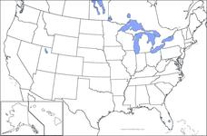
In this United States outline map worksheet, students make note of the political divisions of 50 states of the nation. This map may be used in a variety of classroom activities.
Curated OER
USA Map
In this United States political map worksheet, students examine state boundaries. The map may be used in a variety of classroom activities.
Curated OER
Mexico Map
In this blank outline map worksheet, students study the political boundaries of the North American country of Mexico. This map may be used in a variety of classroom activities.

