Curated OER
Put Me in My Place: Using Alphanumeric Grids to Locate Places
Students practice locating points on a large wall grid and create and label a neighborhood map. In this geography lesson, students spell and discuss places as the teacher places them on the map. They discuss the concept of an...
Curated OER
Landscape Picture Map- The Earth's Surface
Learners discuss different landscapes. In this map instructional activity, students describe what they see when they travel between home and school. Learners use a landscape picture map to locate the places or objects they see.
Curated OER
Gingerbread Map
Second graders read the book Gingerbread Baby, identify local features and cardinal directions on a map, and then construct their own map. In this mapping lesson plan, 2nd graders construct their own map in groups based on where the baby...
Curated OER
Mapping World War II: During and After
In this World War II worksheet, students follow the provided instructions to mark 2 maps according to events and outcomes of the war.
Curated OER
FUN WITH MAPS
Second graders receive a general overview about how maps are made and used, how specific information can be derived from them, and how a student can gain personal information about their surroundings from examining them.
Curated OER
MAP GRIDS, CLIMATES AND HEMISPHERES
Students compare/contrast the grid and latitude/longitude system used on a globe. They describe the areas which are considered to be a tropical, temperate, and polar, based on knowledge of climates.
Curated OER
STORY MAPPING: THE HUNDRED DRESSES
Students illustrate and paraphrase each chapter of The Hundred Dresses, creating a graphic organizer through the use of story mapping. After students have completed their story maps, ask for a few volunteers to present theirs to the class.
Curated OER
Kid Maps: Reading and Creating Maps with Human Characteristics
Young scholars look at maps. In this map lesson, students listen to the book My Map Book by Sara Fanelli and they see the difference between human characteristics (buildings, etc.) and natural characteristics (rivers, etc.)....
Curated OER
The Global Grapefruit - Maps vs Globes
Students tell how maps differ from globes, state some characteristics of 3 different types of map projections, and realize that distortions are inherent in various systems of map projections.
Curated OER
Story Maps and Boxes
Young scholars use a story map template to review the parts of a story and information about a book that they have read. The elements of the story are identified and placed into story boxes and shared with classmates.
Curated OER
Reading Weather Maps
Fourth graders the symbols that are used on weather maps. They develop five day forecasts based on information they gather from weather maps in the newspaper and on the Internet.
Curated OER
Drawing A Map
Students discuss any information they already know about maps. As a class, they draw a map of a park following written directions making sure to include a compass rose and key. They are graded based on a rubric and discuss the need for...
Curated OER
School-Home Link: Maps
In this atlas and parent communication form worksheet, students use an atlas to find several things: the capitol city of Japan, the number of countries in Africa, where to buy a newspaper, the names of Presidents of the United States,...
Curated OER
Geographical Skills-- Map Scale
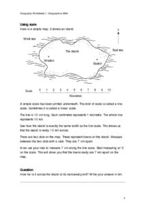
In this maps worksheet, students study a simple map and the scale in kilometres. Students read the directions and answer one question. Students then look at a sketch map of a town and answer 2 questions. Students also read how to show...
Curated OER
Weather Maps
Students interpret information on a weather map in order to construct a graph, and discuss how the weather impacts their lives.
Curated OER
Maps! Maps! Maps!
Third graders examine and identify different types of maps. They review the types of projections and which maps are better for different information. They answer comprehension questions at the end of the lesson.
Curated OER
Reading a Local and National Weather Map
Students examine weather maps. They examine icons and map symbols. Students explore vocabulary words related to weather. Students analyze and evaluate information provided on the weather map.
Curated OER
Map Your House
Students are introduced to the concepts of maps as scale models of the whole. After a brief lecture on creating and using an accurate scale when drawing and reading a map. They create a scale drawing of the floorplan of their homes.
Curated OER
Map Skills
In this history activity, learners utilize a map and legend to answer eleven comprehension questions. Students check their answers when done.
Curated OER
Using a Political Map
In this online interactive map activity activity, students examine a political map of New Jersey and respond to 9 fill in the blank questions.
Curated OER
Maps and Lines
In these organizing data worksheets, 5th graders complete four worksheets of activities that help them learn maps, graphs, and lines. Students then study images of maps, lines, and graphs.
Curated OER
Traveling/Mapping
Students examine routes to gold. In this California gold rush lesson, students map land and water routes to California. Students use maps to copy the routes that they want to market to gold diggers.
Curated OER
Landscape Picture Map
Students explore pollution of water sources. In this ecology lesson, students define and identify natural resources. Students use map skills to locate local rivers and lakes used for recreation. Students brainstorm ways in which to keep...
Curated OER
Making a Mental Map
Students discuss maps and explore the concept of the mental maps they use to navigate their everyday routines including the importance of landmarks. They draw a map of how they travel from home to school.


