Keys to Literacy
Story Map
Recording the key elements of a story (title, setting, characters, problem, ending) on a story map graphic organizer provides primary readers a chance to practice identifying these elements and promotes reading comprehension. The...
Curated OER
Introducing Literacy Elements in Nonfiction
Explore nonfiction writing with your class. They will identify elements in nonfiction by reviewing elements of fiction. Then they use biographies, memoirs, menus, Time for Kids, and text books to identify elements of nonfiction. They...
Keys to Literacy
Story Map
Here's a graphic organizer that promotes comprehension by asking class members to record the elements of a story. Using the provided template, readers identify the setting, the major characters, the problems they face, and the...
Curated OER
LAND USE DEBATE / TOWN MEETING
Ninth graders research, analyze, and orally defend an issue related to the use of geologic resources. They defend their position in written form by composing a letter to an appropriate source.
Curated OER
The Writing Process- Prewriting Using Collaboration
After a class discussion on strategies pupils can use to pre-write, learners are given a topic which they use to guide them in selecting a book to read. Everyone uses a worksheet, embedded in the plan, to write down information from the...
Curated OER
Understanding Stage Design: Using Visual Elements to Provide Information to an Audience
Young scholars study about theatrical design by developing environments for improvised and scripted scenes. They develop focused ideas for an environment using visual elements.
Curated OER
Using a Table of Contents
While simple, this resource would be a great way to introduce your class to the use of the Table of Contents. It provides a step-by-step explanation describing how to find information. A teacher could supplement this presentation with...
Curated OER
Mapping the Sea Floor
Students review their prior knowledge on topographical maps. Using a map, they examine the sea floor off the coast of San Diego, California. With a partner, they chart the sea floor of an area and use cutouts to create a visual...
Curated OER
Creating a Concept Map
In this concept map worksheet, students learn the steps of creating a concept map to show the relationship between concepts. Students create a concept mapping using the 5 steps.
Curated OER
Reading A Weather Map
Ninth graders construct a weather map. In this meteorology lesson, 9th graders construct a weather map using contour lines and temperature.
Curated OER
How Far Is It?
Students use a map key to estimate the distance from Salt Lake City, Utah, to ten other cities. Then they use an online distance calculator to see how close their estimates come!
EngageNY
How Do Dilations Map Segments?
Do you view proofs as an essential geometric skill? The resource builds on an understanding of dilations by proving the Dilation Theorem of Segments. Pupils learn to question and verify rather than make assumptions.
EngageNY
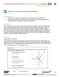
Vectors and Translation Maps
Discover the connection between vectors and translations. Through the lesson, learners see the strong relationship between vectors, matrices, and translations. Their inquiries begin in the two-dimensional plane and then progress to the...
Curated OER
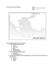
Ancient Greece Map Worksheet
Since the beginning of time, geography has shaped the development of human civilization, and ancient Greece is no exception. This worksheet supports young historians with exploring this relationship as they first identify key land...
NY Learns
Geography of the Fertile Crescent by ECSDM
Using Google Earth, a vocabulary assignment, and map handout, your class members will outline the Fertile Crescent in Mesopotamia and identify the source of the Tigris and Euphrates rivers. They will then complete graphic organizers...
University of Richmond
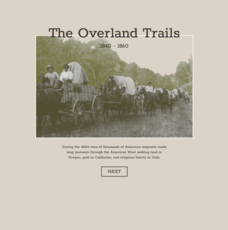
The Overland Trails 1840-1860
What led Americans to head west in the 1800s? Using an interactive map and journals from those who traveled, pupils explore the stories of those who migrated. In addition, they see how the numbers fluctuated in response to the push-pull...
Radford University
Getting Around Millbrook
When is the distance formula not accurate? Referencing a map of the school, pairs determine the walking distance between two locations. Creating coordinates for each location, pupils determine the distance between the two points and...
NOAA
Subduction Zones
Sink into an interactive learning experience about subduction zones! Junior oceanographers examine the earth-shaking and earth-making effects of subduction in the fourth installment in a 13-part series. Hands-on activities include...
Los Angeles Unified School District
River Systems
Scholars must react to the ecosystems of a river. They use inquiry-based learning along with maps and visuals to better understand the impact of rivers on everyday life. To finish, they create final written projects and presentations.
NASA
Air Temperatures Around the World: Student Activity
Check out climate anomalies just like NASA climatologists! Investigators use a GISTEMP map from NASA to analyze one month of climate anomalies. Scientists look for data extremes and generate possible explanations for observable...
Teach Engineering
Identifying Possible Underground Cavern Locations
Teams continue with the Asteroid Impact challenge and determine possible locations to construct their underground shelters. Participants cut scale area models of their shelters from paper and place them on the map to find locations...
National Geographic
Australia, Antarctica, and Oceana
Go on a traveling adventure throughout Australia, Oceana, and Antarctica! This textbook excerpt offers a full unit of study that can easily be supplemented by extra projects or research materials. Learners study maps, read about...
Visit St Augustine
African Americans in St. Augustine
A colorful travel brochure reveals why St. Augustine is considered the birthplace of African-American history. Images and maps bring the rich history of the city to life by displaying the many individuals, events, and sites that honor...
Howard Hughes Medical Institute
Sorting Finch Species
Don't just tell your class about Darwin's finches ... show them! Sort some of science's most famous birds using an interactive lesson. Learners try their hand at classifying finches using song, sonogram, and beak appearance, as well as...


