Curated OER
Locating Patterns of Volcano Distribution
Students examine patterns of volcanic distribution worldwide, use tables to plot and label location of each volcano on map, lightly shade areas where volcanoes are found, and complete open-ended worksheet based on their findings.
Curated OER
Pangaea Puzzle
Students explore plate tectonics and the formations of the Earth's surface and why maps are distorted. In this Earth's surface lesson students complete a lab and answer questions.
Curated OER
Building A Topographic Model
Students visualize, in three dimensions, features represented by contour lines on a topographic map. They see that the different elevations shown on a two dimensional topographic map can be used to build a 3-D model.
Curated OER
JAVA EARTHQUAKE
Students increase awareness of how people have been affected by the Java earthquake. They examine how aid agencies respond to emergencies.
Curated OER
Locate-a-quake
Student, use seismic readings of the same earthquake from three recording stations and locate the epicenter of an earthquake on a map.
Curated OER
Trembling, Spewing Earth: Impacts on Human Activity
Seventh graders study to identify patterns in earthquake activity and impacts on human behavior. They also develop plans to cope with such natural disasters.
Curated OER
American Journeys: Right Place, Right Time
Sixth graders measure distances on a map using string and a ruler. They complete mathematical word problems about measurement.
Curated OER
Natural Disaster Blooms Taxonomy
Students complete activities that lead to greater understanding of the variety of natural disasters that occur all over the world.
Curated OER
Volcanoes
Second graders review the characteristics and aspects of volcanoes. Using this information, they write a creative story and draw illustrations to accompany the words. They use geographical terms to describe a location and the physical...
Curated OER
Mapping Natural Disasters
High schoolers use Cartesian coordinates to plot current natural disasters. They relate location of natural disasters to their specific major project countries. Students tie in geometry within this lesson as connected to spatial...
Curated OER
Surfing for Earthquakes and Volcanoes
Students search the Internet for data pertaining to the world's volcanic and seismic activity.
Environment Agency - Abu Dhabi
Plate Tectonics
Young scholars observe a presentation on plate tectonics, layers of the earth, and plate boundaries. They then use the Internet to research major plates and label them on a world map.
Science 4 Inquiry
Edible Plate Tectonics
Many people think they can't observe plate tectonics, but thanks to GPS, we know that Australia moves at a rate of 2.7 inches per year, North America at 1 inches per year, and the Pacific plate at more than 3 inches per year! Scholars...
Curated OER
Follow The Falling Meteorite
Learners investigate the supposed traveling path of a meteorite. They use sound in order to triangulate the path. The results of the experiment are written on a map to display the path of the meteorite. The culminating activity is when...
Curated OER
Plate Patterns
Students read about a volcano and use the latitude and longitude information to plot and describe the volcano on the map. They discuss patterns seen on the map. In addition, they color code a map according to zones, plates, etc.
Curated OER
Taiwan on Shaky Ground
Students, in groups, examine how various elements of Taiwan's infrastructure were affected in the September 21, 1999 earthquake by analyzing a number of newspaper articles on the quake and its aftermath.
Curated OER
Volcanic Activity in the U.S.
Young scholars locate and map ten volcanoes in United States, create chart comparing volcanoes by last eruption, type of volcano, location, and interesting fact, and create Powerpoint slide show describing basic
information about...
Curated OER
Forecast the Weather
Students analyze different weather conditions before creating their very own first-person report from the eye of a storm. They use maps to analyze different weather conditions, record an online weather script
and write a first-person...
Curated OER
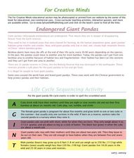
Endangered Giant Pandas
In this giant panda activity, students read and complete 5 pages of information and activities pertaining to the giant panda. Students study maps of the area, read fun facts about pandas, cut and paste life cycle sequencing, and read...
Curated OER
The 50 States and its Holidays
Though the format of this ELL lesson is confusing (the standards listed are for plate tectonics, yet the objectives are for American geography and holidays), a teacher could glean some ideas from the main idea. Here, pupils complete a...
Curated OER
States with Attitude, Latitude and Longitude Dude
Sixth graders identify states whose boundaries are formed by lines of latitude and longitude or natural borders such as rivers. They trace a map of the U.S., and fill in borders, rivers and lines of latitude and longitude.
Curated OER
Plate Tectonics: First Grade Lesson Plans and Activities
A set of first grade geology lessons focuses on plate tectonics and movement of plate boundaries. During the pre-lab, learners experience three types of plate movement through a kinesthetic demonstration. The lab...
Bowland
You Reckon?
Sometimes simple is just better. A set of activities teaches young mathematicians about using plausible estimation to solve problems. They break problems down to simpler problems, use rounding and estimation strategies, and consider...
Curated OER
A Model of Three Faults
Learners investigate faults. For this science lesson, students explore the many stresses and strains in the earth's layers and research the types of faults in their state.


