Curated OER
Suburbs Quiz
In this online interactive geography quiz learning exercise, students examine the chart that includes details about 18 major world suburbs. Students identify the names of the suburbs in 3 minutes.
Curated OER
Three Mapping Activities
Students label three maps of China after being introduced to background information about the country. In this geography instructional activity, students color two maps and label various points of interest in China. Finally, students...
Curated OER
United States Regions
For this United States political map worksheet, students examine regional census boundaries of the US. State boundaries are also included.
Curated OER
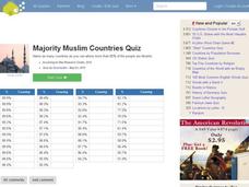
Majority Muslim Countries Quiz
In this online interactive geography quiz worksheet, students respond to 47 identification questions about Muslim cities. Students have 4 minutes to complete the quiz.
Curated OER
Location, Location, Location!
Twelfth graders locate cities, states and countries on maps. They use the cardinal directions to locate places on maps. They describe where they were born by giving clues without naming the exact state. They trade papers and try to guess...
Curated OER
Places That Changed Names Quiz
In this online interactive geography quiz worksheet, students examine the chart that includes the former names of 20 world cities. Students identify the names of the cities today in 4 minutes.
Curated OER
Getting to the Core of World and State Geography
Students create topography relief maps. In this geography skills lesson, students review geography core knowledge skills, design and make a state relief map, and compile a student atlas.
Curated OER
Reading a Local and National Weather Map
Students practice reading a national and local weather map. Using this information, they work together to make predictions about the weather for the next few days. They discuss the use of symbols and maps as a class and discuss how...
Curated OER
Pile 'em High?
Students explore the concept of architectural heritage. In this architecture lesson, students visit selected websites to compare and contrast the architectural features in world cities.
Curated OER
Cities as Transportation Centers
Middle schoolers work in small groups to identify some of the major transportation centers, recommending two as possible sites for a national political convention, based on population density and the travel networks available in 1835.
Freecloud Design
Stack the States™
Kids have fun learning US geography and state facts, including capitals, nicknames, major cities, and landmarks. They can choose between the game, or informational flashcards for each state.
Curated OER
Our 50 States
Students identify the location of the 50 states using an interactive map. They practice geography skills by playing a fun game. Pupils become familiar with the state abbreviations for the US states. Students become familiar with the...
Curated OER
States and Capitals, Mountains and Rivers
Students identify geographical locations in the midwestern United States. In this geography lesson, students identify 12 states and capitals and geographical features in the region by using U.S. maps. Students use blank maps to fill in...
Curated OER
The 50 States and its Holidays
Though the format of this ELL lesson is confusing (the standards listed are for plate tectonics, yet the objectives are for American geography and holidays), a teacher could glean some ideas from the main idea. Here, pupils complete a...
Curated OER
Vermont Map, Word Search, Scrambled Places and Crossword Puzzle
In this geography worksheet, students learn the important physical features and major cities in the state of Vermont by completing any of the 5 worksheets. There is a free form map, a "label me" map, word search, scrambled places and...
Curated OER
Landmarks in Paris
Third graders create a map of France. They use computers to view an "in flight" movie about Paris. They research Paris using books and the internet. Students practice using the program "Comic Life." They import illustrations for each of...
Curated OER
Life in Old Babylonia: The Importance of Trade
Middle schoolers examine the trade network in Old Babylonia. They analyze maps, explore various websites, develop a list of goods imported to and exported from Babylonia, and write an essay.
Curated OER
Asking For Directions
Young scholars draw a map of their surrounding area using appropriate landmarks and identifying characteristics. Students ask for and give directions to locations found on their maps to their partner. This lesson is intended for young...
Curated OER
Africa - Not Just One Big Safari
Students draw a picture of an African city that is similar to a U.S. city and discover how other parts of the world have the same types of buildings. In this global similarities lesson, students create a map of an African city and...
Curated OER
State Poster Fair: US Geography, Social Science, Art
Students research a US state, design and construct a state 'poster' to display important facts about that particular state. They present their work to the class.
Curated OER
Exquisite Excursions
Students locate 6 cities, one on each of the 6 major continents. They find distance for each leg of their journey, convert to percents, use a time zone map, and convert to foreign currencies.
Curated OER
MALI TO MECCA, MANSA MUSA MAKES THE HAJJ
Students explore the historical event when Mansa Musa, Ruler of Mali, made the Hajj (or holy pilgrimage) to Mecca in 1324 AD. They create Web pages or PowerPoint presentations maps, charts, posters, and oral presentations with...
Curated OER
The United States and Its Capitals
Have your class learn about the fifty states in the United States and their capital cities. Learners play matching games, complete quizzes, and a variety of activities in order to cement their knowledge of the states.
Curated OER
Mapping Lab and Lead Poisoning
High schoolers are introduced to GIS and its uses. They make predictions before viewing the actual lead poisoning cases by location of Dade County. Pupils use actual Miami-Dade County spatial data to explore basic principals. Students


