Curated OER
Describe That State
Students broaden knowledge about all the 50 states. They combine their knowledge about states with their knowledge about parts of speech to create grammatically correct sentences that describe the characteristics of the states.
Curated OER
Rock River Watershed
Students discover what a watershed is and which one they live in. Using the internet, they research why watersheds are important to an ecosystem and how to keep them from getting polluted. They use a map to locate various items within a...
Curated OER
Mapping the Transcontinental Journey
Young scholars develop their geography skills. In this Lewis and Clark instructional activity, students collaborate to calculate the time and distance of different segments of the expedition. Young scholars compare their estimate to...
Curated OER
Sharing The Land
Students investigate different geographical terms and concepts. This is done with practicing with maps of the United States to find major coasts, lakes, and rivers. They also put together a floor map of the United States. Students create...
Curated OER
Our Country's Geography
Third graders study geography. In this United States landforms activity, 3rd graders create a map of the U.S. made out of dough. They use various edible treats to mark the country's capital, the plains, the mountains and the rivers &...
Curated OER
Globe Lesson 17 - Alaska and Hawaii - Grade 4-5
Students develop their globe skills. In this geography skills lesson, students explore the area added to the United States when the Alaskan territory was purchased from Russia.
Curated OER
Add and Subtract with Hudson River shipping
Rivers aren't just a place for animals to live, they also provide industrial transportation. The class will examine the Hudson River on a map, discuss all the commercial vessels that use the River to transport materials, then complete a...
Curated OER
The Expansion of The United States, 1846-1848
Students interpret historical maps,identify territories acquired by the United States in the 1840s. Also they identify states later formed from these territories. The primary sources for the lesson are the maps found in the lesson's...
Curated OER
Tracing Our Own Family Pilgrimages
The Pilgrims may have arrived in North America by way of the Mayflower, but chances are, your class members' ancestors came to the United States in another way. Guide them through an exploration of their own heritage, countries of...
Smithsonian Institution
We Have a Story to Tell: Native Peoples of the Chesapeake Region
How did colonial settlement and the establishment of the United States affect Native Americans in the Chesapeake region? Your young historians will analyze contemporary and historical maps, read informational texts, and work in groups to...
National Museum of the American Indian
The A:Shiwi (Zuni) People: A Study in Environment, Adaptation, and Agricultural Practices
Discover the connection of native peoples to their natural world, including cultural and agricultural practices, by studying the Zuni people of the American Southwest. This lesson includes examining a poster's photographs, reading...
Curated OER
Rivers Bridge State Historic Site
Learners use maps, readings, illustrations and photos to analyze the Civil War Rivers Bridge battlefield and describe how geography affected the outcome of the battle. They explore and explain the causes for the battle's heavy human...
Curated OER
Grade 8 Unit 4
Eighth graders analyze aspirations and ideals of the people of the new nation, in terms of its physical landscapes and political divisions, and the territorial expansion of the United States during the terms of the first four presidents.
Curated OER
Indiana Travel Guide
Fourth graders share their information about their home state. In this research lesson, 4th graders use graphic organizers to make a travel guide about the state of Indiana. This lesson could be modified for use with any state, it also...
Curated OER
Discovering Descriptions
Delve into the journey of Lewis and Clark using this lesson on Missouri. After sharing books on Lewis and Clark's journey across the United States, pupils discuss the descriptive language used in their writing, and come up with their own...
Core Knowledge Foundation
Columbus Sailed the Ocean Blue
Young adventurers embark on a journey, setting sail along the blue ocean with Christopher Columbus. Teachers will find that this unit makes their lesson planning smooth sailing!
Curated OER
Splish Splash
Students study drinking water. In this environment lesson, students draw the path of drinking water from the place of precipitation to the tap after researching a map and information from the United States Geological Survey water...
Curated OER
The Lewis and Clark Expedition
Students study westward expansion. In this US history lesson, students describe the adventures and hardships faced by the explorers known as Meriwether Lewis and William Clark. Students write a report to the President about the...
Curated OER
River to the Sea
Students investigate the function of wathersheds and weather while they follow Lewis and Clark on their jouney west. They also create a map using acurate measurements and build a model watershed.
Curated OER
Cadron Settlement and the Trail of Tears
Students examine the reason for removal of the Cherokee and other Indian nations. They map the water route of the Trail of Tears from its origination in the east and through the Arkansas River Valley to Indian Territory.
Curated OER
The Mighty Mississippi River
Students acquire in-depth knowledge of the geographic significance of the Mississippi River. They identify and expand their knowledge of the role of the river in the development of cities. Finally, students gain insight into the ways...
Curated OER
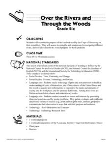
Over the Rivers and Through the Woods
Sixth graders examine the purpose of the keelboat used by the Corps of Discovery on the Lewis and Clark expedition. They assess its strengths and weaknesses for navigating different rivers, and describe its overall purpose for the...
Curated OER
Mechanics Hall
Students complete a variety of activities that go along with the study of and possible fieldtrip to Mechanics Hall (Black River Valley) in Worcester, MA. They examine the role industrial development had in society at the turn of the...
Curated OER
Rising Tensions Over The Nile River Basin
Students analyze the concept of global commons dilemma. For this investigative lesson students read an article on the Middle East Media Research Institute and answer questions accordingly.
