Curated OER
Map Grids
Students study map grids and explore how they can be used to locate positions of objects or features on a map. They read a story and then participate in a grid activity using a large map of the setting of the story.
Curated OER
Map Skills
Students examine the nations, battlefields, troop movement of the Germans through Belgium and the location of both fronts during World War I by creating a map. They visualize the strength of the Germans early in the war.
Curated OER
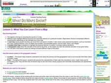
What You Can Learn From a Map
Students discover how to interpret maps. In this geography skills lesson, students explore geographic themes as they complete worksheet activities regarding road maps, shaded relief maps, and topographic maps.
Curated OER
Tectonic Plates, Earthquakes, and Volcanoes
Challenge geography classes to locate the major volcanoes and earthquake faults on a world map. In groups, they identify the pattern made and examine the relationship between the locations of the faults and volcanoes and tectonic plates....
Curated OER
Comparison of hometown life with that of life in a Canadian city
Young scholars research cultural characteristics of a Canadian city with that of their home town. They complete a map handout, providing the relative location on a large map and the absolute location on a provincial map. Students work...
Curated OER
What You Can Learn From a Map
Students investigate the use of road maps, shadeded relief maps, and topographic maps.
Curated OER
How Big is Big?
Geography learners compare and contrast population densities throughout the world. Using maps, they estimate the relative size of the world's regions and populations. They develop analogies to discover the world they live in and...
Curated OER
Nunavut, Our Communities
Students locate the communities of Nanavut on a territorial map and identify community characteristics. They research the online Atlas of Canada
Curated OER
"Yarning" About Latitude and Longitude
Students identify various locations using latitude and longitude. In this map skills lesson, students use yarn and labels to create a "human globe." Students identify the Prime Meridian, the Equator, and Northern and Southern Hemisphere.
Curated OER
It's Happening, Where? Find the Absolute and Relative Location of News Articles
Pupils read newspaper articles. In this social studies lesson, students locate the latitude and longitude of the location where the news article takes place. Pupils write a summary of the news article.
Concord Consortium
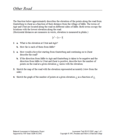
Other Road
Take the road to a greater knowledge of functions. Young mathematicians graph an absolute value function representing a road connecting several towns. Given a description, they identify the locations of the towns on the graph.
Curated OER
A Different Point of View
Fourth graders imagine what North Carolina looks like from the air. Looking at a map, they list the different kinds of views we might find, (i.e., beach, mountains, cities, farms, etc.) then attempt to draw their own version of a map.
Curated OER
A Bird's Eye View of our 50 States
Third graders focus on state birds as they learned absolute location (latitude/longitude) of each state, as well as their relative location (bordering states).
Curated OER
Where is Here?
Students are shown the very basics of navigation. The concepts of relative and absolute location, latitude, longitude and cardinal directions are discussed, as well as the use and principles of a map and compass.
Curated OER
5 Themes Awareness of Current Event Issues
Students analyze newspaper articles for the 5 themes of geography. They create a colorful portfolio explaining how each theme: location, place, etc. is relevant in a chosen current event.
Curated OER
A Place Called Fairfax
Students are introduced to the various types of maps of Fairfax County, Virginia. Using the maps, they explain the relative and absolute locations of the county and discuss the importance of both. They also discover how the county is...
Curated OER
Mapping Africa
Learners identify the location of parallel and meridian coordinates. They illustrate their understanding of the physical shape of the continent of Africa through a mapping activity, then explain the processes that have influenced the...
Rice University
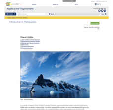
Algebra and Trigonometry
Move on into trigonometry. An informative eBook takes the content of a College Algebra course and adds more relating to trigonometry and trigonometric functions. The content organization allows pupils to build upon their learning by...
Curated OER
Eagle Creek Park (A Hike)
Students plot a hiking course using aerial photos and a topographic overlay and find the latitude and longitude of absolute locations. They measure the total distance of a hiked area and figure the area of the ground walked using Heron's...
Curated OER
Where Am I?
Second graders listen to a Japanese folk tale called "The Traveling Frogs". They role play the story using puppets or costumes. They locate Japan on a map and discuss several geography topics. They independently write about ways they...
Curated OER
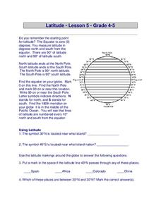
Latitude
In this latitude learning exercise, students answer questions about latitude that include absolute locations of countries and coordinates. Students complete 12 questions.
Curated OER
Cartography Project
A lesson involving mapping, the use of a compass, writing and following directions, and exploring the first two themes of geography is here for you. Learners create original maps that show the routes they take through their own...
Space Awareness
How Light Pollution Affects the Stars: Magnitude Readers
Did you know light can decrease visibility? Light pollution absolutely makes it more difficult to see stars. Scholars build a simple magnitude reader to determine the magnitude of stars. They use these data to estimate the impact of...
Curated OER
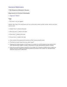
Distances Between Houses
This resource sneaks in the math so your learners will be adding and subtracting positive and negatives on a number line while thinking they are mapping out houses. The activity starts by putting houses the appropriate distance away from...


