Curated OER
Google Earth
Students explore cardinal directions and the compass rose using Google Earth. In this cardinal directions and compass rose lesson, students use Google Earth to visit Disney World. Students choose which direction to go to get there....
Curated OER
Whose Rights are Right?
Young scholars consider the concept of 'human rights' in relation to the current conditions and history of East Timor and discuss the terms "human rights" and "force," applying their responses to specific historical examples.
Advocates for Human Rights
A Global Perspective on Immigration
To gain a global perspective on immigration, groups investigate and create a map of the migration patterns in Africa, Asia, Europe, Latin America, and the Middle East. Class members then examine the background, immigration history, and...
Curated OER
Geography and Culture of China
Take out a map, a paper, a ruler, and those coveted colored pencils for a lesson plan on Chinese culture and geography. This is a multifaceted approach to basic geography skills that incorporate story telling, class discussion, primary...
Curated OER
Across the United States- Home Learning Activity
In this home-school United States map worksheet, students work with a family partner as they study a map of the United States. They talk about the states they have visited, play a game by giving each other clues about states, and write...
Curated OER
Plotting Earthquakes
Students plot earthquakes on a map. In this lesson on earthquakes, students will explore recent earthquake activity in California and Nevada. Students will plot fault lines and earthquake occurrences on a map.
Curated OER
Understanding "The Stans"
Students explore and locate "The Stans" in Central Asia to create, write and illustrate maps, graphs and charts to organize geographic information. They analyze the historical and physical characteristics of Central Asia via graphic...
Curated OER
Baseball Challenge: Social Studies TCAP
Using a baseball theme, this presentation provides a review of social studies topics covered in sixth grade. Students play a game in which they score based on the answers to various questions involving Ancient Rome, Ancient Greece, map...
Curated OER
Middle East Capitals Map Quiz
In this online interactive geography quiz learning exercise, students respond to 25 identification questions regarding Middle Eastern capital cities.
Curated OER
United States Map
Students access prior knowledge and locate the North and South Poles on the map. In this mapping instructional activity, students understand the position of the United States relative to the poles. Students answer questions about the globe.
Curated OER
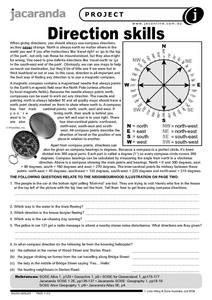
Direction Skills
In this geography worksheet, students read an excerpt on what directions tell someone. They respond to 6 short answer questions related to the neighborhood illustration found on the second page of the worksheet.
Curated OER
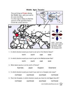
Middle Ages Traveler
In these Middle Ages worksheets, students use the maps to help them find the answers to the questions that help them understand the directions of north, south, east and west. Students also color another map of France according the...
Calvin Crest Outdoor School
Survival
Equip young campers with important survival knowledge with a set of engaging lessons. Teammates work together to complete three outdoor activities, which include building a shelter, starting a campfire, and finding directions in the...
Curated OER
Geography and Topography, History and Architecture
In this social studies lesson plan, students answer short answer questions about the geography, topography, history, and architecture of the east part of the United States. Students complete 24 questions.
Curated OER
Using the Four Main Directions in the Classroom
Students use the four main directions to locate features in the classroom. In this direction lesson, students review the 4 main directions using a world map. Students use a magnetic compass to locate the north wall in their classroom and...
Curated OER
East Asia--The Asian Holocaust
Ninth graders study the effects of the Asian Holocaust by comparing it to the Nazi Holocaust. They view a Power Point and discuss the comparisons between both Holocausts. As they compare and contrast both, they discuss their reactions...
Curated OER
Directionality
Second graders discuss the cardinal directions and intermediate directions and then look at the spooky map to locate different points on the map. They answer questions about where things are located in reference to another object and...
Curated OER
In Mr. Lincoln's Shoes
Students demonstrate basic map skills. In this US history lesson, students review cardinal directions and use a compass rose while at the same time discuss what life was like for Abraham Lincoln.
Curated OER
Mapping Your Schoolyard Habitat
Students explore the terrain, structures, plants and signs of habitats around their schoolyard. They draw a sketch map showing the different areas around the schoolyard. Students identify the location of weeds and native plants on their...
Curated OER
Map Memory
Fifth graders, working in a whole class setting, label a United States map with the names of all the states that they know. They transfer the names of the states to an individual map and color it. Next, they receive directions on how to...
American Museum of Natural History
A Walk Through the Ruins of Petra
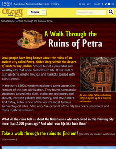
Walking through the ancient Nabataean city of Petra can be a challenge. A tour begins with a 20-minute walk down a rocky slope through the narrow Siq to get to the famous Treasury known to Indiana Jones fans. But that is...
NOAA
Currents
Learn how ocean currents are vital to humans and marine life. The eighth installment of a 23-part NOAA Enrichment in Marine sciences and Oceanography (NEMO) program, focuses on ocean currents and how they affect global climate. The...
National Gallery of Art
Islamic Art and Culture
Provided by the National Gallery of Art in Washington, this resource for teachers examines Islamic art, including calligraphy, arabesques, and geometric designs. A recounting of the spread of the faith and the tumultuous political...
Curated OER
Making Maps
In this map making worksheet, students learn about the science of making maps, which is cartography. They then answer the 11 questions on the worksheet. The answers are on the last page.
Other popular searches
- Middle East Maps
- Blank Middle East Maps
- Middle East Maps Trade
- Ancient Middle East Maps
- Medieval Middle East Maps
- East Asia Geography Maps
- Middle East Maps Puzzles
- Far East Maps
- Maps South East Asia
- East Africa Maps
- Sou East Asia Maps


