Curated OER
The Eagle Has Landed: Aztecs Find a Home
Students investigate the Aztec civilization and locate it on a map. They explain the legend of the city of Tenochtitan and investigate the symbolism of the Mexican flag.
National Earth Science Teachers Association
The Earth Scientist Project
Pairs of learners choose an earth scientist from an extensive list. They collect information by researching online or in books about the childhood, education, and major contributions made by their chosen scientist. When they present...
Curated OER
Creating a Character Chart for the Secret Garden
The Secret Garden, is a wonderful book to read with your class. After reading, why not employ the lesson plan presented here as a follow up activity? In it, pupils create character charts that portray the tremendous changes that...
National Geographic
Genetic Markers: Connecting the Dots
Biology buffs simulate how genetic markers are passed among populations in order to understand how these markers can help anthropologists map human migration. A couple of volunteers leave the room while you walk the remaining learners...
University of Wisconsin
Follow the Drop
Young surveyors look for patterns in water flow around campus. Using a map of the school (that you will need to create), they mark the direction of the path of water. They also perform calculations for the volume that becomes runoff. The...
Curated OER
Create Your Own Country Project
Young scholars demonstrate their knowledge of geography with this fun, collaborative social studies project. Working in small groups, students develop their very own countries, writing descriptions...
It's About Time
The Changing Geography of Your Community
Lead your class in exploring their local communities as well as the general environment. As they determine continental distributions by investigating minerals, rocks, and fossils located in their local region, pupils construct...
Teach Engineering
Drawing Magnetic Fields
Class members use a compass and several points to map out the magnetic field of a magnet. Pairs trace the magnetic field lines produced by a permanent magnet by positioning the compass in numerous spots around the magnet to view the...
Curated OER
Time And Money: Time Zones Word Problems
In this math worksheet, students examine a map of North America with all the time zones marked. Students solve 11 time zone word problems and fill out a chart which displays shipping times.
Baylor College
Microbes and Disease
Discuss how diseases have impacted human history. Divide your class into groups and assign each group one of the following: tuberculosis, malaria, plague, cholera, smallpox, and AIDS. They read up on, complete a concept map, and present...
Baylor College
Heart and Circulation: Pre- and Post-Assessments
Middle schoolers demonstrate what they know about the structure and function of the heart and blood vessels. A set of 15 multiple-choice questions also addresses how the heart handles microgravity and how animals without...
Baylor College
The Heart is a Pump
Circulate this news: the heart is a pump containing one-way valves! Following the previous lesson on the external structure of the heart, learners now take a look at the inside. They use a three-color diagram to label a black-and-white...
California Academy of Science
Earthquakes and Tectonic Plates
Here is a comprehensive package in which middle schoolers learn about types of seismic waves, triangulation, and tectonic plate boundaries. Complete vocabulary, colorful maps, and a worksheet are included via links on the webpage. You...
Memorial Hall Museum
Dedham Deed
Class members examine primary source documents that expose the contrasting views of land ownership between the Pocumtuck and English settlers.
New York State Education Department
US History and Government Examination: January 2017
Looking for a resource that tests both US History and government? Here's a test that serves as a great way to test comprehension of complex concepts by using a variety of question formats and covering a wide array of topics. The...
Curated OER
Hunger in the World
Consider various aspects of world hunger in this writing lesson. After taking a pre-test, middle and high schoolers play a map game, analyze and discuss world statistics, and write a report on an assigned country. The lesson can apply to...
Curated OER
Salt of the Earth: A Caddo Industry in Arkansas
Middle schoolers explore the history of the Caddo Salt Industry found in Arkansas. Along with learning about how salt deposits formed in Arkansas, learners study the process of salt production and how valuable salt is as a natural...
Curated OER
Enough To Make Your Head Spin
Students examine body language in the United States and Bulgaria. They also discover other forms of communication. They also examine a map of Bulgaria.
Curated OER
How Do Artists Effectively Relate Historic Events?
Students explore African American migration. In this black culture and history activity, students use a map to identify northern and southern states in which African Americans lived in the 1900s. Students observe and describe objects and...
Curated OER
The Era of Good Feelings
Setting the context for the first part of the 19th century, the slides presented here display the "Era of Good Feelings," including the presidencies of Monroe and Adams. Maps and photographs help students to contextualize the concepts of...
Curated OER
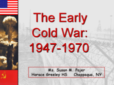
The Early Cold War: 1947-1970
With a combination of images, maps, and valuable information, this presentation is a strong resource for a history class that is coming out of a WWII unit and into a Cold War unit. Some points are outlined for students, while others are...
Curated OER
Human Genetic Diseases
Although there are a few missing titles in this collection of slides, if your class has prior knowledge of genetic diseases then this resource could be useful. The mechanism of genetic inheritance are covered and both flow charts and...
Curated OER
Roman Republic
Experience the birth and rise of the Roman Empire with these slides, which include explanatory maps and pictures. Details of the Roman government draw an easy parallel to the American government, which could start an engaging discussion.
Curated OER
Fort Jackson and Fort St. Phillip
Review the history of Fort Jackson and Fort St. Phillip during the American Civil War in this informative PowerPoint. Included in this presentation are interesting facts, photos, and maps to increase student understanding of these...
Other popular searches
- Middle East Maps
- Blank Middle East Maps
- Middle East Maps Trade
- Ancient Middle East Maps
- Medieval Middle East Maps
- East Asia Geography Maps
- Middle East Maps Puzzles
- Far East Maps
- Maps South East Asia
- East Africa Maps
- Asking Directions Maps
- Sou East Asia Maps


