Curated OER
What in Our World Affects the Way People Live
Sixth graders study various maps that show geographical features and population. They compare the maps and make inferences about how various geographical features influence the population and human activities of an area.
Curated OER
Maps and the Pictures in Our Heads
Geographers of all ages examine different types of maps. They draw maps of their environment, utilizing both three-dimensional and picture maps. They interpret map information, noting how it can sometimes be misleading. Some good...
Curated OER
Orienteering - Lesson 1 - Maps & Map Scales
Lesson 1 of 10 lessons in this orienteering unit is about maps and map scales. After all, orienteering is all about maps, compasses, and finding ones' way around. It is imperative to be able to read maps and understand the relevance of...
Curated OER
Map Skills
Do you need to practice map skills? Children with a range of abilities will complete a KWL chart about maps, practice important map vocabulary and then read a few pages from their textbook. They will use their vocabulary words and...
Curated OER
Investigating the Countries of the World
Explore world geography by creating presentations for different countries around the world. Researchers identify many different countries on a globe and select one for which they will create a presentation. They share their research and...
Curated OER
Orienteering - Lesson 2 - Topographical Maps
One of the most important skills in orienteering is being able to read a topographical map. Understanding the contour lines and symbols and the scale of the map will make planning your route so much better. In this instructional...
Curated OER
State Map of Utah
In this social studies worksheet, students examine a state map of Utah and answer 7 questions, using the map as a reference. The map includes freeways and bodies of water. There is no compass rose.
Curated OER
The World Around Me
Combining visual and language arts, here is a resource that prompts middle schoolers to write stories based on pictures of their surroundings. They use digital cameras to take pictures of favorite areas in the school. Next, they choose...
Curated OER
Read a Map
In this word problem worksheet, 5th graders use a coordinate grid as a map to answer 6 problems. They work with ordered pairs, locate quadrants, and apply the information to find items in the zoo.
Curated OER
Where in the World Is Mexico?
Students practice map-reading skills as they locate Mexico and its cities on a world map. By creating a puzzle out of a map of Mexico, students engage in a meaningful hands-on activity to help them explore that country's geography.
Curated OER
Mapping the New World Lesson Plan
Students compare two maps of the same area from different time periods. In this American History activity, students look at two maps of the English colonies from 1636 and 1651. They discuss why the maps changed and predict maps from the...
Curated OER
Geography and Culture of China
Take out a map, a paper, a ruler, and those coveted colored pencils for a instructional activity on Chinese culture and geography. This is a multifaceted approach to basic geography skills that incorporate story telling, class...
Curated OER
What Do Maps Show?: Lesson 4 How to Read a Topographic Map
Students examine the use of topographic maps as two dimensional representations that show elevations and slopes with contour lines. They read maps of the Salt Lake City, Utah area and complete the associated worksheets that show map...
Curated OER
Exploring Biomes Lesson 4: Mapping Arizona
Once junior ecologists are familiar with Earth's major biomes, they hone in on Arizona's biomes. Using a website about Arizona's natural resources, learners will identify biotic communities. Beautiful maps and worksheets are provided for...
Curated OER
Exploring Arizona's Biotic Communities Lesson 1: Mapping Biotic Communities
As part of a unit on Arizona's biotic communities, young ecology learners create a map. They describe how humans and animals adapt in their habitat. They take notes and create graphic organizers from articles they read. Beautiful maps,...
Smarter Balanced
Exploring the World
To prepare for the Exploring the World Performance Task, class groups generate a list of places they would like to explore, examine images of seven natural wonders of the world, and consider why these sites are wondrous. A map and images...
DocsTeach
Around the World with Ernest Hemingway
Ernest Hemingway was a traveler and added evidence of these travels to his works. An engaging activity asks readers to analyze 20 photographs of the author, then drag the images to the correct location on an interactive map.
Edgate
Why Map a Map?
After brainstorming reasons why Native Americans mapped their lands, your young critical thinkers will work together to review their ideas and determine the definition of a map. With today's extensive use of mapping technology and GPS...
Curated OER
Map of Africa
Using a completed map (not provided), pupils will use this map to fill in the geographic features of Africa. An appropriate map can be printed using the Internet and placed under a document camera for the class to reference.
Curated OER
War of 1812: Map and Label
Map test! Hand out this map of the East Coast of the United States and let learners mark each of the nine sites listed. They'll be making a map that shows the battle sites and areas involved in the War of 1812. Great as a test or as a...
Curated OER
The Netherlands: map
Use the provided list to label a map of Europe and the Netherlands. There are 77 locations to label. You have to know your stuff to fill out this challenging map.
Curated OER
Map: Bahai'ism
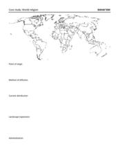
How much do you learners know about the Bahai religion? If this is a topic of study in your class, they'll be able to use the provided map to show the diffusion, location, origin, and distribution of this not-so-well-known sect that...
Curated OER
World War II New Guinea Campaign
Although the big picture for this lesson on the New Guidea Campaign of WWII is taking a field trip to the Douglas MacArthur Memorial, you can easily use it as a guide to an independent or group research project as well. However, if you...
Curated OER
Waldseemuller's Map: World 1507
Students investigate the 1507 word map. In this world geography activity, students examine the details of each section of the map and then draw conclusions about how the people of 1507 understood the world. Students are evalated on...
Other popular searches
- World Outline Maps
- Blank Maps of World
- World War 1 Maps
- Blank World Outline Maps
- World War Ii Maps
- Maps World Deserts
- World Geography Maps
- World Religion Thematic Maps
- Mental Maps World
- World War I Maps
- Maps of World War Ii
- Maps World Heritage Sites


