Curated OER
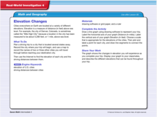
Real World Investigation- Math and Geography- Elevation Changes
For this math and geography real world investigation, 6th graders plan a driving trip to a city that is located several states away from their home while recording the elevations of three cities that are included in the trip. They use...
Curated OER
Measuring Around the House!
Trying to approach measuring in a fun and interactive way? You found it! This worksheet has young learners first cut out two "rulers" - one with simple units marked, and another with blank squares. They begin by going around their house...
Curated OER
Mapping a Site Using a Coordinate Plane
Learners map their playground as if it were an archeological site. They locate objects on the playground and determine their location using coordinate points. A related lesson is Coordinate Grid: Mapping an Archeological Site.
Curated OER
Contour and Cross-Section Skills
In this geography worksheet, learners identify the Wolf Creek Crater and how it was formed. They examine a contour map given of how the crater would look from above. Then, pupils use a ruler to draw lines as on the graph to the side....
Scientific American
Life-Sized Drawing
Ocean explorers or mathematicians research the wreck of the CSS H.L. Hunley. They investigate the actual dimensions of the Hunley using math and measuring skills. Afterward, they sketch a large scale drawing of the submarine outdoors on...
Curated OER
Cartography Project
A lesson involving mapping, the use of a compass, writing and following directions, and exploring the first two themes of geography is here for you. Learners create original maps that show the routes they take through their own...
Edgate
Great Grids
Learners use grid boxes as a measurement tool and discover how grids are used for mapmaking and scaling down an area. They begin by attempting to draw a model shape drawn by the teacher by using the gridding process. At the conclusion of...
Curated OER
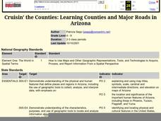
Cruisin' the Counties: Learning Counties and Major Roads in Arizona
Learners examine Arizona counties and use the themes of location and movement to develop an Arizona map.
Curated OER
Around the Town
In the world of GPS, make sure your kids can still read maps and determine distances between locations. You will need neighborhood street maps, ideally of your class' home turf. Ask kids questions about different locations in relation to...
Curated OER
I Will Meet You In The Middle
Students use the 50 States Quarter Reversal as a context of learning a curriculum concept based from the state of Utah. They research the concepts of cause and effect. Also, they use customary units of measurement to find length and...
Curated OER
As Good As Gold
Students find examples of the Golden Ratio on the human body through measurement. Additionally, students learn about the use of the Golden Ratio and the Golden Rectangle in art and architecture. A very interesting lesson for the students!
Curated OER
Math with Maps and Globes
Young scholars round out their math skills with these ‘round the world' ideas. In this math and geography lesson, students try out time zone sticks, a polar race, and tic-tac-globe to engage them in learning more about globes and the...
Curated OER
Archaeology: Digging in the Classroom
Students explore how an archaeologist works and makes discoveries. In this archaeology lesson, students participate in a simulation in which they excavate broken pottery. Students use measurement, geometry, and observation skills during...
Curated OER
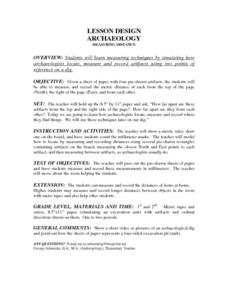
Lesson Design Archaeology- Measuring Distance
Young scholars measure and write specific metric distances. In this archaeology lesson, students are given specific artifact locations on a map and measure the distance using millimeters.
Curated OER
Traditional American Indian Lodges
Young scholars explore the mathematical properties of traditional American Indian lodges. They examine the effect of increasing sides of a polygon, calculate the surface area of prisms and cylinders, and construct a classroom size...
Curated OER
Measuring Up on the Mayflower
Second graders use a meter tape to compare the length of the Mayflower to a basketball court and make homemade butter for crackers. Afterward, all students sit inside the makeshift Mayflower's dimensions and enjoy their Pilgrim butter.
Curated OER
Cookie Topography
Students construct a cross section diagram showing elevation changes on a "cookie island." Using a chocolate chip cookie for an island, they locate the highest point in centimeters on the cookie and create a scale in feet. After tracing...
Curated OER
Mississippian Gardens
Students research and plan a Mississippian garden. In this Native American history lesson, students work in groups to research crops used by Native Americans in the Mississippian Period and use the information to plan and create an...
Curated OER
Capitol Gains
Students use a variety of Web sites to obtain specific information about the campaign finances of different Presidential hopefuls. They create graphs that illustrate all of the aspects of campaign finances researched,
Curated OER
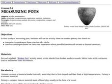
Measuring Pots
Students use an activity sheet to construct analogies about possible function of ancient or historic ceramics and compute circumference from a section of a circle as they study measuring pots.
Curated OER
Mr. Lincoln's Hat
Bring out the inner artist with this Abraham Lincoln lesson. Elementary students work on a home project creating a hat similar to Abraham Lincoln's hat. They will use geometry and measurement to create the scale of the hat, then...
Curated OER
All About Measuring with the Metric System
Students discover the metric system through video clips and Internet activities. In this measurements lesson, students practice using the units of measure for the metric system and compare them to the less popular English system....
Curated OER
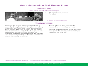
Life in a Sod House: Get a Sense of It
For this history of Nebraska worksheet, students read information about pioneer life in a sod house. Students conduct 4 experiments where they use measurement skills and observational skills to imagine the size, light levels, smell...
Curated OER
An Archaeological Adventure in Athens
Students review map skills and practice finding locations on a map. In groups, they create maps with mystery locations identified by hidden stick-on magnets. Other groups attempt to find the mystery locations and then check their work...
