Curated OER
2nd Grade - Act. 21: Me On the Map
Second graders read book, Me On the Map, and create map of their bedroom and of their house.
Curated OER
Mapmaker, Make Me a Map!
Here is a well-designed, very thorough lesson plan on mapping for very young children. Within the six-page plan, you will find everything you need to implement the lesson plan. They will identify various landforms found in Colorado on a...
Curated OER
Me on the Map Lesson 2
Students analyze and interpret maps, globes and geographic information systems to define and identify cities, counties, states, countries and continents to create a booklet called me on the map. They also determine and calculate the...
Curated OER
Mapmaker, Mapmaker, Make Me a Map
Second and third graders practice with basic map skills. They create their own map including a legend and a compass rose. This fabulous plan has many excellent websites linked which allow learners to explore maps of all kinds; including...
Curated OER
Me On the Map
Second graders listen to Joan Sweeney's book, Me On the Map. They design a map of their bedroom and their house emphasizing the important characteristics.
Curated OER
Me on the Map Lesson 1
Students use maps, globes, geographic information systems and other
sources of information to analyze the nature of places at a variety of scales. They identify on a map and determine the population
of the city, county, state, country...
Curated OER
Me on the Map: Homes, Neighborhoods, and Communities
Students read a book about maps and identify the differences between a picture and a map. In this maps lesson plan, students also label maps of their home, neighborhood, and community.
Curated OER
Those Who Have Come Before Me
Class members are transformed into explorers as they work in groups to locate hidden items and map their journey along the way. They then leave clues for other groups of students to follow, and ultimately discover how past explorations...
Curated OER
Just Draw Me a Map!!!!
Middle schoolers draw a map to give directions to someone rather then give them too many relative locations.
Curated OER
Map Skills
Students explore geography by creating a poster presentation in class. In this mapping lesson, students identify the different components featured on a modern day map and how to utilize them in order to navigate. Students read a book...
Curated OER
How To Read A Map
In this map skills worksheet, students view a map and answer five short answer questions by using the map key as a guide.
Curated OER
Mapping National and Geographic Identity
Students analyze geographic maps. In this map analysis lesson, students analyze the symbols in geographic maps and the impact of cultural, historical, and political concepts. Students compare and contrast maps in various mediums by...
Curated OER
Put Me in My Place: Using Alphanumeric Grids to Locate Places
Students practice locating points on a large wall grid and create and label a neighborhood map. In this geography lesson, students spell and discuss places as the teacher places them on the map. They discuss the concept of an...
Curated OER
Maps and Globes
First graders complete a unit on map skills and the globe. They label maps, create a styrofoam ball globe, create a map of their community, sing a continent song, and complete a map and globe assessment worksheet.
Curated OER
Map Keys
Third graders examine maps and map keys. In this locating map features instructional activity, 3rd graders use crayons, markers and colored pencils to label maps. Students work in partners to read map keys and locate given places and...
Curated OER
Map Maker, Map Maker
Map maker, map maker, make me a map! Your class can sing this tune as they work to create their own regional maps by taping paper to the wall, projecting an overhead transparency image, and tracing. Where this lesson plan intends for the...
Curated OER
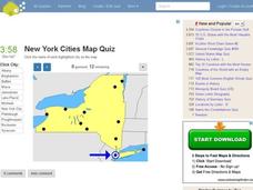
New York Cities Map Quiz
In this online interactive geography worksheet, learners examine a map of New York and identify the 11 noted cities on the map using a pull down menu within 3 minutes.
Curated OER
Mapmaker, Mapmaker, Make Me a Map!
Students evaluate the different types of historical and geographical information that one can gather through close study of historical maps from the 16th through the 19th centuries. They create their own maps.
Curated OER
Learning About the Map's Legend
Students draw a map of a room in their house and place a legend on it. They explain the legend orally.
Curated OER
You Can Depend On me
Discover the natural beauty of California. With a conservation bent, this activity delves into some of the attributes that make this state unique. Learners discuss Yosemite and the forest habitat. They focus on the things plants and...
Curated OER
Map Analysis Worksheet
In this map analysis worksheet, students decipher what type of map they are using based on a complete list of criteria. Students then answer multiple questions based on their discoveries.
Curated OER
Maps! Maps! Maps!
Third graders examine and identify different types of maps. They review the types of projections and which maps are better for different information. They answer comprehension questions at the end of the lesson.
Curated OER
Lesson Design Archaeology- USGS Maps
Students research USGS maps and identify the major features. In this map skills activity, students identify low and high elevations on a USGS map and practice finding latitude and longitude.
Curated OER
Meet Me in Austin
In labeling maps practice worksheet, students label the 11 landmarks in the city of Austin that are highlighted on the provided map.


