Curated OER
North America: Political Outline Map
In this North America political map worksheet, learners examine the state and province boundaries of Mexico, Canada, and the United States.
Curated OER
North America Outline Map
In this blank North America outline map worksheet, students study the political boundaries of the continent. This outline map may be used for a variety of geographic activities.
Curated OER
North America: Unlabelled Map
In this North America political map activity, students examine the unlabelled countries and their respective national boundaries.
Curated OER
North America Map
In this North America outline map worksheet, learners examine the political boundaries and identify the countries of North America.
Curated OER
Americas: Political Map
In this North America and South America outline map worksheet, students examine the political boundaries of the 2 continents.
Curated OER
North America Map
In this North America political map activity, students examine the labeled countries and their respective national boundaries.
Curated OER
North America Outline Map
In this blank outline map instructional activity, students investigate the political boundaries of the continent. This map may be used for a variety of classroom activities.
Curated OER
North America: Three Countries Map
In this North American political map worksheet, students examine the boundaries of the three countries of North America.
Curated OER
Central America Outline Map
In this Central American political map worksheet, students make note of national boundaries and capitals in this region of the world. National capital city locations are noted with stars.
Curated OER
Geographic Regions and Backyard Geology with the USGS Tapestry Map
A beautiful tapestry map of North America is examined by geology masters. The map incorporates the topography and geology of different regions. You can purchase printed copies or a large poster of the map, or if you have a computer lab...
Curated OER
Welcome to the Americas
Young scholars research and map the North and South American continents. For this geography lesson on the Americas, students can locate North, Central and South American countries and states. Young scholars choose a location to research...
PBS
What's In a Name?
What is in a name? Eager historians trace the geographical history of places in the United States with Spanish names. Using a worksheet activity, clues, and web research developed in conjunction with the PBS "Latinos in America" series,...
Curated OER
Canada Outline Map
In this Canada political map activity, students examine the province boundaries of the nation. The province names are labeled on the map.
Curated OER
Colonial America and Roots of Government
Students identify 50 States and the major geographic features, regions, and political representation of each. In connection, they investigate the causes and effects of European colonization on North America. They identify the formation...
Smithsonian Institution
A Ticket to Philly—In 1769: Thinking about Cities, Then and Now
While cities had only a small fraction of the population in colonial America, they played a significant role in pre-revolutionary years, and this was certainly true for the largest city in the North American colonies: Philadelphia. Your...
Curated OER
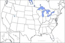
United States Map
In this United States outline map activity, students make note of the political divisions of 50 states of the nation. This map may be used in a variety of classroom activities.
Curated OER
United States Map: Capitals
In this United States outline map instructional activity, students make note of the political divisions of 50 states of the nation. This map is labeled with the 50 state capitals.
Curated OER
Fossil Fuels (Part I), The Geology of Oil
Junior geologists work through three mini-lessons that familiarize them with the formation and location of fossil fuels. Part one involves reading about petroleum and where it comes from via a thorough set of handouts. A lab activity...
Curated OER
USA Map
In this United States political map worksheet, students examine state boundaries. The map may be used in a variety of classroom activities.
Curated OER
Clothesline Sleuth
Fifth graders investigate the effect of North American colonization on human history. In this colonization activity, 5th graders explore the global impact of colonization of North America. Students investigate the impact of geography on...
Curated OER
South American Outline Map
In this blank outline map activity, students study the political boundaries of the continent of North America and those of the countries located there.
Curated OER
Map Keys
Third graders examine maps and map keys. In this locating map features lesson plan, 3rd graders use crayons, markers and colored pencils to label maps. Students work in partners to read map keys and locate given places and things.
Curated OER
Mapping Change
Students compare a political map of North America today with one from 1845. They identify items of continuity in the political map of the United States today and that of 1845 and describe the influence of Indian and Hispanic cultures on...
Curated OER
U.S. and Canada: How are We the Same? How are We Different?
Get high school geographers to compare and contrast Canada and the United States. They begin by drawing a freehand map of North America, then complete readings to gain insight into Canada. The text is not provided; however, another text...


