Curated OER
Breaking the Ice: Who Controls the Northwest Passage?
Students consider the global climate issue. In this Northwest Passage instructional activity, students examine who has sovereignty of the passage and discuss the importance of the Law of the Seas and its impact on the global climate...
Curated OER
Mapping Japan
For this Japan worksheet, students label cities, islands, seas, and more. Students label 11 different areas of the country of Japan.
Curated OER
Mapping the United States
In this map of the United States worksheet, students label mountains, surrounding countries, oceans, and more. Students complete 12 tasks.
Curated OER
Mapping Brazil
In this Brazil worksheet, students label cities, oceans, and surrounding countries around Brazil. Students label and color 10 places.
Curated OER
Map Puzzles
Students make puzzles from world maps, dramatizing how much of the globe is covered by ocean.
Curated OER
Seas of Grass
Students view a video clip about grasslands. They identify threats to grasslands and describe cultures which have adapted to grassland conditions. They discuss possible solutions to preserve grasslands as well.
Curated OER
Under the Sea - KWL Chart
Students create a KWL chart to start the discussion on ocean animals. They practice sorting the animals into their different classifications. They use indexes, table of contents and glossary to find information.
Consortium for Ocean Science Exploration and Engagement (COSEE)
One Ocean: It Matters!
Here is the first of four poignant lessons on how humans and oceans interact, even if people live far from the coast. This particular lesson also examines studies that are taking place in Antarctica of how climate change is affecting the...
Polar Trec
Sea Ice Impact
The arctic seas contain currents that are both warm (with high salinity) and cold (relatively fresh water) that circulate throughout the year. Through discussion, a lab, and a web quest, participants explore the impacts of melting and...
Curated OER
Tools of the Trade
Learners construct functional replicas of oceanographic tools and demonstrate and explain their use.
Curated OER
Density Dynamics
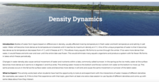
Students set up working models demonstrating lake turnover and the formation of deep water masses in the oceans.
Curated OER
Ocean Exploration: Shapes and Patterns Under the Sea
So many shapes in our vast oceans. Young explorers can discover new shapes in a variety of ways in this lesson. One way is having free exploration with a pattern shape kit handed out by the teacher. Another is by viewing a...
Curated OER
Hurricanes As Heat Engines
Students examine sea surface temperatures to see how hurricanes get heat from the oceans surface. In this hurricanes lesson students use the Internet to find data and make line plots.
California Academy of Science
Tropical Belt
Where in the world is the equator? Explore a world map with your class, coloring in oceans, continents, and rainforests while locating the three major lines of latitude: the equator, Tropic of Cancer, and Tropic of Capricorn. Discuss how...
Virginia Department of Education
Heat and Thermal Energy Transfer
How does radiation affect our daily lives? Answer that question and others with a lesson that discusses radiation and its use in thermal energy transfer through electromagnetic waves. Pupils investigate vaporization and...
Consortium for Ocean Science Exploration and Engagement (COSEE)
Climate Change Impacts on Blue King Crabs
Carbon dioxide is not only causing global temperatures to increase, it causes the oceans to become more acidic. Lesson focuses on the blue king crab and the fragility of the habitat due to climate change. Scholars create a concept map...
Scholastic
Voyage on the Mayflower for Grades 6–8
Imagine living in the hold of a sailing ship for 63 days, enduring rough seas and autumn storms. As part of a study of the voyage of the Mayflower, class members examine an online resource that details life about the ship, watch a slide...
NOAA
Fishy Deep-sea Designs!
Oceans represent more than 80 percent of all habitats, yet we know less about them than most other habitats on the planet. The instructor introduces the epipelagic, mesopelagic, bathypelagic, twilight, and midnight zones in the ocean....
US Geological Survey
Water, Water, Everywhere?
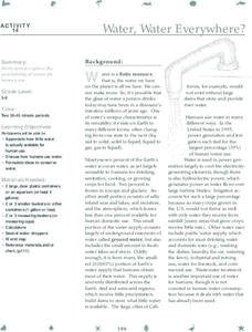
Less than one percent of the earth's water is available for human use. A hands-on activity models the phenomenon for young scientists. Beginning with a specific volume of water, learners remove water that correlates to the percent of...
NOAA
Community Ecology and Sampling
Seamounts in the Coral and Tasman Seas are home to more than 850 different species. Groups explore hydrothermal vents, researching the organisms found there and their energy source. They also learn about seamounts, exploring their unique...
NOAA
Exploring Potential Human Impacts
Arctic sea ice reflects 80 percent of sunlight, striking it back into space; with sea ice melting, the world's oceans become warmer, which furthers global warming. These activities explore how humans are impacting ecosystems around the...
National Institute of Open Schooling
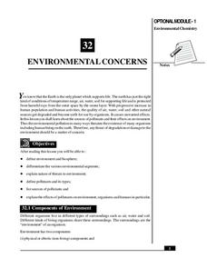
Environmental Concerns
Every year, more than 14 billion pounds of garbage is dumped into the oceans of the world, most of which is plastic and toxic to ocean life. Lesson 32 in the series of 36 focuses on environmental concerns, specifically pollution. Under...
Just Health Action
Introduction to Stormwater Pollution and a Green Stormwater Infrastructure (GSI)
Sometimes when it rains, pollutants pour into sewers which overflow and contaminate the environment. The final two lessons in the Environmental Justice series looks at actions being taken to address stormwater pollution. Class members...
Curated OER
Specialized for the Sea
Students use pictures and make a mural to investigate how ocean animals are adapted to certain parts of their environment.
Other popular searches
- Identify Oceans and Seas
- Oceans and Seas Maps
- Oceans and Seas Preschool
- Balm Oceans and Seas
- Oceans and Seas Worksheet
- Blm Oceans and Seas
- Major Cities/oceans/seas


