Curated OER
Mapping the News
Students explore cartography. In this map skills and map making lesson, Students work in groups to create wall size world maps including legends, compass roses, latitude and longitude, and physical features. Students collect current...
Curated OER
Mapping the Census
Students learn why the census makes a difference. For this U.S. Census lesson plan, students learn the key elements of cartography, examine the difference between data and their representation, and create a map using census data.
Curated OER
Tasty Mapping
Students create an edible map. In this civics and geography lesson, students research their town's features and local government. Students work in groups to design and create a physical map of their town based on research.
Curated OER
Orienteering - Lesson 3 - Topographical Maps and Contour Lines
Learn how to read a topographical map and understand what the contour lines mean. Explore longitude and latitude. Find a cliff, a valley, a mountain peak, and more. This is just one of the ten lessons in this unit on oreinteering....
Polar Trec
Mini-Ocean Bathymetric Mapping Research Cruise
Middle or high schoolers transform into oceanographers in a week-long simulation. To begin, each group follows directions to create a model of the ocean floor with specified features. Next, the groups prepare to set sail on a research...
Curated OER
Create a Country
Students work in small groups to list features and elements found on a variety of grade- appropriate maps. They develop a class list of map features and elements to draw from as they create a map of an imaginary country.
Curated OER
Ecology Explorers
Students create accurate, detailed map showing physical features, plants and trees, and other details of three school sites.
Curated OER
Geography and Culture of China
Take out a map, a paper, a ruler, and those coveted colored pencils for a instructional activity on Chinese culture and geography. This is a multifaceted approach to basic geography skills that incorporate story telling, class...
Curated OER
Understanding "The Stans"
Students explore and locate "The Stans" in Central Asia to create, write and illustrate maps, graphs and charts to organize geographic information. They analyze the historical and physical characteristics of Central Asia via graphic...
Curated OER
Exploring our National Parks
Students utilize maps/Atlases to find key spatial information, locate U.S. National Parks, characterize the geography of a specific region, and create a National Park brochure.
Curated OER
Land Elevation
Students investigate land elevation. In this map skills lesson, students use a physical map to identify various elevations of the land. Students find landform features such hills and coastlines.
Curated OER
The Sands of Arabia
Sixth graders apply geographic information to the study of World History. In this Geography lesson, 6th graders create a political/physical map of the Middle East, develop questions and answers about the culture of the Middle East, and...
Curated OER
Physical Geography of Africa
Fifth graders investigate the topography of Africa. In this physical geography instructional activity, 5th graders research the six regions of Africa and complete a physical map. Students locate various landforms in Africa. Students...
Curated OER
The Roman Empire-Map Activity
For this Roman Empire worksheet, students complete a map activity in which they label and color civilizations, countries and physical features as instructed. There are no maps included.
University of Wisconsin
Noting Notable Features for Rain Gardens
Eight groups in your class are each responsible for a different aspect of surveying the campus for a suitable rain garden location. Features to consider include water flow, topography, sun/shade patterns, land surface, vegetation,...
Curated OER
Natural Features
Students identify natural features on a map. In this map skill lesson, students use a landscape picture map to identify mountains, hills, islands, lakes, and rivers. Students use post-it notes to demonstrate their location.
Curated OER
U.S. Political Map
Learners explore the symbols found in a map legend. In this map skills lesson, students locate the legend on a political map and explain what each of the symbols mean. Learners locate and identify several symbols on the map.
Midnight Martian
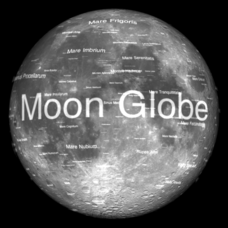
Moon Globe
Not just a simple globe of the moon, this interactive version allows you to choose lighting according to the location of the sun, views from different positions on Earth, and more! Satellite images and topographic data have been combined...
Curated OER
What a Relief Map
Students create a map using cookie dough. In this geography instructional activity, students research the physical features of a country, draw a diagram and design and create a map out of cookie dough.
Curated OER
What Do Maps Show?
Students discover the uses for various types of maps. In this geography skills lesson, students discuss the type of maps that exist and what their individual features are. Students then practice using different types of maps.
Curated OER
Introduction to Maps
Students develop their map skills. In this geography lesson, students participate in an activity that requires them to survey their social studies book in order to find different types of maps and purposes for their uses.
Curated OER
South America Outline Map
In this outline map worksheet, students discover and investigate the continent of South America. No country borders or physical features are depicted. This blank outline map may be used for a variety of classroom activities.
NOAA
A Watery World
With about 70% of the earth's surface covered in oceans, it's fair to say that we live in a very wet world. Young scientists gain a better appreciation of this fact as they use maps to identify the world's ocean basins in the first...
NOAA
Into the Deep
Take young scientists into the depths of the world's ocean with the second instructional activity of this three-part earth science series. After first drawing pictures representing how they imagine the bottom of the ocean to appear,...
Other popular searches
- Maps. Physical Features
- Canada Physical Features Map
- Maps Physical Features
- Physical Features of a Map


